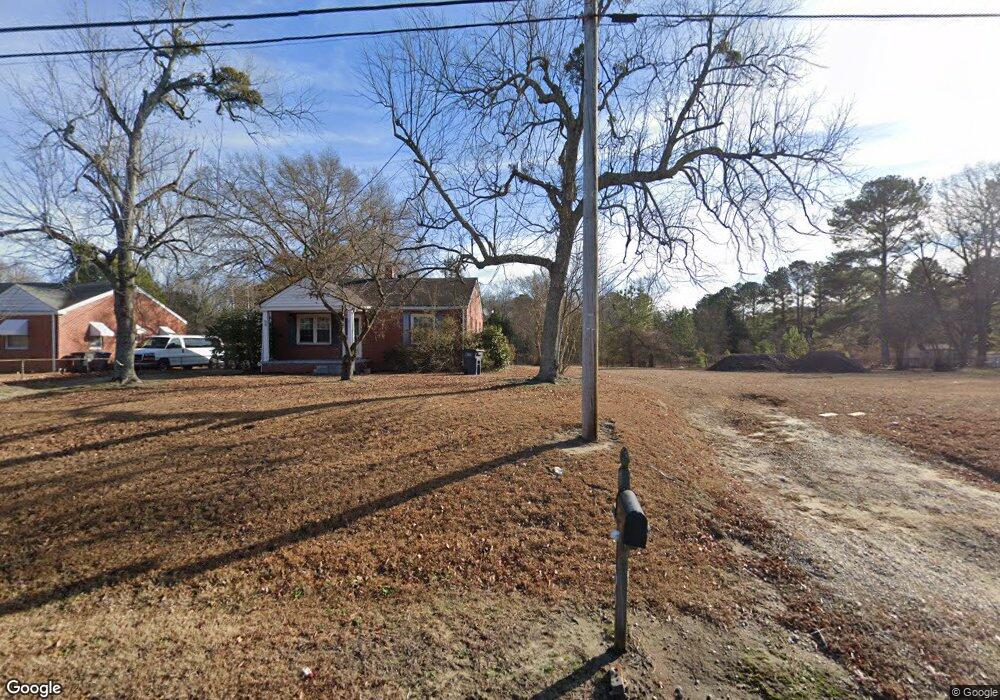
601 Goldrock Rd Rocky Mount, NC 27804
Estimated Value: $147,000 - $247,973
2
Beds
--
Bath
896
Sq Ft
$218/Sq Ft
Est. Value
About This Home
This home is located at 601 Goldrock Rd, Rocky Mount, NC 27804 and is currently estimated at $195,743, approximately $218 per square foot. 601 Goldrock Rd is a home located in Nash County with nearby schools including Northern Nash High School, Benvenue Elementary School, and Red Oak Middle School.
Ownership History
Date
Name
Owned For
Owner Type
Purchase Details
Closed on
May 18, 2018
Sold by
Holloman Melvin B and Holloman Rodner P
Bought by
Goldrock Road Llc
Current Estimated Value
Purchase Details
Closed on
Oct 19, 2017
Sold by
Holloman Melvin B and Holloman Rodner P
Bought by
Hollowman Howard B
Purchase Details
Closed on
Aug 9, 2005
Sold by
Nguyen Loi Tan and Nguyen Thuy Phuong
Bought by
Montoya Mariano and Montoya Marina
Purchase Details
Closed on
Aug 1, 1973
Bought by
Holloman Melvin B
Create a Home Valuation Report for This Property
The Home Valuation Report is an in-depth analysis detailing your home's value as well as a comparison with similar homes in the area
Home Values in the Area
Average Home Value in this Area
Purchase History
| Date | Buyer | Sale Price | Title Company |
|---|---|---|---|
| Goldrock Road Llc | $128,500 | None Available | |
| Hollowman Howard B | -- | None Available | |
| Montoya Mariano | $115,000 | None Available | |
| Holloman Melvin B | $30,000 | -- |
Source: Public Records
Tax History Compared to Growth
Tax History
| Year | Tax Paid | Tax Assessment Tax Assessment Total Assessment is a certain percentage of the fair market value that is determined by local assessors to be the total taxable value of land and additions on the property. | Land | Improvement |
|---|---|---|---|---|
| 2025 | $1,565 | $248,340 | $55,570 | $192,770 |
| 2024 | $1,565 | $120,990 | $55,570 | $65,420 |
| 2023 | $811 | $120,990 | $0 | $0 |
| 2022 | $829 | $120,990 | $55,570 | $65,420 |
| 2021 | $811 | $120,990 | $55,570 | $65,420 |
| 2020 | $811 | $120,990 | $55,570 | $65,420 |
| 2019 | $811 | $120,990 | $55,570 | $65,420 |
| 2018 | $811 | $120,990 | $0 | $0 |
| 2017 | $563 | $84,030 | $0 | $0 |
| 2015 | $626 | $93,446 | $0 | $0 |
| 2014 | $626 | $93,476 | $0 | $0 |
Source: Public Records
Map
Nearby Homes
- 152 Ambergate Ct
- 148 Ambergate Ct
- 144 Ambergate Ct
- 136 Ambergate Ct
- 145 Ambergate Ct
- 1152 Freer Dr
- 105 Ambergate Ct
- 1605 Bobwhite Ln
- 1739 Bobwhite Ln
- 0 Fenner at Jeffreys
- 1732 Bobwhite Ln
- 1760 Country Club Rd
- 612 Short Spoon Cir
- 620 Short Spoon Cir
- 841 Short Spoon Cir
- 1820 Burnt Mill Rd
- 1248 Drivers Cir
- 1210 Stoneridge Ln
- 1204 Stoneridge Ln
- 1212 Stoneridge Ln
- 1216 Stoneridge Ln
- 1222 Stoneridge Ln
- 1224 Stoneridge Ln
- 1209 Stoneridge Ln
- 1205 Stoneridge Ln
- 1213 Stoneridge Ln
- 1217 Stoneridge Ln
- 1228 Stoneridge Ln
- 1221 Stoneridge Ln
- 1225 Stoneridge Ln
- 1232 Stoneridge Ln
- 1231 Stoneridge Ln
- 1235 Stoneridge Ln
- 1238 Stoneridge Ln
- 669 Goldrock Rd