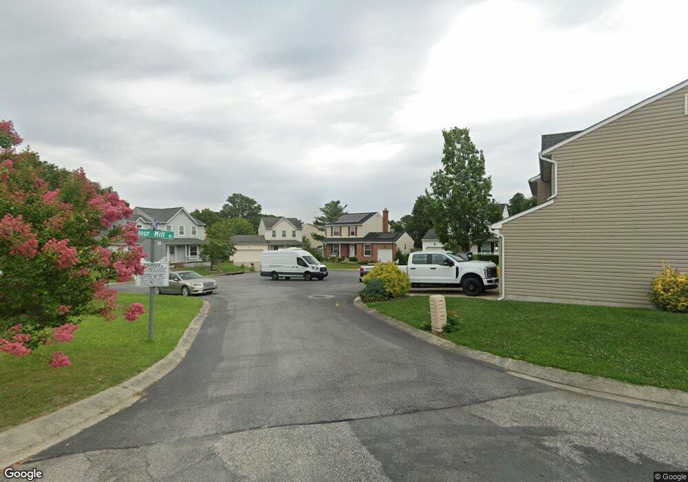
601 Grain Ct E Millersville, MD 21108
Estimated Value: $403,000 - $476,000
--
Bed
2
Baths
1,574
Sq Ft
$283/Sq Ft
Est. Value
About This Home
This home is located at 601 Grain Ct E, Millersville, MD 21108 and is currently estimated at $444,853, approximately $282 per square foot. 601 Grain Ct E is a home located in Anne Arundel County with nearby schools including Rippling Woods Elementary School, Old Mill Middle School North, and Old Mill High School.
Ownership History
Date
Name
Owned For
Owner Type
Purchase Details
Closed on
Jan 31, 2019
Sold by
Kaufman James and Kaufman Kelly
Bought by
Kaufman James
Current Estimated Value
Home Financials for this Owner
Home Financials are based on the most recent Mortgage that was taken out on this home.
Original Mortgage
$237,539
Outstanding Balance
$208,839
Interest Rate
4.5%
Mortgage Type
New Conventional
Estimated Equity
$236,014
Purchase Details
Closed on
Feb 26, 2004
Sold by
Simpson John A
Bought by
Kauffman James and Kauffman Kelly
Purchase Details
Closed on
May 7, 1987
Sold by
Millrace Inc
Bought by
Simpson John A
Home Financials for this Owner
Home Financials are based on the most recent Mortgage that was taken out on this home.
Original Mortgage
$87,800
Interest Rate
10.47%
Create a Home Valuation Report for This Property
The Home Valuation Report is an in-depth analysis detailing your home's value as well as a comparison with similar homes in the area
Home Values in the Area
Average Home Value in this Area
Purchase History
| Date | Buyer | Sale Price | Title Company |
|---|---|---|---|
| Kaufman James | -- | Title Rite Services Inc | |
| Kauffman James | $265,000 | -- | |
| Simpson John A | $94,600 | -- |
Source: Public Records
Mortgage History
| Date | Status | Borrower | Loan Amount |
|---|---|---|---|
| Open | Kaufman James | $237,539 | |
| Previous Owner | Simpson John A | $87,800 |
Source: Public Records
Tax History Compared to Growth
Tax History
| Year | Tax Paid | Tax Assessment Tax Assessment Total Assessment is a certain percentage of the fair market value that is determined by local assessors to be the total taxable value of land and additions on the property. | Land | Improvement |
|---|---|---|---|---|
| 2025 | $4,146 | $357,100 | -- | -- |
| 2024 | $4,146 | $338,100 | $165,600 | $172,500 |
| 2023 | $4,028 | $330,600 | $0 | $0 |
| 2022 | $3,753 | $323,100 | $0 | $0 |
| 2021 | $7,349 | $315,600 | $150,600 | $165,000 |
| 2020 | $3,560 | $308,400 | $0 | $0 |
| 2019 | $3,487 | $301,200 | $0 | $0 |
| 2018 | $2,981 | $294,000 | $115,500 | $178,500 |
| 2017 | $3,221 | $283,500 | $0 | $0 |
| 2016 | -- | $273,000 | $0 | $0 |
| 2015 | -- | $262,500 | $0 | $0 |
| 2014 | -- | $262,500 | $0 | $0 |
Source: Public Records
Map
Nearby Homes
- 2 Arrowleaf Dr
- 630 Cross Chase Dr
- 701 Kenora Ct
- 565 Belmawr Place
- 8421 Norwood Dr
- 584 Brightview Dr
- 2664 Carver Rd
- 529 Chalet Dr W
- 15 Tremont Dr
- 525 Old Mill Rd
- 8011 Horicon Point Dr
- 931 Oakdale Cir
- 8218 Sherbrooke Ct
- 601 Brightwood Rd
- 518 Kenora Dr
- 8218 Daniels Purchase Way
- 884 Oakdale Cir
- Easton Plan at The Willows
- 625 Winding Willow Way
- Potomac Plan at The Willows
- 603 Grain Ct E
- 600 Grain Ct E
- 605 Grain Ct E
- 602 Grain Ct E
- 678 Stone Wheel Ct W
- 679 Stone Wheel Ct W
- 607 Grain Ct E
- 677 Stone Wheel Ct W
- 676 Stone Wheel Ct W
- 675 Stone Wheel Ct W
- 674 Stone Wheel Ct W
- 604 Gearing Ct E
- 602 Gearing Ct E
- 673 Stone Wheel Ct W
- 604 Grain Ct E
- 606 Grain Ct E
- 672 Stone Wheel Ct W
- 606 Gearing Ct E
- 671 Stone Wheel Ct W
- 670 Stone Wheel Ct W
