Estimated Value: $152,000
--
Bed
1
Bath
256
Sq Ft
$594/Sq Ft
Est. Value
About This Home
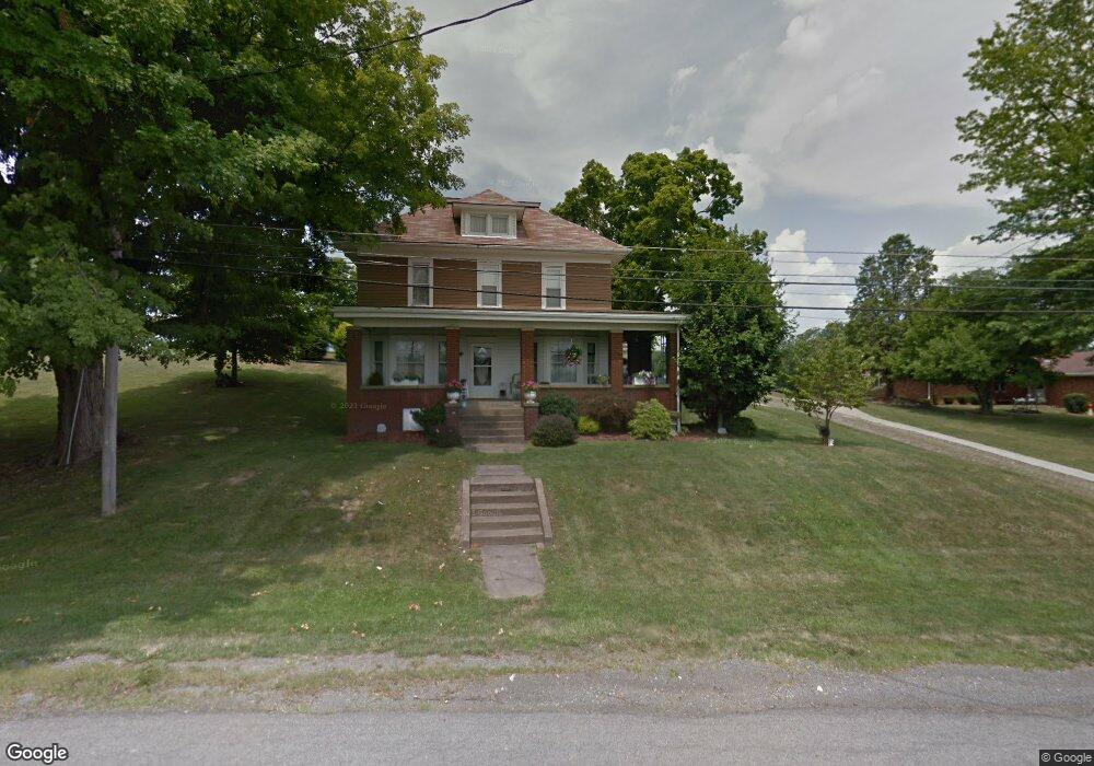
This home is located at 601 Grant St, Cadiz, OH 43907 and is currently estimated at $152,000, approximately $593 per square foot. 601 Grant St is a home located in Harrison County with nearby schools including Harrison Central Elementary School and Harrison Central Junior/Senior High School.
Ownership History
Date
Name
Owned For
Owner Type
Purchase Details
Closed on
Jul 8, 2025
Sold by
Brown Audrey Anne
Bought by
Brown Nest Llc
Current Estimated Value
Home Financials for this Owner
Home Financials are based on the most recent Mortgage that was taken out on this home.
Original Mortgage
$130,000
Interest Rate
6.5%
Mortgage Type
Seller Take Back
Purchase Details
Closed on
May 17, 1993
Purchase Details
Closed on
Jun 20, 1986
Create a Home Valuation Report for This Property
The Home Valuation Report is an in-depth analysis detailing your home's value as well as a comparison with similar homes in the area
Home Values in the Area
Average Home Value in this Area
Purchase History
| Date | Buyer | Sale Price | Title Company |
|---|---|---|---|
| Brown Nest Llc | $130,000 | None Listed On Document | |
| -- | $30,000 | -- | |
| -- | -- | -- |
Source: Public Records
Mortgage History
| Date | Status | Borrower | Loan Amount |
|---|---|---|---|
| Previous Owner | Brown Nest Llc | $130,000 |
Source: Public Records
Tax History Compared to Growth
Tax History
| Year | Tax Paid | Tax Assessment Tax Assessment Total Assessment is a certain percentage of the fair market value that is determined by local assessors to be the total taxable value of land and additions on the property. | Land | Improvement |
|---|---|---|---|---|
| 2024 | $97 | $2,430 | $2,060 | $370 |
| 2023 | $97 | $2,430 | $2,060 | $370 |
| 2022 | $962 | $31,780 | $11,320 | $20,460 |
| 2021 | $930 | $31,780 | $11,320 | $20,460 |
| 2020 | $926 | $31,780 | $11,320 | $20,460 |
| 2019 | $740 | $26,940 | $9,590 | $17,350 |
| 2018 | $740 | $26,940 | $9,590 | $17,350 |
| 2017 | $672 | $26,940 | $9,590 | $17,350 |
| 2016 | $596 | $22,250 | $7,350 | $14,900 |
| 2015 | $976 | $22,250 | $7,350 | $14,900 |
| 2014 | $478 | $21,860 | $7,390 | $14,470 |
| 2013 | $478 | $21,860 | $7,390 | $14,470 |
Source: Public Records
Map
Nearby Homes
- 413 Saint Clair Ave
- 150 E South St
- 254 S Buffalo St
- 508 Lower Lincoln
- 203 Roan Ave
- 616 Mccready Ave
- 207 Maplewood Dr
- 593 Dewey Ave
- 608 Kerr Ave
- 647 Kerr Ave
- 388 N Main St
- 390 Oak Park Rd
- 44208 Meadowlark Ln
- 804 E Market St
- 0 E Market St
- 265 Old Steubenville Pike
- 273 Old Steubenville Pike
- 0 N Main St Unit 5153554
- 39000 Lees Run Rd
- 0 Brewer Rd