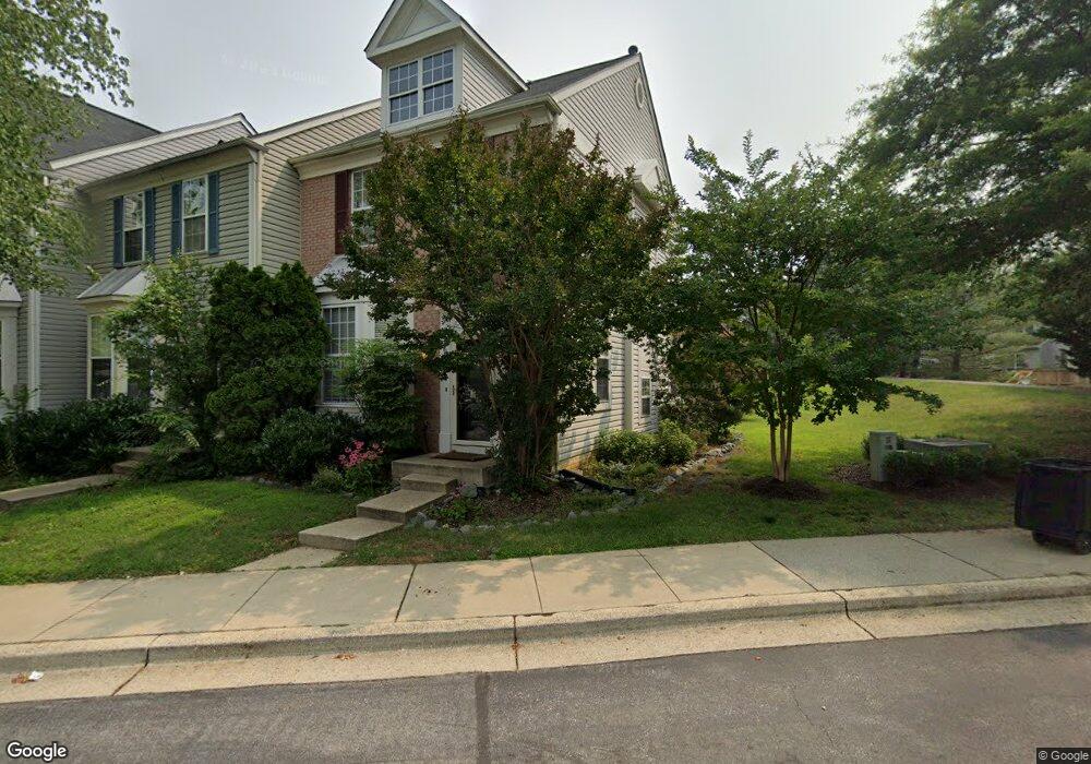
601 Howards Loop Annapolis, MD 21401
Parole NeighborhoodEstimated Value: $444,790 - $509,000
Studio
3
Baths
1,404
Sq Ft
$341/Sq Ft
Est. Value
About This Home
This home is located at 601 Howards Loop, Annapolis, MD 21401 and is currently estimated at $478,448, approximately $340 per square foot. 601 Howards Loop is a home located in Anne Arundel County with nearby schools including West Annapolis Elementary School, Wiley H. Bates Middle School, and Annapolis High School.
Ownership History
Date
Name
Owned For
Owner Type
Purchase Details
Closed on
Jan 12, 2004
Sold by
Howell James S
Bought by
Coyne Andrew N and Coyne Jessica
Current Estimated Value
Purchase Details
Closed on
May 30, 2001
Sold by
Read Katrina
Bought by
Howell James S
Purchase Details
Closed on
Dec 18, 1997
Sold by
Pulte Home Corp
Bought by
Read Katrina
Create a Home Valuation Report for This Property
The Home Valuation Report is an in-depth analysis detailing your home's value as well as a comparison with similar homes in the area
Home Values in the Area
Average Home Value in this Area
Purchase History
| Date | Buyer | Sale Price | Title Company |
|---|---|---|---|
| Coyne Andrew N | $300,000 | -- | |
| Howell James S | $186,000 | -- | |
| Read Katrina | $170,800 | -- |
Source: Public Records
Mortgage History
| Date | Status | Borrower | Loan Amount |
|---|---|---|---|
| Closed | Howell James S | -- |
Source: Public Records
Tax History
| Year | Tax Paid | Tax Assessment Tax Assessment Total Assessment is a certain percentage of the fair market value that is determined by local assessors to be the total taxable value of land and additions on the property. | Land | Improvement |
|---|---|---|---|---|
| 2025 | $4,401 | $416,800 | $180,000 | $236,800 |
| 2024 | $4,401 | $398,367 | $0 | $0 |
| 2023 | $4,186 | $379,933 | $0 | $0 |
| 2022 | $3,778 | $361,500 | $155,000 | $206,500 |
| 2020 | $3,777 | $357,633 | $0 | $0 |
| 2019 | $3,760 | $355,700 | $160,000 | $195,700 |
| 2018 | $3,552 | $350,333 | $0 | $0 |
| 2017 | $3,522 | $344,967 | $0 | $0 |
| 2016 | -- | $339,600 | $0 | $0 |
| 2015 | -- | $333,467 | $0 | $0 |
| 2014 | -- | $327,333 | $0 | $0 |
Source: Public Records
Map
Nearby Homes
- 603 Burtons Cove Way Unit 3
- 775 Howards Loop Unit 167
- 2052 Quaker Way Unit 7
- 2058 Quaker Way Unit 12
- 668 N Bestgate Rd
- 2006 Peggy Stewart Way Unit 204
- 2002 Phillips Terrace Unit 6
- 2013 Warners Terrace S Unit 138
- 2013 Warners Terrace S Unit 242
- 2015 Gov Thomas Bladen Way Unit 204
- 2150 Hideaway Ct Unit 28
- 25 Lincoln Pkwy
- 615 Admiral Dr
- 623 Admiral Dr Unit 304
- 12 Harbour Heights Dr
- 1873 Luce Creek Dr
- 629 Admiral Dr Unit U206
- 34 Harbour Heights Dr
- 1703 Nimitz Dr
- 1930 Severn Grove Rd
- 603 Howards Loop
- 603 Howards Loop Unit 90
- 605 Howards Loop
- 605 Howards Loop Unit 89
- 607 Howards Loop Unit 88
- 609 Howards Loop
- 611 Howards Loop
- 611 Howards Loop Unit 86
- 613 Howards Loop
- 613 Howards Loop Unit 85
- 615 Howards Loop
- 606 Samuels Way Unit 4
- 775 Howards Loop
- 604 Samuels Way
- 604 Samuels Way Unit 3
- 773 Howards Loop
- 773 Howards Loop Unit 60
- 771 Howards Loop
- 601 Burtons Cove Way Unit 6
- 601 Burtons Cove Way Unit 4
Your Personal Tour Guide
Ask me questions while you tour the home.