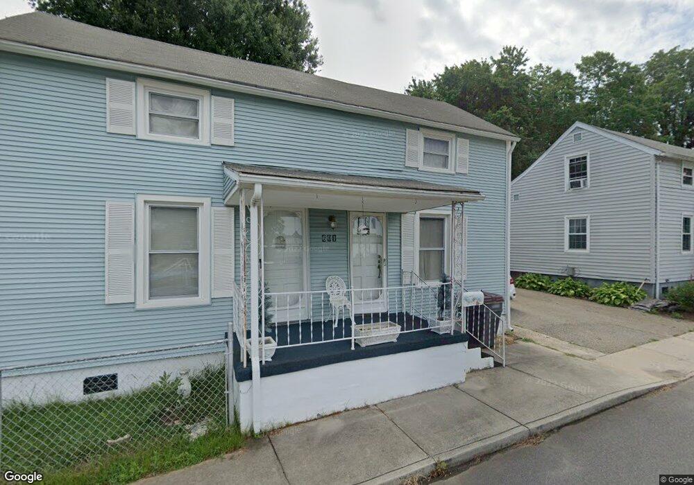
601 Lancaster Dr Reidsville, NC 27320
Estimated Value: $57,000 - $135,000
--
Bed
--
Bath
1,184
Sq Ft
$84/Sq Ft
Est. Value
About This Home
This home is located at 601 Lancaster Dr, Reidsville, NC 27320 and is currently estimated at $98,998, approximately $83 per square foot. 601 Lancaster Dr is a home located in Rockingham County with nearby schools including Reidsville High School, Moss Street Elementary, and Reidsville Middle School.
Ownership History
Date
Name
Owned For
Owner Type
Purchase Details
Closed on
Jan 9, 2025
Sold by
Yost Faith Davis
Bought by
Bautista Brandon Efrain Perez
Current Estimated Value
Purchase Details
Closed on
Mar 25, 2024
Sold by
Davis Charles F and Davis Yvonne Moseley
Bought by
Yost Faith Davis
Create a Home Valuation Report for This Property
The Home Valuation Report is an in-depth analysis detailing your home's value as well as a comparison with similar homes in the area
Home Values in the Area
Average Home Value in this Area
Purchase History
| Date | Buyer | Sale Price | Title Company |
|---|---|---|---|
| Bautista Brandon Efrain Perez | $55,000 | None Listed On Document | |
| Bautista Brandon Efrain Perez | $55,000 | None Listed On Document | |
| Bautista Brandon Efrain Perez | $55,000 | None Listed On Document | |
| Yost Faith Davis | -- | None Listed On Document | |
| Yost Faith Davis | -- | None Listed On Document |
Source: Public Records
Tax History Compared to Growth
Tax History
| Year | Tax Paid | Tax Assessment Tax Assessment Total Assessment is a certain percentage of the fair market value that is determined by local assessors to be the total taxable value of land and additions on the property. | Land | Improvement |
|---|---|---|---|---|
| 2025 | $1,137 | $91,661 | $4,798 | $86,863 |
| 2024 | $1,137 | $91,661 | $4,798 | $86,863 |
| 2023 | $1,137 | $44,167 | $3,870 | $40,297 |
| 2022 | $275 | $44,167 | $3,870 | $40,297 |
| 2021 | $633 | $44,167 | $3,870 | $40,297 |
| 2020 | $275 | $44,167 | $3,870 | $40,297 |
| 2019 | $277 | $44,167 | $3,870 | $40,297 |
| 2018 | $322 | $47,266 | $6,112 | $41,154 |
| 2017 | $322 | $47,266 | $6,112 | $41,154 |
| 2015 | $325 | $47,266 | $6,112 | $41,154 |
| 2014 | -- | $47,266 | $6,112 | $41,154 |
Source: Public Records
Map
Nearby Homes
- 607 Lancaster Dr
- 105 Edna St
- 515 Barnes St
- 511 Barnes St
- 802 Montgomery St
- 335 S Branch St
- 816 Barnes St
- 502 Thomas St
- 202 Woodrow St
- 612 Thomas St
- 312 Church St
- 802 Lawsonville Ave
- 716 Watson St
- 308 S Main St
- 801 Watson St
- 101 S Branch St
- 403 Pennsylvania Ave
- 00 Robinson Cir
- 00 E Morehead St
- 319 Maple Ave
- 603 Lancaster Dr
- 309 Ellington St
- 605 Lancaster Dr
- 602 Lancaster Dr
- 308 Ellington St
- 604 Lancaster Dr
- 606 Lancaster Dr
- 606 Montgomery St
- 203 Ellington St
- 602 Montgomery St
- 608 Montgomery St Unit C
- 608 Montgomery St
- 608 Lancaster Dr
- 609 Lancaster Dr
- 508 Montgomery St
- 610 Lancaster Dr
- 611 Lancaster Dr
- 610 Montgomery St
- 612 Lancaster Dr
- 603 Montgomery St