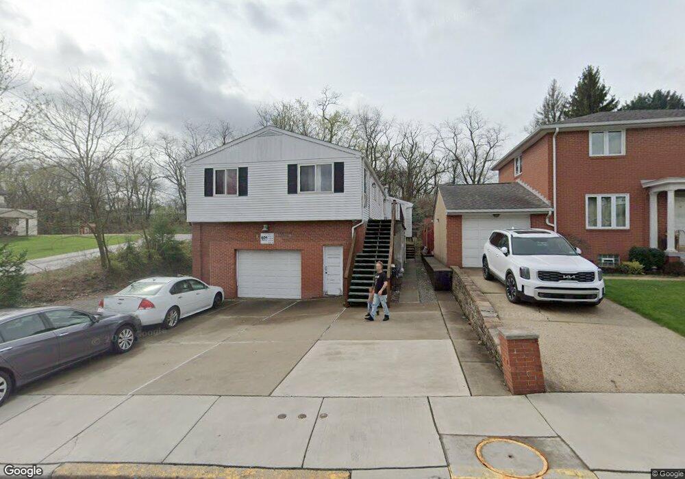
601 Main St Mc Kees Rocks, PA 15136
Stowe Township NeighborhoodEstimated Value: $109,000 - $242,000
3
Beds
3
Baths
1,665
Sq Ft
$103/Sq Ft
Est. Value
About This Home
This home is located at 601 Main St, Mc Kees Rocks, PA 15136 and is currently estimated at $171,346, approximately $102 per square foot. 601 Main St is a home located in Allegheny County with nearby schools including Sto-Rox Upper Elementary School, Sto-Rox Primary Center, and Sto-Rox Junior/Senior High School.
Ownership History
Date
Name
Owned For
Owner Type
Purchase Details
Closed on
Mar 27, 2019
Sold by
Catanzaro Joel
Bought by
Catz Inc
Current Estimated Value
Purchase Details
Closed on
Jun 2, 2005
Sold by
Sappo Caroline
Bought by
Catanzaro Joel
Home Financials for this Owner
Home Financials are based on the most recent Mortgage that was taken out on this home.
Original Mortgage
$78,000
Interest Rate
5.83%
Mortgage Type
New Conventional
Create a Home Valuation Report for This Property
The Home Valuation Report is an in-depth analysis detailing your home's value as well as a comparison with similar homes in the area
Home Values in the Area
Average Home Value in this Area
Purchase History
| Date | Buyer | Sale Price | Title Company |
|---|---|---|---|
| Catz Inc | $108,984 | Attorney | |
| Catanzaro Joel | $97,000 | -- |
Source: Public Records
Mortgage History
| Date | Status | Borrower | Loan Amount |
|---|---|---|---|
| Previous Owner | Catanzaro Joel | $78,000 |
Source: Public Records
Tax History Compared to Growth
Tax History
| Year | Tax Paid | Tax Assessment Tax Assessment Total Assessment is a certain percentage of the fair market value that is determined by local assessors to be the total taxable value of land and additions on the property. | Land | Improvement |
|---|---|---|---|---|
| 2025 | $4,131 | $95,600 | $17,300 | $78,300 |
| 2024 | $4,131 | $95,600 | $17,300 | $78,300 |
| 2023 | $3,971 | $95,600 | $17,300 | $78,300 |
| 2022 | $3,844 | $95,600 | $17,300 | $78,300 |
| 2021 | $452 | $95,600 | $17,300 | $78,300 |
| 2020 | $3,757 | $95,600 | $17,300 | $78,300 |
| 2019 | $3,757 | $95,600 | $17,300 | $78,300 |
| 2018 | $452 | $95,600 | $17,300 | $78,300 |
| 2017 | $3,671 | $95,600 | $17,300 | $78,300 |
| 2016 | $452 | $95,600 | $17,300 | $78,300 |
| 2015 | $452 | $95,600 | $17,300 | $78,300 |
| 2014 | $3,671 | $95,600 | $17,300 | $78,300 |
Source: Public Records
Map
Nearby Homes
- 543 Elizabeth Ave
- 813 13th St
- 124 Pleasant Ridge Rd
- 932 Ridge Ave
- 601 Hillcrest Ave
- 1212 Woodward Ave
- 809 11th St
- 802 10th St
- 810 10th St
- 1408 Broadway Ave
- 1406 Broadway Ave
- 155 Roosevelt Ave
- 813 10th St
- 837 Benwood Ave
- 815 10th St
- 1131 13th St
- 270 Wheeler Ave
- 813 8th St
- 86 Thorncrest Dr
- 908 Russellwood Ave
- 603 Main St
- 605 Main St
- 448 Macarthur St
- 434 Macarthur St
- 424 Macarthur St
- 500 Macarthur St
- 513 Mccoy Rd
- 402 Mccoy Rd
- 447 Macarthur St
- 500 Mccoy Rd
- 506 Macarthur St
- 515 Mccoy Rd
- 400 Mccoy Rd
- 435 Macarthur St
- 416 Macarthur St
- 609 Main St
- 429 Macarthur St
- 512 Macarthur St
- 517 Mccoy Rd
- 511 Macarthur St