601 Martin Rd Waterloo, IA 50701
Estimated Value: $149,557 - $181,000
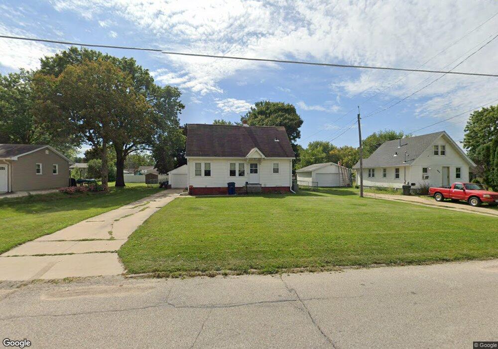
About This Home
This home is located at 601 Martin Rd, Waterloo, IA 50701 and is currently estimated at $161,889, approximately $142 per square foot. 601 Martin Rd is a home located in Black Hawk County with nearby schools including Kingsley Elementary School, Hoover Middle School, and West High School.
Ownership History
We collect this data history from publicly available records. To have your information removed, we recommend requesting removal directly through your county’s website.
Purchase Details
Purchase Details
Home Financials for this Owner
Home Financials are based on the most recent Mortgage that was taken out on this home.Purchase Details
Home Financials for this Owner
Home Financials are based on the most recent Mortgage that was taken out on this home.Purchase History
We collect this data history from publicly available records. To have your information removed, we recommend requesting removal directly through your county’s website.
| Date | Buyer | Sale Price | Title Company |
|---|---|---|---|
| -- | None Available | ||
| -- | None Available | ||
| $94,000 | Cedar Valley Settlement & Es |
Mortgage History
We collect this data history from publicly available records. To have your information removed, we recommend requesting removal directly through your county’s website.
| Date | Status | Borrower | Loan Amount |
|---|---|---|---|
| Previous Owner | $88,000 | ||
| Previous Owner | $18,105 |
Tax History
We collect this data history from publicly available records. To have your information removed, we recommend requesting removal directly through your county’s website.
| Year | Tax Paid | Tax Assessment Tax Assessment Total Assessment is a certain percentage of the fair market value that is determined by local assessors to be the total taxable value of land and additions on the property. | Land | Improvement |
|---|---|---|---|---|
| 2025 | $2,346 | $130,790 | $32,400 | $98,390 |
| 2024 | $2,346 | $118,350 | $32,400 | $85,950 |
| 2023 | $2,130 | $118,350 | $32,400 | $85,950 |
| 2022 | $2,072 | $105,840 | $32,400 | $73,440 |
| 2021 | $1,904 | $105,840 | $32,400 | $73,440 |
| 2020 | $1,870 | $92,680 | $25,920 | $66,760 |
| 2019 | $1,870 | $92,680 | $25,920 | $66,760 |
| 2018 | $1,872 | $92,680 | $25,920 | $66,760 |
| 2017 | $1,932 | $92,680 | $25,920 | $66,760 |
| 2016 | $1,904 | $92,680 | $25,920 | $66,760 |
| 2015 | $1,904 | $92,680 | $25,920 | $66,760 |
| 2014 | $1,942 | $92,680 | $25,920 | $66,760 |
Map
- 576 Pioneer Rd
- 2138 Casper Ave
- 141 Stewart Ave
- 247 Martin Rd
- 0 Provision Pkwy
- 3105 Ansborough Ave
- 314 Lillian Ln
- Village West 2nd Addn Lot 2
- 0 Hwy 63 Land Unit NBR20254281
- 0 Hwy 63 Land Unit NBR20255994
- 0 Ridgeway Ave Unit Corner Lot
- Dixon Drive Unit Residential Lot
- 3329 Lincolnshire Rd
- 3335 Lincolnshire Rd
- 3325 Lincolnshire Rd
- 3356 Lincolnshire Rd
- 0.72 Acres Highway 63
- LOT W W Ridgeway Ave
- 1638 Oriole Ave
- 1525 Robin Rd
- 570 Martin Rd
- 558 Martin Rd
- 600 Martin Rd
- 443 Meadowbrook Ln
- 435 Meadowbrook Ln
- 552 Martin Rd
- 2368 Muncy Ave
- 2362 Muncy Ave
- 429 Meadowbrook Ln
- 571 Martin Rd
- 544 Martin Rd
- 551 Martin Rd
- 603 Martin Rd
- 608 Martin Rd Unit 610
- 421 Meadowbrook Ln
- 549 Martin Rd
- 536 Martin Rd
- 2354 Muncy Ave
- 2405 Delane Ave
- 434 Meadowbrook Ln
Ask me questions while you tour the home.