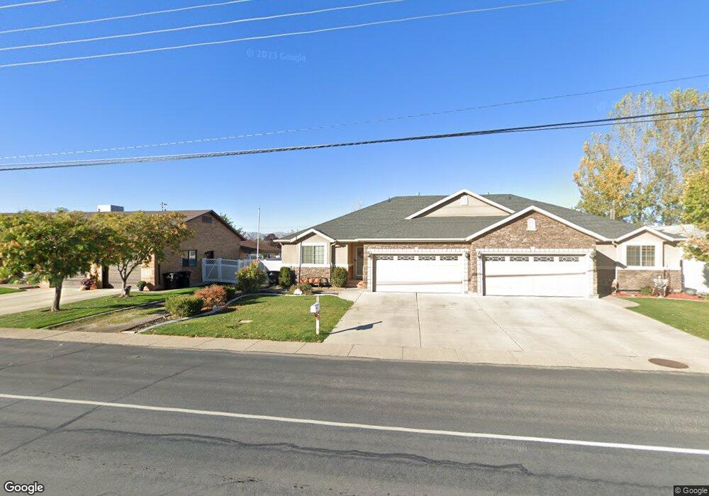
601 N 300 W Spanish Fork, UT 84660
Estimated Value: $362,000 - $405,550
3
Beds
2
Baths
2,912
Sq Ft
$135/Sq Ft
Est. Value
About This Home
This home is located at 601 N 300 W, Spanish Fork, UT 84660 and is currently estimated at $391,888, approximately $134 per square foot. 601 N 300 W is a home located in Utah County with nearby schools including Brockbank Elementary School, Spanish Fork Jr High School, and Spanish Fork High School.
Ownership History
Date
Name
Owned For
Owner Type
Purchase Details
Closed on
Jan 21, 2021
Sold by
Mateus Carlos and Mateus Amanda Lee
Bought by
Mateus Amanda and Mateus Carlos
Current Estimated Value
Home Financials for this Owner
Home Financials are based on the most recent Mortgage that was taken out on this home.
Original Mortgage
$288,350
Outstanding Balance
$256,853
Interest Rate
2.6%
Mortgage Type
New Conventional
Estimated Equity
$135,035
Purchase Details
Closed on
Feb 23, 2015
Sold by
Mateus Carlos
Bought by
Mateus Carlos and Mateus Amanda Lee
Home Financials for this Owner
Home Financials are based on the most recent Mortgage that was taken out on this home.
Original Mortgage
$165,826
Interest Rate
3.62%
Mortgage Type
FHA
Purchase Details
Closed on
May 14, 2009
Sold by
Dahlen James H and Dahlen Marie C
Bought by
Mateus Carlos
Home Financials for this Owner
Home Financials are based on the most recent Mortgage that was taken out on this home.
Original Mortgage
$179,685
Interest Rate
4.8%
Mortgage Type
FHA
Purchase Details
Closed on
Jan 3, 2008
Sold by
Raines Donald
Bought by
Dahlen James H and Dahlen Marie C
Home Financials for this Owner
Home Financials are based on the most recent Mortgage that was taken out on this home.
Original Mortgage
$207,000
Interest Rate
6.05%
Mortgage Type
Purchase Money Mortgage
Purchase Details
Closed on
Jun 15, 2007
Sold by
Grant Joseph Clay and Grant Jan M
Bought by
English Matthew A
Home Financials for this Owner
Home Financials are based on the most recent Mortgage that was taken out on this home.
Original Mortgage
$167,708
Interest Rate
6.36%
Mortgage Type
Commercial
Create a Home Valuation Report for This Property
The Home Valuation Report is an in-depth analysis detailing your home's value as well as a comparison with similar homes in the area
Home Values in the Area
Average Home Value in this Area
Purchase History
| Date | Buyer | Sale Price | Title Company |
|---|---|---|---|
| Mateus Amanda | -- | Gateway Title Ins Agency Llc | |
| Mateus Carlos | -- | Meridian Title Co | |
| Mateus Carlos | -- | Pinnacle Title | |
| Dahlen James H | -- | Equity Title Orem Blvd | |
| English Matthew A | -- | Investors Title Insurance A | |
| Grant Joseph Clay | -- | Investors Title Insurance A |
Source: Public Records
Mortgage History
| Date | Status | Borrower | Loan Amount |
|---|---|---|---|
| Open | Mateus Amanda | $288,350 | |
| Closed | Mateus Carlos | $165,826 | |
| Closed | Mateus Carlos | $179,685 | |
| Previous Owner | Dahlen James H | $207,000 | |
| Previous Owner | Grant Joseph Clay | $167,708 | |
| Previous Owner | English Matthew A | $189,329 |
Source: Public Records
Tax History Compared to Growth
Tax History
| Year | Tax Paid | Tax Assessment Tax Assessment Total Assessment is a certain percentage of the fair market value that is determined by local assessors to be the total taxable value of land and additions on the property. | Land | Improvement |
|---|---|---|---|---|
| 2025 | $2,202 | $219,285 | $77,500 | $321,200 |
| 2024 | $2,202 | $226,985 | $0 | $0 |
| 2023 | $2,228 | $229,900 | $0 | $0 |
| 2022 | $2,071 | $209,550 | $0 | $0 |
| 2021 | $1,831 | $296,500 | $65,600 | $230,900 |
| 2020 | $1,728 | $272,000 | $65,600 | $206,400 |
| 2019 | $1,582 | $262,000 | $65,600 | $196,400 |
| 2018 | $1,386 | $221,800 | $65,600 | $156,200 |
| 2017 | $1,397 | $120,175 | $0 | $0 |
| 2016 | $1,198 | $101,750 | $0 | $0 |
| 2015 | $1,115 | $93,500 | $0 | $0 |
| 2014 | $1,013 | $85,250 | $0 | $0 |
Source: Public Records
Map
Nearby Homes
- 393 N 400 W
- 433 N 100 W
- 559 N Mitchell Dr
- 40 W 400 N Unit 1-6
- 294 W 200 N
- 55 E 700 N
- 555 N 100 E
- 134 N 300 W
- 1841 N 630 St W Unit 71
- 1788 N 630 St W Unit 47
- 1826 N 630 St W Unit 101
- 136 E 900 N
- 440 N 200 E
- 143 E 200 N
- 833 W 250 N
- 288 E 800 N Unit 144
- 235 E 900 N
- 226 N 860 W Unit 156
- 13 N 710 W
- 385 E 700 N