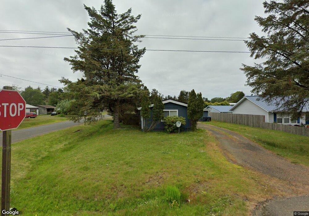
601 N Forrest St Westport, WA 98595
Estimated Value: $143,000 - $282,000
--
Bed
--
Bath
600
Sq Ft
$356/Sq Ft
Est. Value
About This Home
This home is located at 601 N Forrest St, Westport, WA 98595 and is currently estimated at $213,710, approximately $356 per square foot. 601 N Forrest St is a home located in Grays Harbor County with nearby schools including Ocosta Elementary School and Ocosta Junior/Senior High School.
Ownership History
Date
Name
Owned For
Owner Type
Purchase Details
Closed on
Dec 2, 2010
Sold by
Mackinnon Shelton Donnell R
Bought by
Lowe Gabriel J and Lowe Jerry J
Current Estimated Value
Home Financials for this Owner
Home Financials are based on the most recent Mortgage that was taken out on this home.
Original Mortgage
$50,500
Outstanding Balance
$1,126
Interest Rate
4.17%
Mortgage Type
FHA
Estimated Equity
$212,584
Purchase Details
Closed on
Dec 29, 2009
Sold by
Bartmann Larry
Bought by
Mackinnon Shelton Donnell R
Create a Home Valuation Report for This Property
The Home Valuation Report is an in-depth analysis detailing your home's value as well as a comparison with similar homes in the area
Home Values in the Area
Average Home Value in this Area
Purchase History
| Date | Buyer | Sale Price | Title Company |
|---|---|---|---|
| Lowe Gabriel J | $55,000 | Coast Title | |
| Mackinnon Shelton Donnell R | -- | None Available |
Source: Public Records
Mortgage History
| Date | Status | Borrower | Loan Amount |
|---|---|---|---|
| Open | Lowe Gabriel J | $50,500 |
Source: Public Records
Tax History Compared to Growth
Tax History
| Year | Tax Paid | Tax Assessment Tax Assessment Total Assessment is a certain percentage of the fair market value that is determined by local assessors to be the total taxable value of land and additions on the property. | Land | Improvement |
|---|---|---|---|---|
| 2025 | $1,234 | $145,024 | $56,867 | $88,157 |
| 2023 | $1,188 | $132,800 | $56,867 | $75,933 |
| 2022 | $1,523 | $132,267 | $19,950 | $112,317 |
| 2021 | $1,384 | $132,267 | $19,950 | $112,317 |
| 2020 | $1,044 | $109,886 | $19,000 | $90,886 |
| 2019 | $954 | $79,400 | $25,500 | $53,900 |
| 2018 | $868 | $74,500 | $25,500 | $49,000 |
| 2017 | $713 | $60,500 | $25,500 | $35,000 |
| 2016 | $739 | $60,500 | $25,500 | $35,000 |
| 2014 | -- | $59,325 | $25,500 | $33,825 |
| 2013 | -- | $69,420 | $30,000 | $39,420 |
Source: Public Records
Map
Nearby Homes
- 0 N Forrest St Unit NWM2417282
- 331 N Melbourne St
- 0 Olympia St Unit NWM2367648
- 711 N Baker St
- 730 N Adams St
- 902 N Baker St
- 605 N Montesano St
- 201 S Hoquiam St
- 280 S Surf St
- 719 N 2nd St
- 608 N 2nd St
- 200 E Harms Dr
- 401 S Starr St
- 702 N Third St
- 712 N Third St
- 714 N Third St
- 704 N Third St
- 507 W Veterans Ave
- 603 W Veterans Ave
- 507 E Pacific Ave
- 603 N Forrest St
- 571 N Forrest St
- 621 N Forrest St
- 811 W Sprague Ave
- 630 N Hoquiam St
- 610 N Forrest St
- 681 N Forrest St
- 520 N Hoquiam St
- 3 N Hoquiam St
- 650 Hoquiam
- 670 N Forrest St
- 570 N Forrest St
- 676 N Forrest St
- 521 N Forrest St
- 800 W Sprague Ave
- 680 N Forrest St
- 520 N Forrest St
- 511 N Forrest St
- 649 N Central St
- 521 N Hoquiam St