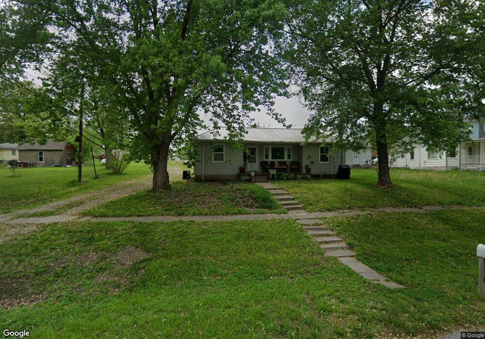
601 N Main St Clarksdale, MO 64430
Estimated Value: $73,000 - $120,000
1
Bed
1
Bath
728
Sq Ft
$132/Sq Ft
Est. Value
About This Home
This home is located at 601 N Main St, Clarksdale, MO 64430 and is currently estimated at $96,286, approximately $132 per square foot. 601 N Main St is a home with nearby schools including Maysville Elementary School and Maysville Junior/Senior High School.
Ownership History
Date
Name
Owned For
Owner Type
Purchase Details
Closed on
Feb 24, 2013
Sold by
Bruff Christina Enloe
Bought by
Grable Nathan Lee
Current Estimated Value
Purchase Details
Closed on
Jul 2, 2012
Sold by
Green Dondi Lee and Grable Dondi Lee
Bought by
Grable Nathan
Purchase Details
Closed on
Jun 29, 2012
Sold by
Cox Aria and Cox Ryan
Bought by
Grable Nathan
Purchase Details
Closed on
Jun 26, 2012
Sold by
Grable Dannin L
Bought by
Grable Nathan
Create a Home Valuation Report for This Property
The Home Valuation Report is an in-depth analysis detailing your home's value as well as a comparison with similar homes in the area
Home Values in the Area
Average Home Value in this Area
Purchase History
| Date | Buyer | Sale Price | Title Company |
|---|---|---|---|
| Grable Nathan Lee | -- | None Available | |
| Grable Nathan | -- | None Available | |
| Grable Nathan | -- | None Available | |
| Grable Nathan | -- | None Available | |
| Grable Nathan | -- | None Available |
Source: Public Records
Tax History Compared to Growth
Tax History
| Year | Tax Paid | Tax Assessment Tax Assessment Total Assessment is a certain percentage of the fair market value that is determined by local assessors to be the total taxable value of land and additions on the property. | Land | Improvement |
|---|---|---|---|---|
| 2024 | $356 | $5,400 | $530 | $4,870 |
| 2023 | $355 | $5,400 | $530 | $4,870 |
| 2022 | $339 | $5,160 | $530 | $4,630 |
| 2021 | $338 | $5,160 | $530 | $4,630 |
| 2020 | $327 | $4,970 | $340 | $4,630 |
| 2019 | $323 | $4,970 | $340 | $4,630 |
| 2018 | $318 | $4,920 | $0 | $4,920 |
| 2017 | $326 | $4,920 | $0 | $4,920 |
| 2016 | $329 | $4,920 | $0 | $0 |
| 2015 | -- | $4,920 | $0 | $0 |
| 2012 | -- | $4,920 | $0 | $0 |
Source: Public Records
Map
Nearby Homes
- 0 SW Taylor Rd
- 6944 SW Thornton Rd
- 0 SW Grindstone Rd
- 710 Groom St
- 3730 State Route N
- 106 Meadowbrook Ln
- 8608 N Rd
- 0 Main St Unit 2415604
- 103 10th St
- 7538 NW 356th St
- 113 W 6th St
- 0 SW Patton Rd
- 2 SW Patton Rd
- 0 Spring Holler SE
- 1315 SW State Rt Rd N
- 0 SE 36 Hwy
- 3799 E Lowell St
- TBD SW Wamsley Rd
- 111 N Woodward St
- 0 NW Waldo Rd