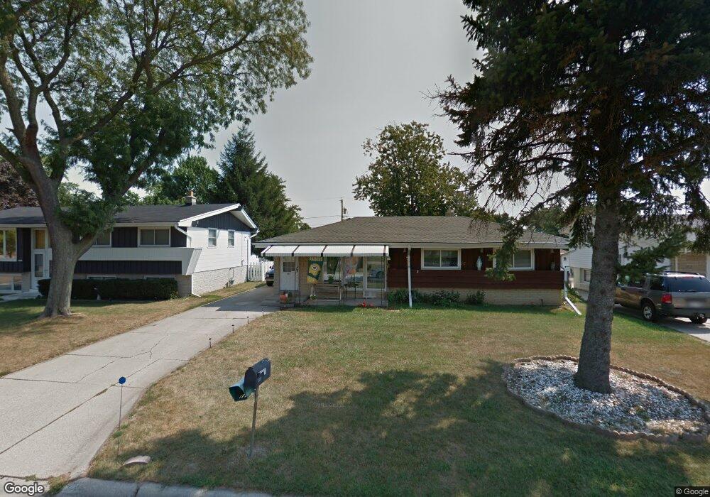
601 Nicholson Ave South Milwaukee, WI 53172
Estimated Value: $276,451 - $310,000
--
Bed
--
Bath
1,137
Sq Ft
$262/Sq Ft
Est. Value
About This Home
This home is located at 601 Nicholson Ave, South Milwaukee, WI 53172 and is currently estimated at $298,363, approximately $262 per square foot. 601 Nicholson Ave is a home located in Milwaukee County with nearby schools including Rawson Elementary School, South Milwaukee Middle School, and South Milwaukee High School.
Ownership History
Date
Name
Owned For
Owner Type
Purchase Details
Closed on
Jul 15, 2004
Sold by
Malak Daniel G and Malak Lori A
Bought by
Gross Richard A and Gross Leslie L
Current Estimated Value
Home Financials for this Owner
Home Financials are based on the most recent Mortgage that was taken out on this home.
Original Mortgage
$110,000
Interest Rate
6.34%
Mortgage Type
Purchase Money Mortgage
Purchase Details
Closed on
Oct 27, 1997
Sold by
Malak Robert J and Malak Suzanne J
Bought by
Malak Daniel G and Malak Lori A
Home Financials for this Owner
Home Financials are based on the most recent Mortgage that was taken out on this home.
Original Mortgage
$81,500
Interest Rate
7.42%
Mortgage Type
Purchase Money Mortgage
Create a Home Valuation Report for This Property
The Home Valuation Report is an in-depth analysis detailing your home's value as well as a comparison with similar homes in the area
Home Values in the Area
Average Home Value in this Area
Purchase History
| Date | Buyer | Sale Price | Title Company |
|---|---|---|---|
| Gross Richard A | $155,000 | Metropolitan Title Company | |
| Malak Daniel G | -- | -- |
Source: Public Records
Mortgage History
| Date | Status | Borrower | Loan Amount |
|---|---|---|---|
| Closed | Gross Richard A | $110,000 | |
| Previous Owner | Malak Daniel G | $81,500 |
Source: Public Records
Tax History Compared to Growth
Tax History
| Year | Tax Paid | Tax Assessment Tax Assessment Total Assessment is a certain percentage of the fair market value that is determined by local assessors to be the total taxable value of land and additions on the property. | Land | Improvement |
|---|---|---|---|---|
| 2024 | $2,181 | $224,300 | $72,000 | $152,300 |
| 2023 | $4,258 | $224,300 | $72,000 | $152,300 |
| 2022 | $4,331 | $224,300 | $72,000 | $152,300 |
| 2021 | $3,918 | $147,000 | $57,000 | $90,000 |
| 2020 | $3,941 | $147,000 | $57,000 | $90,000 |
| 2019 | $3,859 | $147,000 | $57,000 | $90,000 |
| 2018 | $4,183 | $147,000 | $57,000 | $90,000 |
| 2017 | $3,735 | $147,000 | $57,000 | $90,000 |
| 2016 | $3,652 | $147,000 | $57,000 | $90,000 |
| 2015 | $3,673 | $147,000 | $57,000 | $90,000 |
| 2014 | $3,585 | $147,000 | $57,000 | $90,000 |
| 2013 | $3,860 | $147,000 | $57,000 | $90,000 |
Source: Public Records
Map
Nearby Homes
- 2051 E Poplar Ave
- 1729 Hickory St
- 6961 S Rolling Meadows Ct Unit 101
- 1722 Manitoba Ave
- 1301 College Ave Unit 5
- 7300 S Delaine Dr
- 6240 S Creekside Dr Unit 2
- 2227 E Excalibur Ct Unit 2227
- 6195 Walnut Ln Unit 65
- 6035 S Crosswinds Dr Unit 7
- 5829 S Delaware Ave Unit 29A
- 201 N Chicago Ave
- 6010 S Crosswinds Dr Unit 7
- 1320 Milwaukee Ave
- 6040 S Buckhorn Ave
- 3373 E Henry Ave
- 1216 N Chicago Ave
- 3614 E Kimberly Ave
- 6196 S Tarbert Ct
- 616 Aspen St
- 609 Nicholson Ave
- 525 Nicholson Ave
- 617 Nicholson Ave
- 517 Nicholson Ave
- 600 Willow Ln
- 524 Willow Ln
- 608 Willow Ln
- 509 Nicholson Ave
- 616 Willow Ln
- 516 Willow Ln
- 1890 Elm Ave
- 1878 Elm Ave
- 508 Willow Ln
- 501 Nicholson Ave
- 1868 Elm Ave
- 624 Willow Ln
- 500 Willow Ln
- 417 Nicholson Ave
- 6594 S Crane Dr
- 6584 S Crane Dr