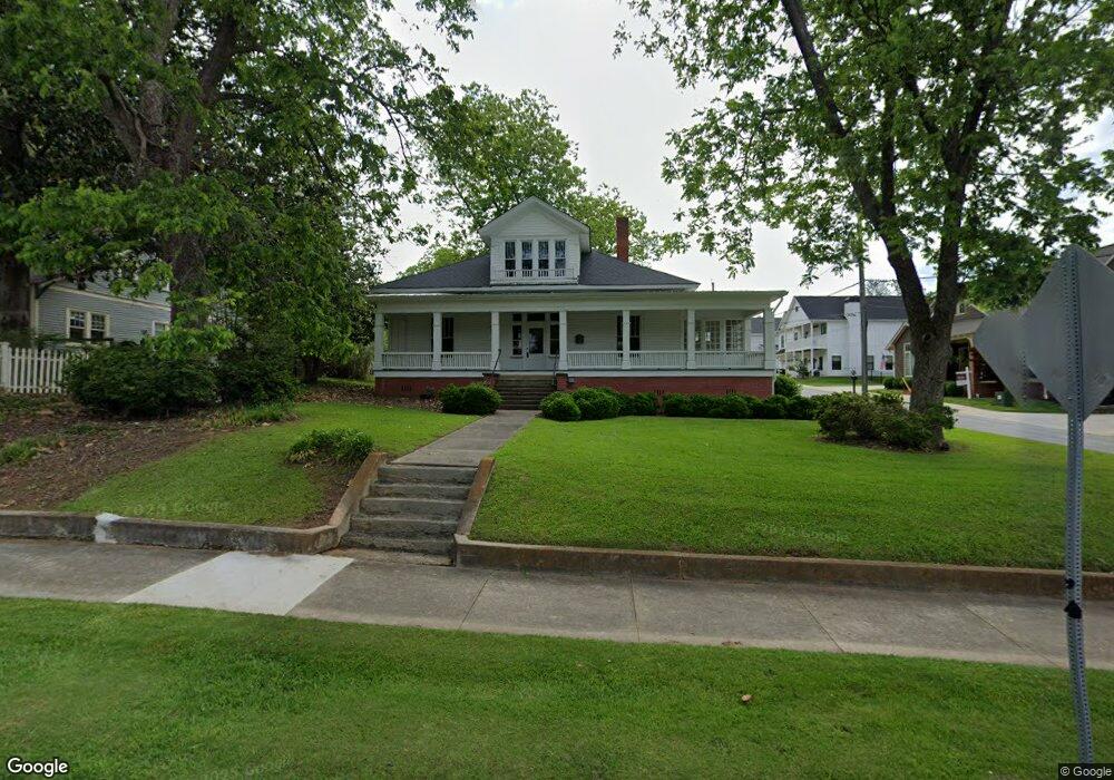
601 Rome St Carrollton, GA 30117
Estimated Value: $353,000 - $456,000
3
Beds
3
Baths
3,204
Sq Ft
$126/Sq Ft
Est. Value
About This Home
This home is located at 601 Rome St, Carrollton, GA 30117 and is currently estimated at $402,590, approximately $125 per square foot. 601 Rome St is a home with nearby schools including Carrollton Elementary School, Carrollton Upper Elementary School, and Carrollton Middle School.
Ownership History
Date
Name
Owned For
Owner Type
Purchase Details
Closed on
Jul 7, 2008
Sold by
Lease Purchase Ii Inc
Bought by
Young Robert
Current Estimated Value
Purchase Details
Closed on
Jun 3, 2008
Sold by
Not Provided
Bought by
Young Robert
Purchase Details
Closed on
Feb 9, 2005
Sold by
Walls Paul
Bought by
Goldin Robert L
Home Financials for this Owner
Home Financials are based on the most recent Mortgage that was taken out on this home.
Original Mortgage
$177,859
Interest Rate
5.68%
Mortgage Type
Commercial
Purchase Details
Closed on
Oct 25, 1985
Bought by
Walls H Paul
Create a Home Valuation Report for This Property
The Home Valuation Report is an in-depth analysis detailing your home's value as well as a comparison with similar homes in the area
Home Values in the Area
Average Home Value in this Area
Purchase History
| Date | Buyer | Sale Price | Title Company |
|---|---|---|---|
| Young Robert | $167,500 | -- | |
| Young Robert | $99,001 | -- | |
| Goldin Robert L | $175,000 | -- | |
| Walls H Paul | $55,000 | -- |
Source: Public Records
Mortgage History
| Date | Status | Borrower | Loan Amount |
|---|---|---|---|
| Previous Owner | Goldin Robert L | $177,859 |
Source: Public Records
Tax History Compared to Growth
Tax History
| Year | Tax Paid | Tax Assessment Tax Assessment Total Assessment is a certain percentage of the fair market value that is determined by local assessors to be the total taxable value of land and additions on the property. | Land | Improvement |
|---|---|---|---|---|
| 2024 | $4,586 | $167,835 | $20,382 | $147,453 |
| 2023 | $4,586 | $154,345 | $20,382 | $133,963 |
| 2022 | $2,323 | $79,595 | $13,588 | $66,007 |
| 2021 | $1,946 | $66,664 | $10,050 | $56,614 |
| 2020 | $1,773 | $60,694 | $10,050 | $50,644 |
| 2019 | $1,696 | $57,490 | $10,050 | $47,440 |
| 2018 | $1,599 | $53,451 | $10,050 | $43,401 |
| 2017 | $1,608 | $53,451 | $10,050 | $43,401 |
| 2016 | $1,617 | $53,451 | $10,050 | $43,401 |
| 2015 | $2,032 | $65,779 | $7,200 | $58,579 |
| 2014 | $2,041 | $65,779 | $7,200 | $58,579 |
Source: Public Records
Map
Nearby Homes
- 110 Town Walk Ln
- 0 Ward St Unit 10390499
- 205 Johnson Ave Unit 231
- 103 W Chandler St
- 108 Springwood Dr
- 405 N Park St
- TRACT1-7 Us Highway 27
- 541 N White St Unit 12
- 541 N White St
- 777 College St
- 322 Cedar St
- 120 Stewart St
- 301 C4 Bradley St
- 201 Stewart St
- 301 Bradley St
- 109 S Park St
- 654 King St
- 123 Cedar Park Way
- 119 Oxford Square
- 27 South St
- 605 Rome St
- 25 Rhudy St Unit 2
- 535 Rome St
- 35 Rhudy St
- 0 Rhudy St Unit 8728892
- 0 Rhudy St Unit 9001320
- 0 Rhudy St Unit 8792757
- 0 Rhudy St Unit 8337696
- 0 Rhudy St Unit 8337118
- 114 Rhudy St
- 20 E Reese St
- 20 E Reese St Unit 6
- 45 Rhudy St
- 515 Rome St
- 30 E Reese St
- 118 Rhudy St
- 602 Rome St
- 122 Rhudy St
- 504 Rome St
- 619 Rome St