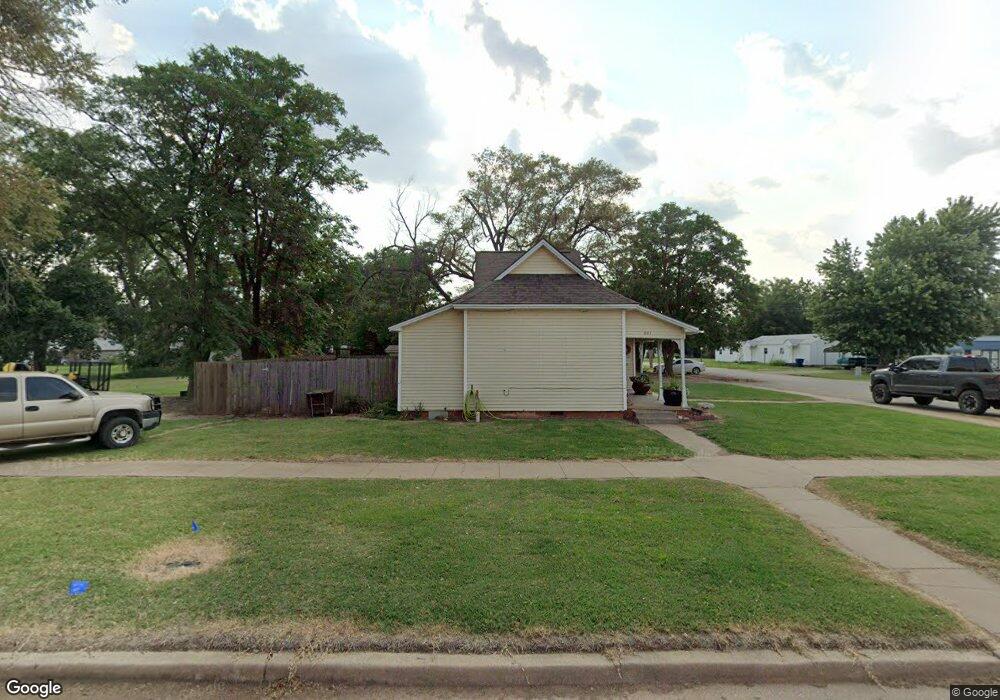
601 S Massachusetts Ave Cherokee, OK 73728
Estimated Value: $65,729 - $100,000
3
Beds
1
Bath
1,399
Sq Ft
$56/Sq Ft
Est. Value
About This Home
This home is located at 601 S Massachusetts Ave, Cherokee, OK 73728 and is currently estimated at $77,932, approximately $55 per square foot. 601 S Massachusetts Ave is a home located in Alfalfa County with nearby schools including Cherokee Middle School and Cherokee High School.
Ownership History
Date
Name
Owned For
Owner Type
Purchase Details
Closed on
May 22, 2012
Sold by
Ferrell Dennis
Bought by
Ferrell Rentals, L.L.C.
Current Estimated Value
Purchase Details
Closed on
Mar 16, 2007
Sold by
Liberty Federal Savings
Bought by
Dennis Ferrell
Purchase Details
Closed on
Jul 31, 2006
Sold by
Bruce Anthony Johnson
Bought by
Liberty Federal Sav. Bank
Purchase Details
Closed on
Jun 23, 1999
Sold by
Diana L Don Carlos Etvir
Bought by
Bruce A Johnson
Purchase Details
Closed on
Jun 21, 1999
Sold by
Lula Mae Mclaughkin
Bought by
Diana L Don Carlos Etvir
Purchase Details
Closed on
Jul 7, 1997
Sold by
Lula Mae Mclaughkin
Bought by
Diana Lee Don Carlos
Create a Home Valuation Report for This Property
The Home Valuation Report is an in-depth analysis detailing your home's value as well as a comparison with similar homes in the area
Purchase History
| Date | Buyer | Sale Price | Title Company |
|---|---|---|---|
| Ferrell Rentals, L.L.C. | -- | -- | |
| Dennis Ferrell | $9,000 | -- | |
| Liberty Federal Sav. Bank | $22,500 | -- | |
| Bruce A Johnson | $32,000 | -- | |
| Diana L Don Carlos Etvir | -- | -- | |
| Diana Lee Don Carlos | $28,000 | -- | |
| Lula Mae Mclaughlin | -- | -- |
Source: Public Records
Tax History
| Year | Tax Paid | Tax Assessment Tax Assessment Total Assessment is a certain percentage of the fair market value that is determined by local assessors to be the total taxable value of land and additions on the property. | Land | Improvement |
|---|---|---|---|---|
| 2025 | $251 | $2,545 | $609 | $1,936 |
| 2024 | $246 | $2,423 | $609 | $1,814 |
| 2023 | $234 | $2,308 | $609 | $1,699 |
| 2022 | $216 | $2,198 | $609 | $1,589 |
| 2021 | $227 | $2,159 | $609 | $1,550 |
| 2020 | $421 | $4,194 | $609 | $3,585 |
| 2019 | $441 | $4,284 | $609 | $3,675 |
| 2018 | $418 | $4,254 | $609 | $3,645 |
| 2017 | $414 | $4,298 | $608 | $3,690 |
| 2016 | $417 | $4,094 | $521 | $3,573 |
| 2015 | $357 | $3,899 | $497 | $3,402 |
| 2014 | $324 | $3,712 | $499 | $3,213 |
Source: Public Records
Map
Nearby Homes
- 609 S Pennsylvania Ave
- 414 E 7th St
- 420 S Colorado Ave
- 211 E 5th St
- 308, 310 & 314 S Kansas Ave
- 906 S Grand Ave
- 214 W 5th St
- 416 S Florida Ave
- 223 W 10th St
- 229 W 9th St
- 121 N Colorado Ave
- 421 W Main St
- 61151 Harper Rd
- 35565 N2570 Rd
- E0200 Rd N2600 Rd
- 69937 Dewy Rd
- 24682 County Road 740
- 101 N 7th
- 34077 County Road 670
- 000
- 314 E 6th St
- 613 S Massachusetts Ave
- 521 S Massachusetts Ave
- 612 S Massachusetts Ave
- 321 E 7th St
- 608 S Pennsylvania Ave
- 309 E 6th St
- 616 S Massachusetts Ave
- 517 S Massachusetts Ave
- 616 S Pennsylvania Ave
- 602 S Pennsylvania Ave
- 401 E 7th St
- 518 S Pennsylvania Ave
- 515 S Massachusetts Ave
- 622 S Pennsylvania Ave
- 516 S Pennsylvania Ave
- 505 S Massachusetts Ave
- 702 S Massachusetts Ave
- 603 S Pennsylvania Ave
- 512 S Pennsylvania Ave
Your Personal Tour Guide
Ask me questions while you tour the home.