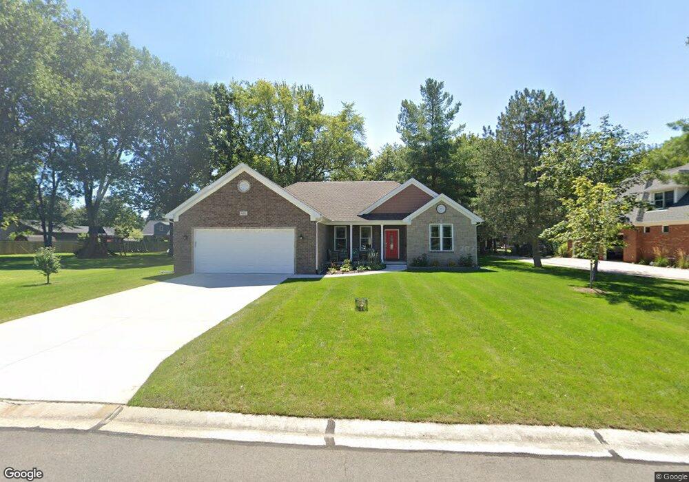
601 St Andrews Saint Clair, MI 48079
Estimated Value: $299,970 - $356,000
3
Beds
2
Baths
1,494
Sq Ft
$217/Sq Ft
Est. Value
About This Home
This home is located at 601 St Andrews, Saint Clair, MI 48079 and is currently estimated at $323,993, approximately $216 per square foot. 601 St Andrews is a home located in St. Clair County with nearby schools including Gearing Elementary School, St. Clair Middle School, and St. Clair High School.
Ownership History
Date
Name
Owned For
Owner Type
Purchase Details
Closed on
Dec 5, 2019
Sold by
Seibel Daniel L and Seibel Joanne P
Bought by
Wild Mark Robert and Wild Rosemarie Joan
Current Estimated Value
Purchase Details
Closed on
Dec 20, 2017
Sold by
Seibel Daniel L and Seibel Joanne P
Bought by
Schweihofer Sam and Schweihofer Kellyn
Home Financials for this Owner
Home Financials are based on the most recent Mortgage that was taken out on this home.
Original Mortgage
$30,000
Interest Rate
3.92%
Mortgage Type
Seller Take Back
Create a Home Valuation Report for This Property
The Home Valuation Report is an in-depth analysis detailing your home's value as well as a comparison with similar homes in the area
Home Values in the Area
Average Home Value in this Area
Purchase History
| Date | Buyer | Sale Price | Title Company |
|---|---|---|---|
| Wild Mark Robert | $42,000 | Transnation Title | |
| Schweihofer Sam | $40,000 | Huron Title |
Source: Public Records
Mortgage History
| Date | Status | Borrower | Loan Amount |
|---|---|---|---|
| Previous Owner | Schweihofer Sam | $30,000 |
Source: Public Records
Tax History
| Year | Tax Paid | Tax Assessment Tax Assessment Total Assessment is a certain percentage of the fair market value that is determined by local assessors to be the total taxable value of land and additions on the property. | Land | Improvement |
|---|---|---|---|---|
| 2025 | $4,140 | $166,200 | $0 | $0 |
| 2024 | $4,028 | $167,300 | $0 | $0 |
| 2022 | $4,161 | $105,900 | $0 | $0 |
| 2020 | $1,646 | $28,200 | $28,200 | $0 |
| 2019 | $705 | $19,800 | $0 | $0 |
| 2018 | $0 | $0 | $0 | $0 |
Source: Public Records
Map
Nearby Homes
- 740 Highland Dr
- 669 N Riverside Ave Unit 4
- 513 N 6th St
- 770 N Riverside Ave
- 0 Braeburn Dr Unit 6
- 592 Snowbird Cir E
- 715 Thornapple St
- 4455 Irene Dr
- 206 S 4th St
- 310 S 6th St
- 402 S 5th St
- 1 S Carney Dr
- 2 Riley
- 2 S Carney Dr Unit Lot TBD
- 3 S Carney Dr
- 211 N Carney Dr
- 920 Clinton Ave
- 1936 Shelldrake Ln Unit Lot 29
- 1 Shelldrake Ln
- 2 Shelldrake Ln
Your Personal Tour Guide
Ask me questions while you tour the home.