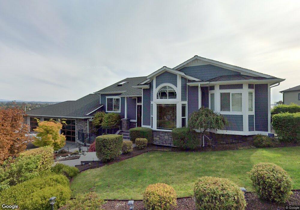
601 SW Founders Dr Oak Harbor, WA 98277
Estimated Value: $999,000 - $1,312,645
5
Beds
4
Baths
4,892
Sq Ft
$242/Sq Ft
Est. Value
About This Home
This home is located at 601 SW Founders Dr, Oak Harbor, WA 98277 and is currently estimated at $1,185,411, approximately $242 per square foot. 601 SW Founders Dr is a home with nearby schools including Broadview Elementary School, Oak Harbor Middle School, and Oak Harbor High School.
Ownership History
Date
Name
Owned For
Owner Type
Purchase Details
Closed on
Mar 13, 2008
Sold by
Maple Hill Development Inc
Bought by
Wallin Ron D and Wallin Gayle D
Current Estimated Value
Home Financials for this Owner
Home Financials are based on the most recent Mortgage that was taken out on this home.
Original Mortgage
$512,500
Outstanding Balance
$316,272
Interest Rate
5.65%
Mortgage Type
Purchase Money Mortgage
Estimated Equity
$869,139
Create a Home Valuation Report for This Property
The Home Valuation Report is an in-depth analysis detailing your home's value as well as a comparison with similar homes in the area
Home Values in the Area
Average Home Value in this Area
Purchase History
| Date | Buyer | Sale Price | Title Company |
|---|---|---|---|
| Wallin Ron D | $720,000 | Chicago Title Co Island Div |
Source: Public Records
Mortgage History
| Date | Status | Borrower | Loan Amount |
|---|---|---|---|
| Open | Wallin Ron D | $512,500 |
Source: Public Records
Tax History Compared to Growth
Tax History
| Year | Tax Paid | Tax Assessment Tax Assessment Total Assessment is a certain percentage of the fair market value that is determined by local assessors to be the total taxable value of land and additions on the property. | Land | Improvement |
|---|---|---|---|---|
| 2025 | $9,638 | $1,129,545 | $250,000 | $879,545 |
| 2024 | $9,523 | $1,136,937 | $250,000 | $886,937 |
| 2023 | $9,523 | $1,129,545 | $250,000 | $879,545 |
| 2022 | $9,423 | $1,043,158 | $240,000 | $803,158 |
| 2021 | $8,965 | $879,569 | $175,000 | $704,569 |
| 2020 | $8,890 | $834,138 | $150,000 | $684,138 |
| 2019 | $7,703 | $818,686 | $200,000 | $618,686 |
| 2018 | $8,418 | $770,345 | $150,000 | $620,345 |
| 2017 | $7,979 | $742,025 | $125,000 | $617,025 |
| 2016 | $8,331 | $748,662 | $125,000 | $623,662 |
| 2015 | $8,575 | $751,796 | $121,500 | $630,296 |
| 2013 | -- | $765,066 | $121,500 | $643,566 |
Source: Public Records
Map
Nearby Homes
- 942 SW Barrington Dr
- 1101 SW Harrier Cir Unit 106
- 30901 State Route 20 Unit D2
- 485 SW Bayshore Dr Unit C201
- 1121 SW Barrington Dr Unit 3
- 1850 SW Scenic Heights St Unit B304
- 915 SW Kimball Dr Unit B3
- 660 SW Harrier Cir Unit 1
- 1250 SW Heller Rd Unit C1
- 1250 SW Heller St Unit B2
- 0 XXX
- 984 SW 6th Ave
- 1380 SW Swantown Ave
- 0 XXX State Route 20 (Lot 3)
- 2029 Baymont Dr
- 478 SW Judson Dr
- 270 SE Barrington Dr Unit A-304
- 1700 SW Mulberry Place Unit A302
- 748 SW Heller St
- 1651 SW Mulberry Place Unit E204
- 611 SW Founders Dr
- 606 SW Founder Dr
- 600 SW Founders Dr
- 617 SW Founders Dr
- 618 SW Founders Dr
- 624 SW Founders Dr
- 642 SW Founders Dr
- 1188 SW Fairhaven Dr
- 1091 SW Fleet St
- 0 SW Founders Dr Unit 553109
- 0 SW Founders Dr Unit 924046
- 1224 SW Fairhaven Dr
- 1154 SW Fairhaven Dr
- 1120 SW Fleet St
- 1248 SW Fairhaven Dr
- 1128 SW Fairhaven Dr
- 1095 SW Erie St
- 633 SW Founders Dr