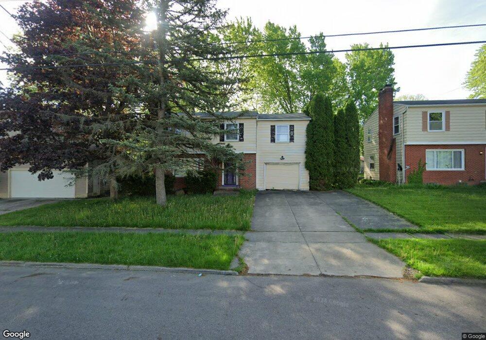
601 Treeside Dr Akron, OH 44313
Northwest Akron NeighborhoodEstimated Value: $184,000 - $238,138
4
Beds
3
Baths
1,556
Sq Ft
$136/Sq Ft
Est. Value
About This Home
This home is located at 601 Treeside Dr, Akron, OH 44313 and is currently estimated at $212,285, approximately $136 per square foot. 601 Treeside Dr is a home located in Summit County with nearby schools including Case Community Learning Center, Summit Academy School, and Our Lady Of The Elms Elementary School.
Ownership History
Date
Name
Owned For
Owner Type
Purchase Details
Closed on
Jan 20, 2022
Sold by
Sami Amilia D
Bought by
Bugg Dolores
Current Estimated Value
Purchase Details
Closed on
Aug 31, 2021
Sold by
Bugg Dolores
Bought by
Sami Amilia D
Purchase Details
Closed on
Nov 21, 2002
Sold by
Whatley Deonne L
Bought by
Bugg Dolores
Home Financials for this Owner
Home Financials are based on the most recent Mortgage that was taken out on this home.
Original Mortgage
$104,500
Interest Rate
6.22%
Purchase Details
Closed on
Sep 9, 1999
Sold by
Gross Family Ltd Partnership
Bought by
Whatley Deonne L
Home Financials for this Owner
Home Financials are based on the most recent Mortgage that was taken out on this home.
Original Mortgage
$108,600
Interest Rate
7.77%
Create a Home Valuation Report for This Property
The Home Valuation Report is an in-depth analysis detailing your home's value as well as a comparison with similar homes in the area
Home Values in the Area
Average Home Value in this Area
Purchase History
| Date | Buyer | Sale Price | Title Company |
|---|---|---|---|
| Bugg Dolores | -- | None Listed On Document | |
| Sami Amilia D | $122,980 | None Available | |
| Bugg Dolores | $110,000 | Midland Commerce Group Fairl | |
| Whatley Deonne L | $112,000 | Midland Commerce Group |
Source: Public Records
Mortgage History
| Date | Status | Borrower | Loan Amount |
|---|---|---|---|
| Previous Owner | Bugg Dolores | $104,500 | |
| Previous Owner | Whatley Deonne L | $108,600 |
Source: Public Records
Tax History
| Year | Tax Paid | Tax Assessment Tax Assessment Total Assessment is a certain percentage of the fair market value that is determined by local assessors to be the total taxable value of land and additions on the property. | Land | Improvement |
|---|---|---|---|---|
| 2024 | $5,640 | $59,830 | $11,477 | $48,353 |
| 2023 | $5,640 | $59,830 | $11,477 | $48,353 |
| 2022 | $4,004 | $43,044 | $8,257 | $34,787 |
| 2021 | $4,044 | $43,044 | $8,257 | $34,787 |
| 2020 | $3,651 | $43,050 | $8,260 | $34,790 |
| 2019 | $3,470 | $30,300 | $7,840 | $22,460 |
| 2018 | $2,265 | $30,300 | $7,840 | $22,460 |
| 2017 | $2,301 | $30,300 | $7,840 | $22,460 |
| 2016 | $2,303 | $30,300 | $7,840 | $22,460 |
| 2015 | $2,301 | $30,300 | $7,840 | $22,460 |
| 2014 | $2,283 | $30,300 | $7,840 | $22,460 |
| 2013 | $2,361 | $32,060 | $7,840 | $24,220 |
Source: Public Records
Map
Nearby Homes
- 635 N Hawkins Ave
- 1700 Karg Dr
- 1804-1808 Cromwell Dr
- 469 Garnette Rd
- 508 Clearbrook Dr
- 1821 Ganyard Rd
- 1606 Fairfax Rd
- 1612 Fairfax Rd
- 2330 Thurmont Rd
- 1639 Liberty Dr
- 302 N Pershing Ave
- 1491 Rowles Dr
- 242 N Hawkins Ave
- 1332 Shanabrook Dr
- 1976 Stabler Rd
- 1054 Karen Dr
- 1057 Kevin Dr
- 483 Parkside Dr
- 1123 Courtleigh Dr
- 129 Idlewild St
- 595 Treeside Dr
- 589 Treeside Dr
- 602 N Hawkins Ave
- 608 N Hawkins Ave
- 596 N Hawkins Ave
- 614 N Hawkins Ave
- 590 N Hawkins Ave
- 592 Treeside Dr
- 583 Treeside Dr
- 617 Treeside Dr
- 622 N Hawkins Ave
- 598 Treeside Dr
- 584 Treeside Dr
- 582 592 Treeside Dr
- 584 N Hawkins Ave
- 628 N Hawkins Ave
- 625 Treeside Dr
- 1675 Dominion Dr
- 634 N Hawkins Ave
- 607 N Hawkins Ave
Your Personal Tour Guide
Ask me questions while you tour the home.