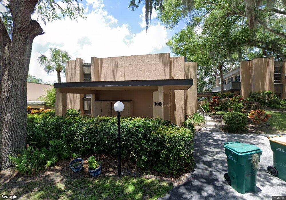
601 W Old Us Highway 441 Unit 9-A Mount Dora, FL 32757
Estimated Value: $263,521 - $301,000
2
Beds
2
Baths
1,864
Sq Ft
$152/Sq Ft
Est. Value
About This Home
This home is located at 601 W Old Us Highway 441 Unit 9-A, Mount Dora, FL 32757 and is currently estimated at $283,130, approximately $151 per square foot. 601 W Old Us Highway 441 Unit 9-A is a home located in Lake County with nearby schools including Triangle Elementary School, Mt. Dora Middle School, and Mt. Dora High School.
Ownership History
Date
Name
Owned For
Owner Type
Purchase Details
Closed on
Dec 29, 2022
Sold by
Benassi John A and Benassi Susan B
Bought by
Benassi Family Trust
Current Estimated Value
Purchase Details
Closed on
Apr 1, 2005
Sold by
Cannaday Ann J
Bought by
Benassi John A and Benassi Susan B
Purchase Details
Closed on
Sep 14, 2001
Sold by
Cook Denton L
Bought by
Cannaday Ann J
Home Financials for this Owner
Home Financials are based on the most recent Mortgage that was taken out on this home.
Original Mortgage
$78,300
Interest Rate
6.98%
Purchase Details
Closed on
Aug 28, 2001
Sold by
Mcgrath Mona Le
Bought by
Cook Denton L
Home Financials for this Owner
Home Financials are based on the most recent Mortgage that was taken out on this home.
Original Mortgage
$78,300
Interest Rate
6.98%
Purchase Details
Closed on
Jun 14, 1993
Sold by
Osborne Brett
Bought by
Cook Denton L
Create a Home Valuation Report for This Property
The Home Valuation Report is an in-depth analysis detailing your home's value as well as a comparison with similar homes in the area
Home Values in the Area
Average Home Value in this Area
Purchase History
| Date | Buyer | Sale Price | Title Company |
|---|---|---|---|
| Benassi Family Trust | -- | -- | |
| Benassi John A | $138,500 | -- | |
| Cannaday Ann J | $87,000 | -- | |
| Cook Denton L | -- | -- | |
| Cook Denton L | $50,000 | -- |
Source: Public Records
Mortgage History
| Date | Status | Borrower | Loan Amount |
|---|---|---|---|
| Previous Owner | Cannaday Ann J | $78,300 |
Source: Public Records
Tax History Compared to Growth
Tax History
| Year | Tax Paid | Tax Assessment Tax Assessment Total Assessment is a certain percentage of the fair market value that is determined by local assessors to be the total taxable value of land and additions on the property. | Land | Improvement |
|---|---|---|---|---|
| 2025 | $3,220 | $218,504 | $63,000 | $155,504 |
| 2024 | $3,220 | $218,504 | $63,000 | $155,504 |
| 2023 | $3,220 | $208,644 | $63,000 | $145,644 |
| 2022 | $2,959 | $182,644 | $37,000 | $145,644 |
| 2021 | $2,606 | $149,610 | $0 | $0 |
| 2020 | $2,532 | $139,318 | $0 | $0 |
| 2019 | $2,385 | $127,293 | $0 | $0 |
| 2018 | $2,058 | $100,156 | $0 | $0 |
| 2017 | $1,655 | $79,578 | $0 | $0 |
| 2016 | $1,653 | $79,578 | $0 | $0 |
| 2015 | $1,666 | $78,162 | $0 | $0 |
| 2014 | $1,601 | $76,875 | $0 | $0 |
Source: Public Records
Map
Nearby Homes
- 665 James Moore Dr
- 620 Casey Loop
- 505 W 10th Ave
- 421 W 10th Ave
- 351 W 10th Ave
- 622 W 11th Ave
- 630 W 11th Ave
- 629 Helen St
- 580 Page Ln
- 601 N McDonald St Unit 2
- 1212 Hilltop Dr
- 999 Fairview Ave
- 995 W 11th Ave
- 714 Kay Ct
- 1224 Normandy Dr
- 1405 Hilltop Dr
- 1467 Hilltop Dr
- 908 N Tremain St
- 658 James Moore Dr
- 1620 Crestview Dr
- 601 W Old Us Highway 441 Unit 2A
- 601 W Old Us Highway 441 Unit 8A
- 601 W Old Us Highway 441 Unit 1A
- 601 W Old Us Highway 441 Unit 1B
- 601 W Old Us Highway 441 Unit 4A
- 601 W Old Us Highway 441 Unit 7A
- 601 W Old Us Highway 441 Unit 5A
- 601 W Old Us Highway 441
- 601 W Old Us Highway 441
- 601 W Old Us Highway 441 Unit 2
- 601 W Old Us Highway 441 Unit 6-B
- 601 W Old Us Highway 441 Unit 6-A
- 601 W Old Us Highway 441 Unit 11A
- 601 W Old Us Highway 441 Unit 8B
- 601 W Old Us Highway 441 Unit 11B
- 601 W Old Us Highway 441 Unit 12A
- 601 W
- 601 W Old Hwy 441 Unit 11B
- 601 W Old Us 441 Unit 4B
- 601 W Old Us 441 Unit 4A