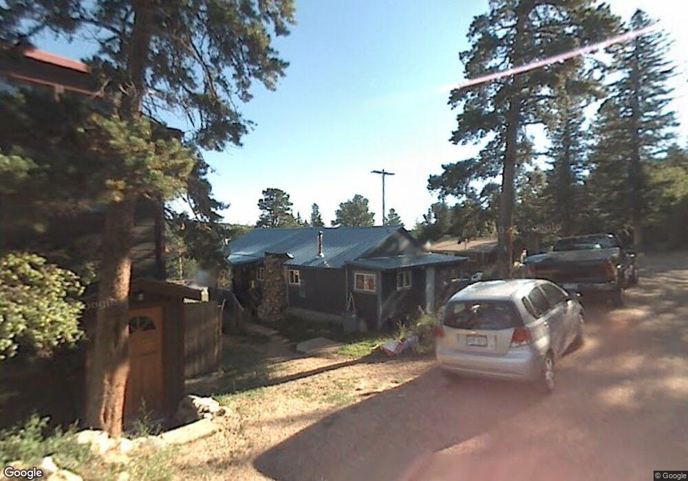
601 W Rollinsville St Nederland, CO 80466
Estimated Value: $435,202 - $531,000
3
Beds
1
Bath
968
Sq Ft
$495/Sq Ft
Est. Value
About This Home
This home is located at 601 W Rollinsville St, Nederland, CO 80466 and is currently estimated at $478,801, approximately $494 per square foot. 601 W Rollinsville St is a home with nearby schools including Nederland Elementary School and Nederland Middle-Senior High School.
Ownership History
Date
Name
Owned For
Owner Type
Purchase Details
Closed on
Sep 27, 1999
Sold by
Fresquez Joseph D
Bought by
Gomez Frank
Current Estimated Value
Home Financials for this Owner
Home Financials are based on the most recent Mortgage that was taken out on this home.
Original Mortgage
$126,020
Interest Rate
7.73%
Purchase Details
Closed on
Apr 22, 1998
Sold by
Fresquez Eleanor L and Fresquez Benjamin D
Bought by
Fresquez Joseph D
Home Financials for this Owner
Home Financials are based on the most recent Mortgage that was taken out on this home.
Original Mortgage
$55,843
Interest Rate
7.09%
Purchase Details
Closed on
Jul 31, 1985
Bought by
Gomez Frank
Purchase Details
Closed on
Jan 10, 1973
Bought by
Gomez Frank
Create a Home Valuation Report for This Property
The Home Valuation Report is an in-depth analysis detailing your home's value as well as a comparison with similar homes in the area
Home Values in the Area
Average Home Value in this Area
Purchase History
| Date | Buyer | Sale Price | Title Company |
|---|---|---|---|
| Gomez Frank | $125,000 | -- | |
| Fresquez Joseph D | -- | -- | |
| Gomez Frank | -- | -- | |
| Gomez Frank | $6,000 | -- |
Source: Public Records
Mortgage History
| Date | Status | Borrower | Loan Amount |
|---|---|---|---|
| Closed | Gomez Frank | $126,020 | |
| Previous Owner | Fresquez Joseph D | $55,843 |
Source: Public Records
Tax History Compared to Growth
Tax History
| Year | Tax Paid | Tax Assessment Tax Assessment Total Assessment is a certain percentage of the fair market value that is determined by local assessors to be the total taxable value of land and additions on the property. | Land | Improvement |
|---|---|---|---|---|
| 2025 | $2,137 | $22,826 | $3,188 | $19,638 |
| 2024 | $2,137 | $22,826 | $3,188 | $19,638 |
| 2023 | $2,080 | $18,606 | $2,961 | $19,330 |
| 2022 | $2,148 | $18,362 | $2,683 | $15,679 |
| 2021 | $2,117 | $18,890 | $2,760 | $16,130 |
| 2020 | $1,844 | $16,281 | $3,289 | $12,992 |
| 2019 | $1,822 | $16,281 | $3,289 | $12,992 |
| 2018 | $1,684 | $14,882 | $4,392 | $10,490 |
| 2017 | $1,649 | $16,454 | $4,856 | $11,598 |
| 2016 | $1,632 | $14,359 | $5,492 | $8,867 |
| 2015 | $1,565 | $14,464 | $4,219 | $10,245 |
| 2014 | $1,647 | $14,464 | $4,219 | $10,245 |
Source: Public Records
Map
Nearby Homes
- 590 W Pine St
- 710 Mcmillen Way
- 550 W Breed St
- 470 W Spring St
- 105 S Caribou St
- 24333 Peak To Peak Hwy
- 11650 Peak To Peak Hwy
- 0 Peak To Peak Hwy Unit REC2002177
- 0 Peak To Peak Hwy Unit 1040129
- 0 Peak To Peak Hwy Unit 1042718
- 850 W 5th St
- 252 5th St
- 135 E 2nd St
- 87 Sundance Cir
- 0 E 5th St Unit 1034288
- 242 E 5th St
- 546 Haul Rd
- 239 Big Springs Dr
- 5 Ridge View Rd
- 46 Pinecliff Trail
- 605 W Rollinsville St
- 504 S Peak To Peak Hwy
- 611 W Rollinsville St
- 701 S Hendricks St
- 580 Highway 72
- 619 W Rollinsville St
- 752 S Hendricks St
- 612 Peak To Peak Hwy
- 706 S Hendricks St
- 502 S Peak To Peak Hwy
- 600 S Peak To Peak Hwy
- 751 S Hendricks St
- 626 Highway 72
- 639 W Rollinsville St
- 626 Peak To Peak Hwy
- 630 Peak To Peak Hwy
- 650 W Rollinsville St
- 630 W Spruce St
- 630 Spruce Cir
- 662 Rollinsville Rd