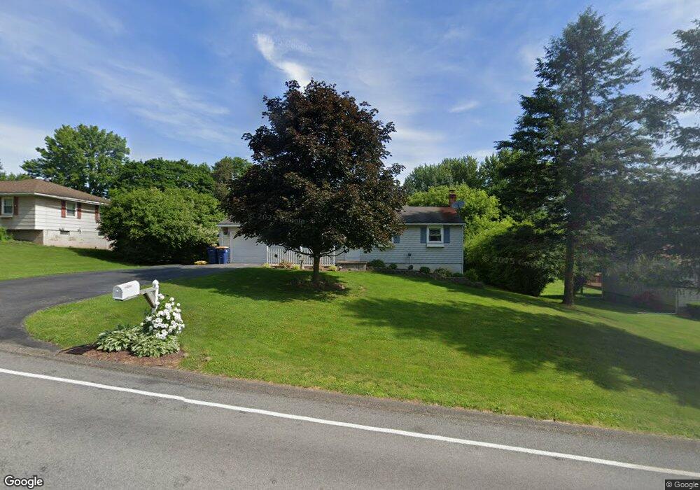
601 Wilkinson Rd MacEdon, NY 14502
Estimated Value: $210,000 - $282,000
4
Beds
1
Bath
1,428
Sq Ft
$181/Sq Ft
Est. Value
About This Home
This home is located at 601 Wilkinson Rd, MacEdon, NY 14502 and is currently estimated at $259,092, approximately $181 per square foot. 601 Wilkinson Rd is a home located in Wayne County with nearby schools including Palmyra-Macedon Primary School, Palmyra-Macedon Intermediate School, and Palmyra-Macedon Middle School.
Ownership History
Date
Name
Owned For
Owner Type
Purchase Details
Closed on
Dec 19, 2023
Sold by
Poole Bryan W and Landon-Poole Christine M
Bought by
Landon-Poole Christine M
Current Estimated Value
Purchase Details
Closed on
Aug 28, 2019
Sold by
Landon-Poole Christine M
Bought by
Poole Bryan W and Landon-Poole Christine M
Purchase Details
Closed on
Sep 30, 1999
Sold by
Gavin Kenneth D
Bought by
Landon Christine M
Purchase Details
Closed on
Dec 29, 1995
Sold by
Hart David F and Hart Beverly A
Bought by
Gavin Kenneth D and Gavin Collette J
Create a Home Valuation Report for This Property
The Home Valuation Report is an in-depth analysis detailing your home's value as well as a comparison with similar homes in the area
Home Values in the Area
Average Home Value in this Area
Purchase History
| Date | Buyer | Sale Price | Title Company |
|---|---|---|---|
| Landon-Poole Christine M | -- | None Available | |
| Poole Bryan W | -- | -- | |
| Landon Christine M | $89,900 | John Morell | |
| Gavin Kenneth D | $86,000 | -- |
Source: Public Records
Tax History Compared to Growth
Tax History
| Year | Tax Paid | Tax Assessment Tax Assessment Total Assessment is a certain percentage of the fair market value that is determined by local assessors to be the total taxable value of land and additions on the property. | Land | Improvement |
|---|---|---|---|---|
| 2024 | $5,859 | $183,000 | $24,000 | $159,000 |
| 2023 | $5,859 | $183,000 | $24,000 | $159,000 |
| 2022 | $5,498 | $183,000 | $24,000 | $159,000 |
| 2021 | $5,015 | $119,100 | $18,400 | $100,700 |
| 2020 | $4,035 | $119,100 | $18,400 | $100,700 |
| 2019 | $3,974 | $119,100 | $18,400 | $100,700 |
| 2018 | $3,891 | $119,100 | $18,400 | $100,700 |
| 2017 | $3,865 | $119,100 | $18,400 | $100,700 |
Source: Public Records
Map
Nearby Homes
- 950 Bunker Hill Dr
- 945 Bunker Hill Dr
- 913 Wayneport Rd
- 985 Wayneport Rd
- 785 N Hook Rd
- 1096 Victor Rd
- 1303 Mary Dr
- 173 Mulberry Dr
- 5959 Woodside Cir
- 0 Pittsford Palmyra Rd
- 1485 Woodsview Way
- 689 Canal Dr E
- 294 Canal Dr W Unit 206
- 134 Paddy Ln
- 3 Burwell Dr
- 0 Kemp Dr Unit E R1632246
- 627 Hook Rd
- 10 Mildenhall Ridge
- 9 Southview Cir
- 10 Olympus Dr
- 609 Wilkinson Rd
- 593 Wilkinson Rd
- 606 Lowell Dr
- 585 Wilkinson Rd
- 965 Wilson Rd
- 977 Wilson Rd
- 598 Lowell Dr
- 606 Wilkinson Rd
- 588 Lowell Dr
- 985 Wilson Rd
- 616 Wilkinson Rd
- 575 Wilkinson Rd
- 580 Lowell Dr
- 572 Wilkinson Rd
- 630 Wilkinson Rd
- 567 Wilkinson Rd
- 932 Bunker Hill Dr
- 601 Lowell Dr
- 570 Lowell Dr
- 593 Lowell Dr