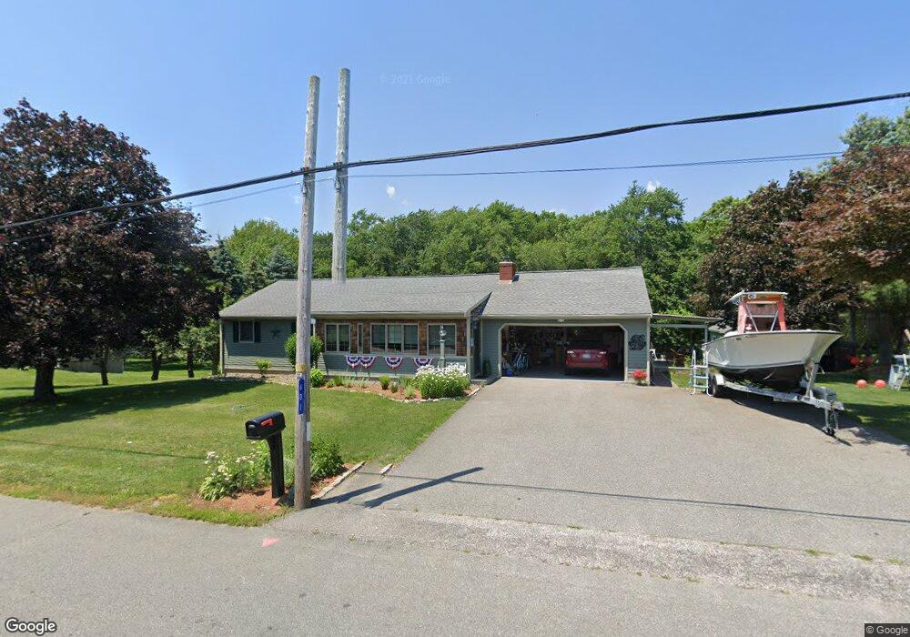
601 Wood St Swansea, MA 02777
West Swansea NeighborhoodEstimated Value: $527,000 - $562,000
3
Beds
1
Bath
1,605
Sq Ft
$338/Sq Ft
Est. Value
About This Home
This home is located at 601 Wood St, Swansea, MA 02777 and is currently estimated at $541,992, approximately $337 per square foot. 601 Wood St is a home located in Bristol County with nearby schools including Joseph Case High School, Swansea Wood School, and SCEC Life Academy.
Ownership History
Date
Name
Owned For
Owner Type
Purchase Details
Closed on
Mar 24, 2017
Sold by
Smith Charles M and Smith Claudette M
Bought by
Smith Claudette M and Smith Charles M
Current Estimated Value
Purchase Details
Closed on
Oct 8, 1993
Sold by
Bessette Henry and Bessette Claire G
Bought by
Smith Charles M and Smith Claudette M
Create a Home Valuation Report for This Property
The Home Valuation Report is an in-depth analysis detailing your home's value as well as a comparison with similar homes in the area
Home Values in the Area
Average Home Value in this Area
Purchase History
| Date | Buyer | Sale Price | Title Company |
|---|---|---|---|
| Smith Claudette M | -- | -- | |
| Smith Charles M | $135,000 | -- |
Source: Public Records
Mortgage History
| Date | Status | Borrower | Loan Amount |
|---|---|---|---|
| Previous Owner | Smith Charles M | $92,000 | |
| Previous Owner | Smith Charles M | $112,300 | |
| Previous Owner | Smith Charles M | $94,300 | |
| Previous Owner | Smith Charles M | $25,000 |
Source: Public Records
Tax History Compared to Growth
Tax History
| Year | Tax Paid | Tax Assessment Tax Assessment Total Assessment is a certain percentage of the fair market value that is determined by local assessors to be the total taxable value of land and additions on the property. | Land | Improvement |
|---|---|---|---|---|
| 2025 | $5,412 | $454,000 | $176,000 | $278,000 |
| 2024 | $5,396 | $450,000 | $176,000 | $274,000 |
| 2023 | $5,249 | $399,800 | $128,800 | $271,000 |
| 2022 | $5,159 | $358,500 | $117,100 | $241,400 |
| 2021 | $4,727 | $302,400 | $117,100 | $185,300 |
| 2020 | $4,696 | $301,400 | $117,100 | $184,300 |
| 2019 | $4,479 | $288,800 | $104,500 | $184,300 |
| 2018 | $4,248 | $278,000 | $102,800 | $175,200 |
| 2017 | $3,692 | $278,000 | $102,800 | $175,200 |
| 2016 | $3,557 | $263,100 | $88,500 | $174,600 |
| 2015 | $3,221 | $245,300 | $88,500 | $156,800 |
| 2014 | $3,177 | $247,400 | $88,500 | $158,900 |
Source: Public Records
Map
Nearby Homes
- 420 Hortonville Rd
- 0 Proprietors Way Unit 73324662
- 264 Hortonville Rd
- 397RR Locust St
- 141 Milford Rd
- 0A Cummings Rd
- 0B Cummings Rd
- 100 Oxford Ln
- 0 Hortonville Rd Unit 73242268
- 55 Sophia Dr
- 51 Sophia Dr
- 50 Yvonne Ln
- 131 Maple Ave
- 31 Yvonne Ln
- 5 Ava Ln
- 147 Elm St
- 1261 Gar Hwy
- 283 Plain St
- 9 Sophia Dr
- 47 Spring St
- 605 Wood St
- 599 Wood St
- 609 Wood St
- 2 Driftwood Cir
- 16 Driftwood Cir
- 16 Shaylee Place
- LOT16 Shaylee Place
- 615 Wood St
- 1 Shaylee Place
- LOT24 Shaylee Place
- LOT15 Shaylee Place
- LOT25 Shaylee Place
- 32 Shaylee Place
- 18 Driftwood Cir
- 25 Shaylee Place
- 15 Driftwood Cir
- 635 Wood St
- 577 Wood St
- 590 Wood St
- 48 Shaylee Place