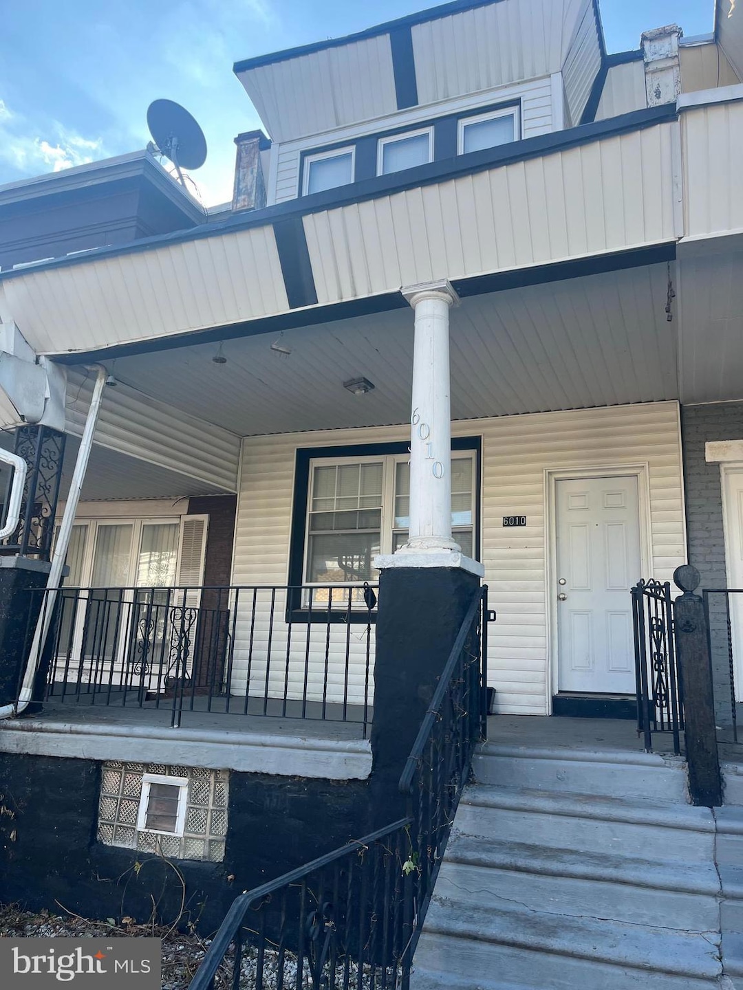
6010 N Lambert St Philadelphia, PA 19138
East Germantown NeighborhoodEstimated payment $942/month
Highlights
- Open Floorplan
- Straight Thru Architecture
- Bathtub with Shower
- Oak Street Elementary School Rated A
- No HOA
- Recessed Lighting
About This Home
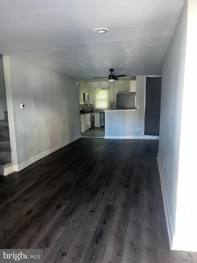
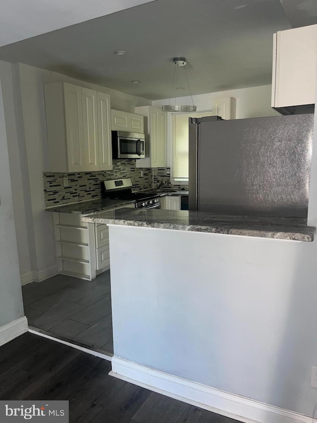
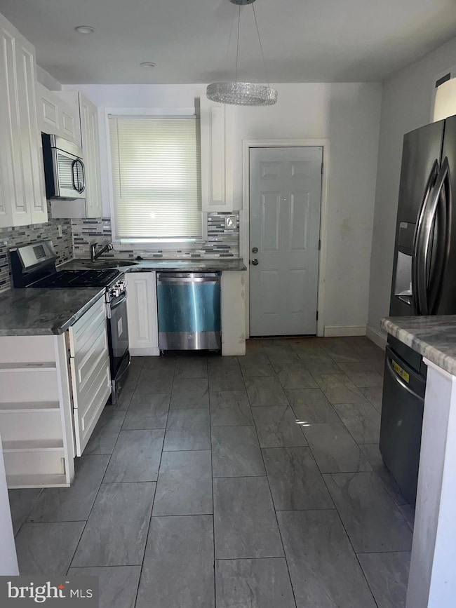
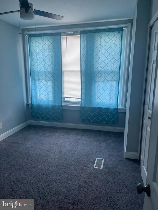
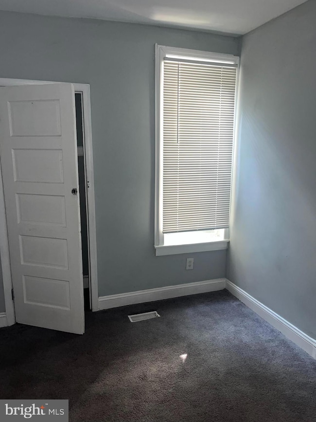
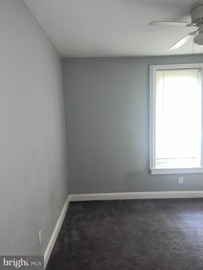
6010 N Lambert St, Philadelphia, PA 19138 – REO Property with Seller Financing Available! Don’t miss this incredible opportunity to own in the heart of Philadelphia! This REO property is being sold in its current condition and offers plenty of upside whether you’re an investor looking for immediate returns or a first-time buyer ready to build instant equity with a little TLC. Step inside and you’ll find a welcoming layout featuring: Granite countertops with newer kitchen cabinets Appliances included – refrigerator, dishwasher, range, and microwave Laminate flooring throughout the first floor for easy maintenance Carpeted second floor for comfort in the bedrooms With no disclosures available, this home is ready for the right buyer to bring their vision. Add your finishing touches and enjoy the value this property has to offer. Seller financing available – making it easier than ever to invest or own your first home. This is the perfect chance to secure a solid property in a desirable area and create equity right away. Opportunities like this don’t last long – schedule your showing today!
Listing Agent
(267) 581-4136 tyharrell@kw.com Keller Williams Real Estate-Horsham Listed on: 09/20/2025

Townhouse Details
Home Type
- Townhome
Est. Annual Taxes
- $1,825
Year Built
- Built in 1925
Lot Details
- 1,050 Sq Ft Lot
- Lot Dimensions are 15.00 x 70.00
Parking
- On-Street Parking
Home Design
- Straight Thru Architecture
- Brick Foundation
- Masonry
Interior Spaces
- 1,120 Sq Ft Home
- Property has 2 Levels
- Open Floorplan
- Ceiling Fan
- Recessed Lighting
- Carpet
- Unfinished Basement
Kitchen
- Stove
- Microwave
- Dishwasher
Bedrooms and Bathrooms
- 3 Main Level Bedrooms
- 1 Full Bathroom
- Bathtub with Shower
Laundry
- Dryer
- Washer
Utilities
- Central Air
- Cooling System Utilizes Natural Gas
- Hot Water Heating System
- Electric Water Heater
Community Details
- No Home Owners Association
- Oak Lane Subdivision
Listing and Financial Details
- Tax Lot 1072
- Assessor Parcel Number 172428700
Map
Home Values in the Area
Average Home Value in this Area
Tax History
| Year | Tax Paid | Tax Assessment Tax Assessment Total Assessment is a certain percentage of the fair market value that is determined by local assessors to be the total taxable value of land and additions on the property. | Land | Improvement |
|---|---|---|---|---|
| 2026 | $1,460 | $130,400 | $26,080 | $104,320 |
| 2025 | $1,460 | $130,400 | $26,080 | $104,320 |
| 2024 | $1,460 | $130,400 | $26,080 | $104,320 |
| 2023 | $1,460 | $104,300 | $20,860 | $83,440 |
| 2022 | $1,165 | $104,300 | $20,860 | $83,440 |
| 2021 | $1,165 | $0 | $0 | $0 |
| 2020 | $1,165 | $0 | $0 | $0 |
| 2019 | $1,216 | $0 | $0 | $0 |
| 2018 | $1,215 | $0 | $0 | $0 |
| 2017 | $1,215 | $0 | $0 | $0 |
| 2016 | $1,215 | $0 | $0 | $0 |
| 2015 | $1,163 | $0 | $0 | $0 |
| 2014 | -- | $86,800 | $6,405 | $80,395 |
| 2012 | -- | $7,328 | $765 | $6,563 |
Property History
| Date | Event | Price | List to Sale | Price per Sq Ft |
|---|---|---|---|---|
| 11/03/2025 11/03/25 | Price Changed | $150,000 | -6.3% | $134 / Sq Ft |
| 10/13/2025 10/13/25 | Price Changed | $160,000 | -3.0% | $143 / Sq Ft |
| 09/20/2025 09/20/25 | For Sale | $165,000 | -- | $147 / Sq Ft |
Purchase History
| Date | Type | Sale Price | Title Company |
|---|---|---|---|
| Deed | $35,000 | None Available | |
| Deed | $14,100 | -- |
Mortgage History
| Date | Status | Loan Amount | Loan Type |
|---|---|---|---|
| Previous Owner | $34,999 | New Conventional |
Source: Bright MLS
MLS Number: PAPH2539710
APN: 172428700
Disclaimer: Certain information contained herein is derived from information provided by parties other than Homes.com. All information provided is deemed reliable, but is not guaranteed to be accurate and should be independently verified.
![]() The data relating to real estate for sale on this website appears in part through the BRIGHT Internet Data Exchange program, a voluntary cooperative exchange of property listing data between licensed real estate brokerage firms, and is provided by BRIGHT through a licensing agreement.
The data relating to real estate for sale on this website appears in part through the BRIGHT Internet Data Exchange program, a voluntary cooperative exchange of property listing data between licensed real estate brokerage firms, and is provided by BRIGHT through a licensing agreement.
Listing information is from various brokers who participate in the Bright MLS IDX program and not all listings may be visible on the site.
The property information being provided on or through the website is for the personal, non-commercial use of consumers and such information may not be used for any purpose other than to identify prospective properties consumers may be interested in purchasing.
Some properties which appear for sale on the website may no longer be available because they are for instance, under contract, sold or are no longer being offered for sale.
Property information displayed is deemed reliable but is not guaranteed.
Copyright 2025 Bright MLS, Inc.
- 2025 Church Ln
- 6055 N Norwood St
- 5982 N 20th St
- 6065 N Beechwood St
- 5963 65 N Opal St
- 6102 N Norwood St
- 2027 Widener Place
- 2023 Widener Place
- 6075 N Norwood St
- 6036 N Beechwood St
- 1963 W Spencer Ave
- 6152 N Lambert St
- 6142 N Woodstock St
- 6121 N Beechwood St
- 6144 N Norwood St
- 6125 N Beechwood St
- 6018 N 19th St
- 5833 N Woodstock St
- 6709 N Woodstock St
- 6012 N 19th St
- 6016 N 20th St
- 1999 Church Ln Unit 1
- 2130 W Spencer Ave
- 6138 N Lambert St
- 2025 Widener Place
- 6043 Wister St Unit 1F
- 5504 Devon St
- 5524 Matthews St Unit 10
- 5548 Matthews St
- 5581 Blakemore St
- 6308 N Lambert St
- 2170 Conlyn St
- 6314 Wister St
- 6328 N Beechwood St
- 2103 E Chelten Ave Unit 1
- 6001 N 17th St Unit 102
- 6001 N 17th St Unit 404
- 6001 N 17th St Unit 10
- 1203 E Chelten Ave
- 1807 Medary Ave