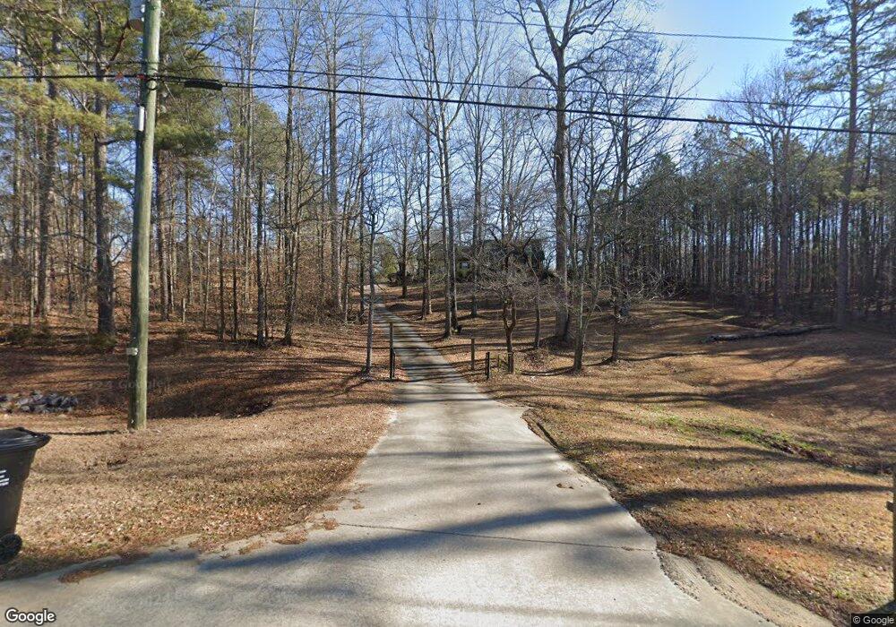
6011 Sycamore Rd Buford, GA 30518
Estimated Value: $346,000 - $457,355
3
Beds
2
Baths
1,959
Sq Ft
$207/Sq Ft
Est. Value
About This Home
This home is located at 6011 Sycamore Rd, Buford, GA 30518 and is currently estimated at $405,089, approximately $206 per square foot. 6011 Sycamore Rd is a home located in Gwinnett County with nearby schools including Sycamore Elementary School, Lanier Middle School, and Lanier High School.
Ownership History
Date
Name
Owned For
Owner Type
Purchase Details
Closed on
Jun 11, 2015
Sold by
Colfin Ai Ga 1 Llc
Bought by
Cah 2015 1 Borrower Llc
Current Estimated Value
Purchase Details
Closed on
Apr 2, 2013
Sold by
Stidham Connie B
Bought by
Colfin Ai Ga 1 Llc
Purchase Details
Closed on
May 26, 2000
Sold by
Barnes Ricky J and Barnes Belinda S
Bought by
Stidham Connie B
Home Financials for this Owner
Home Financials are based on the most recent Mortgage that was taken out on this home.
Original Mortgage
$164,255
Interest Rate
11.99%
Mortgage Type
New Conventional
Create a Home Valuation Report for This Property
The Home Valuation Report is an in-depth analysis detailing your home's value as well as a comparison with similar homes in the area
Home Values in the Area
Average Home Value in this Area
Purchase History
| Date | Buyer | Sale Price | Title Company |
|---|---|---|---|
| Cah 2015 1 Borrower Llc | -- | -- | |
| Colfin Ai Ga 1 Llc | $120,000 | -- | |
| Stidham Connie B | $172,900 | -- |
Source: Public Records
Mortgage History
| Date | Status | Borrower | Loan Amount |
|---|---|---|---|
| Previous Owner | Stidham Connie B | $164,255 |
Source: Public Records
Tax History Compared to Growth
Tax History
| Year | Tax Paid | Tax Assessment Tax Assessment Total Assessment is a certain percentage of the fair market value that is determined by local assessors to be the total taxable value of land and additions on the property. | Land | Improvement |
|---|---|---|---|---|
| 2024 | $5,458 | $143,360 | $60,720 | $82,640 |
| 2023 | $5,458 | $143,360 | $60,720 | $82,640 |
| 2022 | $3,742 | $95,840 | $35,440 | $60,400 |
| 2021 | $3,793 | $95,840 | $35,440 | $60,400 |
| 2020 | $3,218 | $101,080 | $35,440 | $65,640 |
| 2019 | $3,106 | $79,440 | $30,360 | $49,080 |
| 2018 | $3,106 | $79,440 | $30,360 | $49,080 |
| 2016 | $2,770 | $69,360 | $24,960 | $44,400 |
| 2015 | $2,816 | $69,360 | $24,960 | $44,400 |
| 2014 | -- | $48,000 | $37,000 | $11,000 |
Source: Public Records
Map
Nearby Homes
- Hampstead Plan at Arbors at Richland Creek
- Lancaster Plan at Arbors at Richland Creek
- Savoy Plan at Arbors at Richland Creek
- 1060 Crescent Ridge Dr
- 5870 Tallant Dr
- 1403 Sparkling Cove Dr
- 1260 Magellan Dr
- 1250 Magellan Dr
- 816 Dodd Trail Unit 172
- 6050 April Dr
- 1240 Magellan Dr
- 6131 Sparkling Cove Ln
- 6049 Cove Park Dr
- 5880 April Dr Unit 1
- 1585 Jimmy Dodd Rd
- 6054 Stewart Rd
- 1218 Lanier Springs Dr
- 1183 Lanier Springs Dr
- 6031 Sycamore Rd
- 1351 Jimmy Dodd Rd
- 6000 Sycamore Rd
- 1361 Jimmy Dodd Rd
- 5990 Sycamore Rd
- 5980 Sycamore Rd
- 5970 Sycamore Rd
- 5960 Sycamore Rd
- 1411 Jimmy Dodd Rd
- 1411 Jimmy Dodd Rd Unit A
- 975 Crescent Ridge Dr
- 985 Crescent Ridge Dr
- 965 Crescent Ridge Dr
- 995 Crescent Ridge Dr
- 1005 Crescent Ridge Dr
- 955 Crescent Ridge Dr
- 1015 Crescent Ridge Dr
- 1421 Jimmy Dodd Rd
- 1025 Crescent Ridge Dr
- 5935 Tallant Dr
