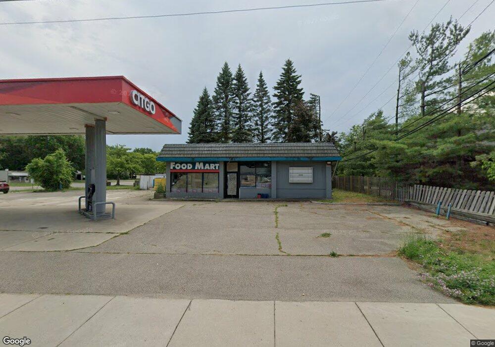
6011 Williams Lake Rd Waterford Township, MI 48329
Waterford Township NeighborhoodEstimated Value: $614,482
--
Bed
--
Bath
1,477
Sq Ft
$416/Sq Ft
Est. Value
About This Home
This home is located at 6011 Williams Lake Rd, Waterford Township, MI 48329 and is currently estimated at $614,482, approximately $416 per square foot. 6011 Williams Lake Rd is a home located in Oakland County with nearby schools including Schoolcraft Elementary School, Waterford Kettering High School, and Mason Middle School.
Ownership History
Date
Name
Owned For
Owner Type
Purchase Details
Closed on
Sep 15, 2023
Sold by
R N A Petroleum Inc
Bought by
P & R Waterford Llc
Current Estimated Value
Purchase Details
Closed on
Sep 29, 2006
Sold by
Mahfouz Chafic
Bought by
R N A Petroleum Inc
Purchase Details
Closed on
Oct 3, 2001
Sold by
K A Marathon Inc
Bought by
Williams Lake Inv
Purchase Details
Closed on
Aug 6, 1998
Sold by
Atlas Oil Holding Co
Bought by
K A Marathon Inc
Purchase Details
Closed on
Dec 18, 1997
Sold by
Marathon Oil Co
Bought by
Marathon Ashland Petroleum
Create a Home Valuation Report for This Property
The Home Valuation Report is an in-depth analysis detailing your home's value as well as a comparison with similar homes in the area
Home Values in the Area
Average Home Value in this Area
Purchase History
| Date | Buyer | Sale Price | Title Company |
|---|---|---|---|
| P & R Waterford Llc | $560,000 | Devon Title Agency | |
| R N A Petroleum Inc | $262,500 | Metropolitan | |
| Williams Lake Inv | $475,000 | -- | |
| Mahfouz Chafic | -- | -- | |
| K A Marathon Inc | $415,000 | -- | |
| Marathon Ashland Petroleum | -- | -- |
Source: Public Records
Tax History Compared to Growth
Tax History
| Year | Tax Paid | Tax Assessment Tax Assessment Total Assessment is a certain percentage of the fair market value that is determined by local assessors to be the total taxable value of land and additions on the property. | Land | Improvement |
|---|---|---|---|---|
| 2024 | $5,155 | $131,030 | $0 | $0 |
| 2023 | $3,837 | $113,000 | $0 | $0 |
| 2022 | $5,212 | $103,070 | $0 | $0 |
| 2021 | $5,571 | $90,780 | $0 | $0 |
| 2020 | $3,592 | $90,890 | $0 | $0 |
| 2019 | $7,556 | $145,490 | $0 | $0 |
| 2018 | $7,151 | $166,380 | $0 | $0 |
| 2017 | $8,099 | $166,380 | $0 | $0 |
| 2015 | -- | $147,050 | $0 | $0 |
| 2014 | -- | $145,780 | $0 | $0 |
| 2011 | -- | $147,870 | $0 | $0 |
Source: Public Records
Map
Nearby Homes
- 6015 Rowley Blvd
- 6275 Williams Lake Rd
- 6391 Rowley Blvd
- 6376 Lanman Dr
- 3077 Nanwich Dr
- 3867 Percy King Rd
- 6031 Southward Ave
- 5502 Rowley Blvd
- 6625 Lanman Dr
- 3880 Lotus Dr
- 3912 Cambrook Ln
- 3229 Homestead Dr
- 4083 Ledgestone Dr
- 6441 Crest Dr
- 000 Waterloo St
- 6533 Cloverton Dr
- 3194 Whitfield Dr
- 4281 Marcus Rd
- 6522 Saline Dr
- 4148 Conne Mara Ln
- 6041 Williams Lake Rd
- 3502 David K Dr
- 3490 Airport Rd
- 3470 Airport Rd
- 6004 Williams Lake Rd
- 3510 David K Dr
- 3460 Airport Rd
- 6162 Lindsay Dr
- 3475 Oakbeach Ave
- 3522 David K Dr
- 6180 Lindsay Dr
- 3435 Airport Rd
- 6130 Williams Lake Rd
- 3461 Oakbeach Ave
- 3517 David K Dr
- 3444 Airport Rd
- 6145 Lindsay Dr
- 3534 David K Dr
- 3506 Percy King Rd
- 3529 David K Dr