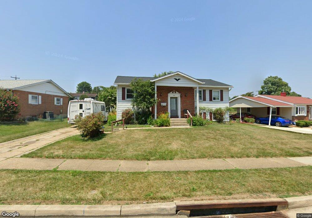
6012 Chesworth Rd Catonsville, MD 21228
Estimated Value: $327,957 - $418,000
3
Beds
3
Baths
1,278
Sq Ft
$293/Sq Ft
Est. Value
About This Home
This home is located at 6012 Chesworth Rd, Catonsville, MD 21228 and is currently estimated at $373,989, approximately $292 per square foot. 6012 Chesworth Rd is a home located in Baltimore County with nearby schools including Woodbridge Elementary School, Southwest Academy, and Woodlawn High School.
Ownership History
Date
Name
Owned For
Owner Type
Purchase Details
Closed on
Mar 21, 2022
Sold by
605 E Patapsco Avenue Llc
Bought by
Ahmed Shakeel
Current Estimated Value
Purchase Details
Closed on
Jan 27, 2017
Sold by
Singh Surinder
Bought by
605 E Patapsco Avenue Llc
Home Financials for this Owner
Home Financials are based on the most recent Mortgage that was taken out on this home.
Original Mortgage
$280,000
Interest Rate
4.05%
Mortgage Type
Commercial
Purchase Details
Closed on
May 14, 2013
Sold by
Estate Of Roland Nelosn Spaide
Bought by
Singh Surinder
Home Financials for this Owner
Home Financials are based on the most recent Mortgage that was taken out on this home.
Original Mortgage
$100,000
Interest Rate
15%
Mortgage Type
Stand Alone First
Create a Home Valuation Report for This Property
The Home Valuation Report is an in-depth analysis detailing your home's value as well as a comparison with similar homes in the area
Home Values in the Area
Average Home Value in this Area
Purchase History
| Date | Buyer | Sale Price | Title Company |
|---|---|---|---|
| Ahmed Shakeel | $183,700 | Sage Title | |
| 605 E Patapsco Avenue Llc | -- | None Available | |
| Singh Surinder | $183,700 | Passport Title Services Llc | |
| Singh Surinder | $183,700 | Passport Title Services Llc |
Source: Public Records
Mortgage History
| Date | Status | Borrower | Loan Amount |
|---|---|---|---|
| Previous Owner | 605 E Patapsco Avenue Llc | $280,000 | |
| Previous Owner | Singh Surinder | $100,000 |
Source: Public Records
Tax History Compared to Growth
Tax History
| Year | Tax Paid | Tax Assessment Tax Assessment Total Assessment is a certain percentage of the fair market value that is determined by local assessors to be the total taxable value of land and additions on the property. | Land | Improvement |
|---|---|---|---|---|
| 2025 | $4,882 | $293,200 | -- | -- |
| 2024 | $4,882 | $276,000 | $74,800 | $201,200 |
| 2023 | $2,300 | $262,767 | $0 | $0 |
| 2022 | $4,306 | $249,533 | $0 | $0 |
| 2021 | $2,083 | $236,300 | $74,800 | $161,500 |
| 2020 | $2,804 | $231,333 | $0 | $0 |
| 2019 | $2,744 | $226,367 | $0 | $0 |
| 2018 | $4,277 | $221,400 | $62,000 | $159,400 |
| 2017 | $3,802 | $212,233 | $0 | $0 |
| 2016 | $2,370 | $203,067 | $0 | $0 |
| 2015 | $2,370 | $193,900 | $0 | $0 |
| 2014 | $2,370 | $193,900 | $0 | $0 |
Source: Public Records
Map
Nearby Homes
- 6031 Burnt Oak Rd
- 800 Crosby Rd
- 6028 Moorehead Rd
- 6200 Gilston Park Rd
- 3 Mcgrady Square
- 1418 Harberson Rd
- 1009 Rowe Ln
- 67 Walden Mill Way
- 908 Vanderwood Rd
- 920 Vanderwood Rd
- 1007 Kent Ave
- 930 Sedgley Rd
- 1111 Cummings Ave
- 6263 Gilston Park Rd
- 6011 Johnnycake Rd
- 1019 Cummings Ave
- 6001 Johnnycake Rd
- 1013 Cummings Ave
- 1109 Marksworth Rd
- 1124 Brigadoon Trail
- 6014 Chesworth Rd
- 6016 Chesworth Rd
- 6008 Chesworth Rd
- 6011 Burnt Oak Rd
- 6013 Burnt Oak Rd
- 6009 Burnt Oak Rd
- 6013 Chesworth Rd
- 6018 Chesworth Rd
- 6007 Chesworth Rd
- 6007 Chesworth Rd Unit A
- 6006 Chesworth Rd
- 6015 Burnt Oak Rd
- 6009 Chesworth Rd
- 6015 Chesworth Rd
- 6007 Burnt Oak Rd
- 6007A Chesworth Rd
- 6017 Chesworth Rd
- 6004 Chesworth Rd
- 6020 Chesworth Rd
- 6017 Burnt Oak Rd