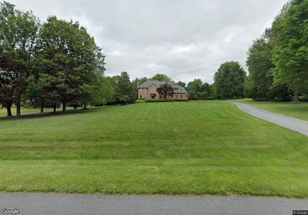
6012 White Flint Dr Frederick, MD 21702
Estimated Value: $949,039 - $1,139,000
About This Home
This home is located at 6012 White Flint Dr, Frederick, MD 21702 and is currently estimated at $1,020,760, approximately $236 per square foot. 6012 White Flint Dr is a home located in Frederick County with nearby schools including Yellow Springs Elementary School, Monocacy Middle School, and Gov. Thomas Johnson High School.
Ownership History
We collect this data history from publicly available records. To have your information removed, we recommend requesting removal directly through your county’s website.
Purchase Details
Home Financials for this Owner
Home Financials are based on the most recent Mortgage that was taken out on this home.Purchase Details
Purchase Details
Purchase Details
Home Values in the Area
Average Home Value in this Area
Purchase History
We collect this data history from publicly available records. To have your information removed, we recommend requesting removal directly through your county’s website.
| Date | Buyer | Sale Price | Title Company |
|---|---|---|---|
| $215,500 | None Available | ||
| $120,000 | -- | ||
| $110,000 | -- | ||
| $500,000 | -- |
Mortgage History
We collect this data history from publicly available records. To have your information removed, we recommend requesting removal directly through your county’s website.
| Date | Status | Borrower | Loan Amount |
|---|---|---|---|
| Open | $110,000 |
Tax History
We collect this data history from publicly available records. To have your information removed, we recommend requesting removal directly through your county’s website.
| Year | Tax Paid | Tax Assessment Tax Assessment Total Assessment is a certain percentage of the fair market value that is determined by local assessors to be the total taxable value of land and additions on the property. | Land | Improvement |
|---|---|---|---|---|
| 2025 | $8,407 | $770,067 | -- | -- |
| 2024 | $8,407 | $708,533 | $0 | $0 |
| 2023 | $7,662 | $647,000 | $142,200 | $504,800 |
| 2022 | $7,556 | $637,833 | $0 | $0 |
| 2021 | $7,343 | $628,667 | $0 | $0 |
| 2020 | $7,343 | $619,500 | $142,200 | $477,300 |
| 2019 | $7,343 | $619,500 | $142,200 | $477,300 |
| 2018 | $7,409 | $619,500 | $142,200 | $477,300 |
| 2017 | $7,467 | $630,200 | $0 | $0 |
| 2016 | $8,814 | $612,300 | $0 | $0 |
| 2015 | $8,814 | $594,400 | $0 | $0 |
| 2014 | $8,814 | $576,500 | $0 | $0 |
Map
- 6603 Babak Dr
- 5993 White Flint Dr
- 6618 Nahal Dr
- 1823 Colt Ln
- 8701C Yellow Springs Rd
- 8528 Rocky Springs Rd
- 9016 Bethel Rd
- 2600 Kellerton Ave Unit NOTTINGHAM
- 2600 Kellerton Ave Unit MAGNOLIA
- 2600 Kellerton Ave Unit SAVANNAH
- 2600 Kellerton Ave Unit DEVONSHIRE
- 500 Slugger Aly Unit BRADBURY
- 500 Slugger Aly Unit WYNDHAM
- 500 Slugger Aly Unit MILTON
- 2916 Fence Buster Ct
- 5827 Etzler Rd
- 8423 Yellow Springs Rd
- 9126B Bethel Rd
- 2728 Hillfield Dr
- 2820 Heartland Cir
- 5996 White Flint Dr
- 6024 White Flint Dr
- 6043 White Flint Dr
- 6036 White Flint Dr
- 6048 White Flint Dr
- 6602 Babak Dr
- 5984 White Flint Dr
- 8902 Babak Run
- 8706 Marshall Cir
- 6053 White Flint Dr
- 6605 Babak Dr
- 5972 White Flint Dr
- 6060 White Flint Dr
- 5955 White Flint Dr
- 8704 Marshall Cir
- 5960 White Flint Dr
- 6615 Nahal Dr
- 6606 Babak Dr
- 8814 Yellow Springs Rd
- 8575 Indian Springs Rd
Ask me questions while you tour the home.