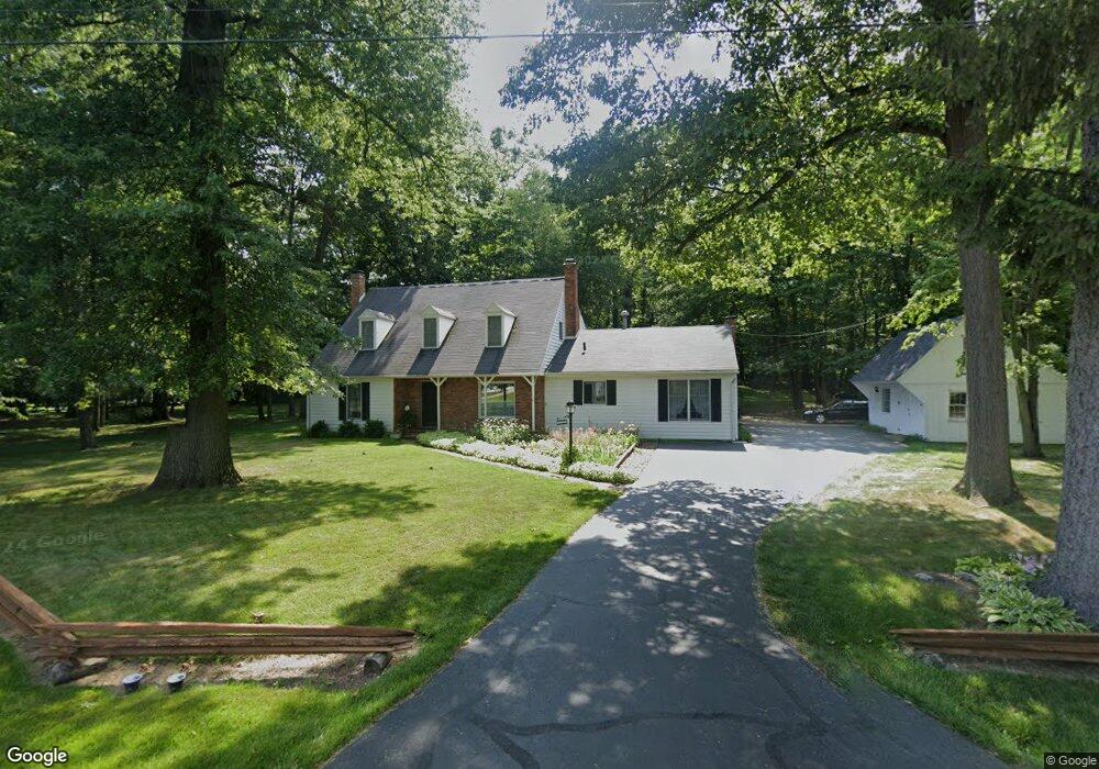
6012 Winslow Rd Whitehouse, OH 43571
West Lucas County NeighborhoodEstimated Value: $418,000 - $539,540
3
Beds
3
Baths
3,181
Sq Ft
$156/Sq Ft
Est. Value
About This Home
This home is located at 6012 Winslow Rd, Whitehouse, OH 43571 and is currently estimated at $494,847, approximately $155 per square foot. 6012 Winslow Rd is a home located in Lucas County with nearby schools including Anthony Wayne High School and Lial Catholic School.
Ownership History
Date
Name
Owned For
Owner Type
Purchase Details
Closed on
Jul 8, 2019
Sold by
Hiser Paul M
Bought by
Hiser Dorothy M
Current Estimated Value
Home Financials for this Owner
Home Financials are based on the most recent Mortgage that was taken out on this home.
Original Mortgage
$53,381
Outstanding Balance
$46,843
Interest Rate
3.9%
Mortgage Type
New Conventional
Estimated Equity
$448,004
Purchase Details
Closed on
Oct 26, 1988
Sold by
Macinnis Bruce B
Create a Home Valuation Report for This Property
The Home Valuation Report is an in-depth analysis detailing your home's value as well as a comparison with similar homes in the area
Home Values in the Area
Average Home Value in this Area
Purchase History
| Date | Buyer | Sale Price | Title Company |
|---|---|---|---|
| Hiser Dorothy M | -- | None Available | |
| -- | -- | -- |
Source: Public Records
Mortgage History
| Date | Status | Borrower | Loan Amount |
|---|---|---|---|
| Open | Hiser Dorothy M | $53,381 |
Source: Public Records
Tax History Compared to Growth
Tax History
| Year | Tax Paid | Tax Assessment Tax Assessment Total Assessment is a certain percentage of the fair market value that is determined by local assessors to be the total taxable value of land and additions on the property. | Land | Improvement |
|---|---|---|---|---|
| 2024 | $3,616 | $141,645 | $34,405 | $107,240 |
| 2023 | $5,970 | $105,875 | $29,435 | $76,440 |
| 2022 | $6,038 | $105,875 | $29,435 | $76,440 |
| 2021 | $6,076 | $105,875 | $29,435 | $76,440 |
| 2020 | $6,434 | $90,300 | $24,990 | $65,310 |
| 2019 | $6,024 | $90,300 | $24,990 | $65,310 |
| 2018 | $5,628 | $90,300 | $24,990 | $65,310 |
| 2017 | $5,511 | $77,000 | $48,895 | $28,105 |
| 2016 | $5,469 | $220,000 | $139,700 | $80,300 |
| 2015 | $5,288 | $220,000 | $139,700 | $80,300 |
| 2014 | $5,760 | $94,540 | $48,410 | $46,130 |
| 2013 | $5,760 | $94,540 | $48,410 | $46,130 |
Source: Public Records
Map
Nearby Homes
- 10700 Brexton Ct
- 10706 Brexton Ct
- 10701 Brexton Ct
- 10751 Brexton Ct
- 6306 Weckerly Rd
- 6414 Lenderson Ave
- 5935 Lynwood Ct
- 5901 Wildwood Ln
- 6547 Lenderson Ave
- 6316 Pimlico Rd
- 7002 Red Stag Ct
- 5908 Finzel Rd
- 6715 Oakbrook Dr
- 11149 West St
- 10160 Blue Creek S
- 9931 Charles Glen Ln
- 6935 Big Buck Trail
- 6746 Oak Crossing Ln
- 6951 Red Stag Ct
- 11158 Whitetail Way
- 6040 Winslow Rd
- 5954 Winslow Rd
- 5938 Winslow Rd
- 5926 Winslow Rd
- 5957 Jane Lynn Dr
- 5943 Jane Lynn Dr
- 5914 Winslow Rd
- 5935 Winslow Rd
- 5955 Winslow Rd
- 5931 Jane Lynn Dr
- 5958 Jane Lynn Dr
- 6047 Forest Edge Dr
- 6053 Forest Edge Dr
- 10720 Brexton Ct
- 6061 Forest Edge Dr
- 10844 Pine Vista Dr
- 6143 Brimley Ct
- 5940 Jane Lynn Dr
- 5917 Jane Lynn Dr
- 6105 Forest Edge Dr