6015 Curtis Rd Bridgeport, MI 48722
Estimated Value: $153,051 - $211,000
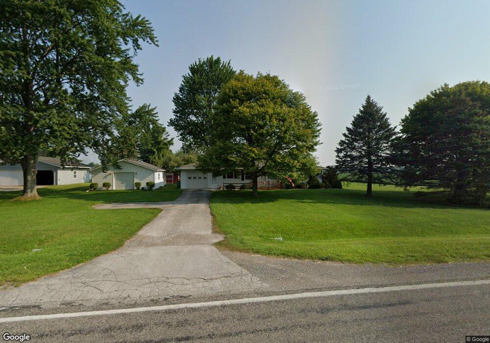
About This Home
This home is located at 6015 Curtis Rd, Bridgeport, MI 48722 and is currently estimated at $181,263, approximately $168 per square foot. 6015 Curtis Rd is a home located in Saginaw County with nearby schools including Thomas White School, Martin G. Atkins Elementary School, and Bridgeport-Spaulding Middle School - Martin G. Atkins.
Ownership History
We collect this data history from publicly available records. To have your information removed, we recommend requesting removal directly through your county’s website.
Purchase Details
Purchase Details
Home Financials for this Owner
Home Financials are based on the most recent Mortgage that was taken out on this home.Purchase History
We collect this data history from publicly available records. To have your information removed, we recommend requesting removal directly through your county’s website.
| Date | Buyer | Sale Price | Title Company |
|---|---|---|---|
| -- | -- | ||
| $82,000 | -- | ||
| $82,000 | -- |
Mortgage History
We collect this data history from publicly available records. To have your information removed, we recommend requesting removal directly through your county’s website.
| Date | Status | Borrower | Loan Amount |
|---|---|---|---|
| Open | $81,950 |
Tax History
We collect this data history from publicly available records. To have your information removed, we recommend requesting removal directly through your county’s website.
| Year | Tax Paid | Tax Assessment Tax Assessment Total Assessment is a certain percentage of the fair market value that is determined by local assessors to be the total taxable value of land and additions on the property. | Land | Improvement |
|---|---|---|---|---|
| 2025 | $433 | $62,900 | $0 | $0 |
| 2024 | $420 | $60,900 | $0 | $0 |
| 2023 | $400 | $53,700 | $0 | $0 |
| 2022 | $1,421 | $48,100 | $0 | $0 |
| 2021 | $1,306 | $42,600 | $0 | $0 |
| 2020 | $1,270 | $39,300 | $0 | $0 |
| 2019 | $1,208 | $37,000 | $4,500 | $32,500 |
| 2018 | $349 | $36,800 | $0 | $0 |
| 2017 | $1,094 | $34,700 | $0 | $0 |
| 2016 | $1,180 | $34,600 | $0 | $0 |
| 2014 | -- | $30,300 | $0 | $25,800 |
| 2013 | -- | $30,200 | $0 | $0 |
Map
- 7123 Dixie Hwy
- 7813 Rookway Rd
- Parcel E W Rolling Hills Dr
- Parcel B W Rolling Hills Dr
- Parcel D W Rolling Hills Dr
- Parcel F W Rolling Hills Dr
- Parcel C W Rolling Hills Dr
- 6364 Townline Rd
- 4301 Curtis Rd
- 6000 Lange Rd
- 6190 Maple Rd
- 3937 Curtis Rd
- 8525 Dixie Hwy
- 6605 Bridgeport Hwy
- 8780 Dixie Hwy
- 0 Judd Rd
- 6412 Tin Lizzy Ln
- VL Fort Rd
- 3241 Curtis Rd
- 6232 Baker Rd
- 5967 Curtis Rd
- 6040 Curtis Rd
- 6020 Curtis Rd
- 6082 Curtis Rd
- 6262 Curtis Rd
- 6262 Curtis Rd
- 3100 E Curtis Rd
- 0 E Curtis Rd
- 7085 Moorish Rd
- 7105 Moorish Rd
- 6180 Curtis Rd
- 1385 E Curtis Rd
- 7145 Moorish Rd
- 5917 Curtis Rd
- 6252 Curtis Rd
- 7165 Moorish Rd
- 6258 Curtis Rd
- 6258 Curtis Rd
- 5799 Curtis Rd
- 5799 Curtis Rd
Ask me questions while you tour the home.