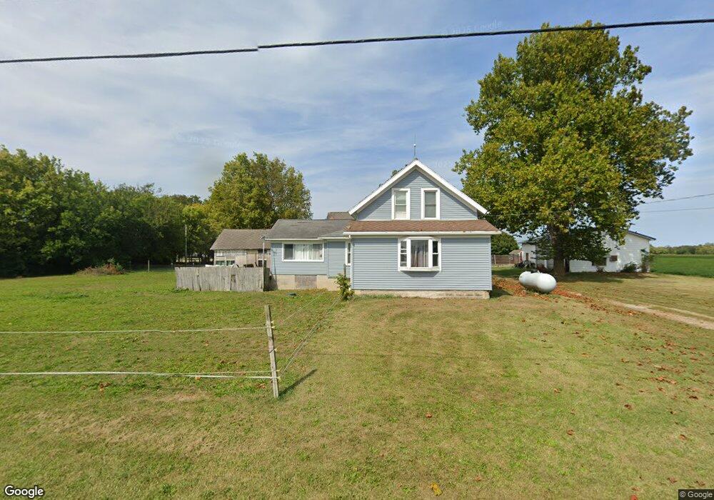
6015 Heywood Rd Sandusky, OH 44870
Estimated Value: $182,000 - $272,556
3
Beds
2
Baths
1,848
Sq Ft
$126/Sq Ft
Est. Value
About This Home
This home is located at 6015 Heywood Rd, Sandusky, OH 44870 and is currently estimated at $232,139, approximately $125 per square foot. 6015 Heywood Rd is a home located in Erie County with nearby schools including Margaretta Elementary School, Margaretta High School, and Firelands Christian Academy.
Ownership History
Date
Name
Owned For
Owner Type
Purchase Details
Closed on
Jul 19, 2007
Sold by
Homecomings Financial Network Inc
Bought by
Paule Rhonda J
Current Estimated Value
Home Financials for this Owner
Home Financials are based on the most recent Mortgage that was taken out on this home.
Original Mortgage
$83,500
Outstanding Balance
$52,787
Interest Rate
6.72%
Mortgage Type
New Conventional
Estimated Equity
$179,352
Purchase Details
Closed on
Mar 25, 1997
Sold by
Kaufman Mary
Bought by
Roth Kevin D
Home Financials for this Owner
Home Financials are based on the most recent Mortgage that was taken out on this home.
Original Mortgage
$131,500
Interest Rate
7.82%
Mortgage Type
New Conventional
Create a Home Valuation Report for This Property
The Home Valuation Report is an in-depth analysis detailing your home's value as well as a comparison with similar homes in the area
Home Values in the Area
Average Home Value in this Area
Purchase History
| Date | Buyer | Sale Price | Title Company |
|---|---|---|---|
| Paule Rhonda J | $83,500 | Sovereign Title Agency Llc | |
| Roth Kevin D | $131,500 | -- |
Source: Public Records
Mortgage History
| Date | Status | Borrower | Loan Amount |
|---|---|---|---|
| Open | Paule Rhonda J | $83,500 | |
| Previous Owner | Roth Kevin D | $131,500 |
Source: Public Records
Tax History Compared to Growth
Tax History
| Year | Tax Paid | Tax Assessment Tax Assessment Total Assessment is a certain percentage of the fair market value that is determined by local assessors to be the total taxable value of land and additions on the property. | Land | Improvement |
|---|---|---|---|---|
| 2024 | $2,446 | $63,682 | $13,671 | $50,011 |
| 2023 | $2,446 | $46,476 | $12,152 | $34,324 |
| 2022 | $2,044 | $46,473 | $12,152 | $34,321 |
| 2021 | $2,026 | $46,470 | $12,150 | $34,320 |
| 2020 | $1,864 | $40,300 | $12,150 | $28,150 |
| 2019 | $1,916 | $40,300 | $12,150 | $28,150 |
| 2018 | $2,015 | $40,300 | $12,150 | $28,150 |
| 2017 | $1,793 | $36,680 | $12,610 | $24,070 |
| 2016 | $1,774 | $36,680 | $12,610 | $24,070 |
| 2015 | $1,743 | $36,680 | $12,610 | $24,070 |
| 2014 | $1,798 | $36,680 | $12,610 | $24,070 |
| 2013 | $1,758 | $36,680 | $12,610 | $24,070 |
Source: Public Records
Map
Nearby Homes
- 0 Mccartney Rd
- 4708 Venice Heights Blvd
- 4708 Venice Heights Blvd Unit 204
- 4708 Venice Heights Blvd Unit 101
- 5704 Mccartney Rd
- 4514 Homegardner Rd
- 802 S Meadow Dr
- 4809 Venice Rd
- 719 Cold Creek Blvd
- 3005 Bardshar Rd
- 0 Venice Rd
- 1 Venice Rd
- 0 Lakeside Unit 20253835
- 0 Vl Cold Creek Ct Unit 20232610
- 0 Vl Cold Creek Ct Unit 4477272
- 3710 Venice Rd
- 3601 Bardshar Rd
- 3806 Ronald Dr
- 2614 Tiffin Ave
- 2614 Tiffin Ave Unit 103
- 1314 Maple Ave
- 1310 Maple Ave
- 1315 Maple Ave
- 1309 Maple Ave
- 1218 Maple Ave
- 1218 Maple Ave
- 1303 Maple Ave
- 5917 Heywood Rd
- 1210 Maple Ave
- 5918 Heywood
- 6004 Heywood Rd
- 1211 Maple Ave
- 5903 Heywood Rd
- 1205 Maple Ave
- 1201 Maple Ave
- 1116 Maple Ave
- 6213 Heywood Rd
- 1115 Maple Ave
- 1110 Maple Ave
- 6215 Heywood Rd