Estimated Value: $188,570 - $230,000
3
Beds
2
Baths
1,503
Sq Ft
$140/Sq Ft
Est. Value
About This Home
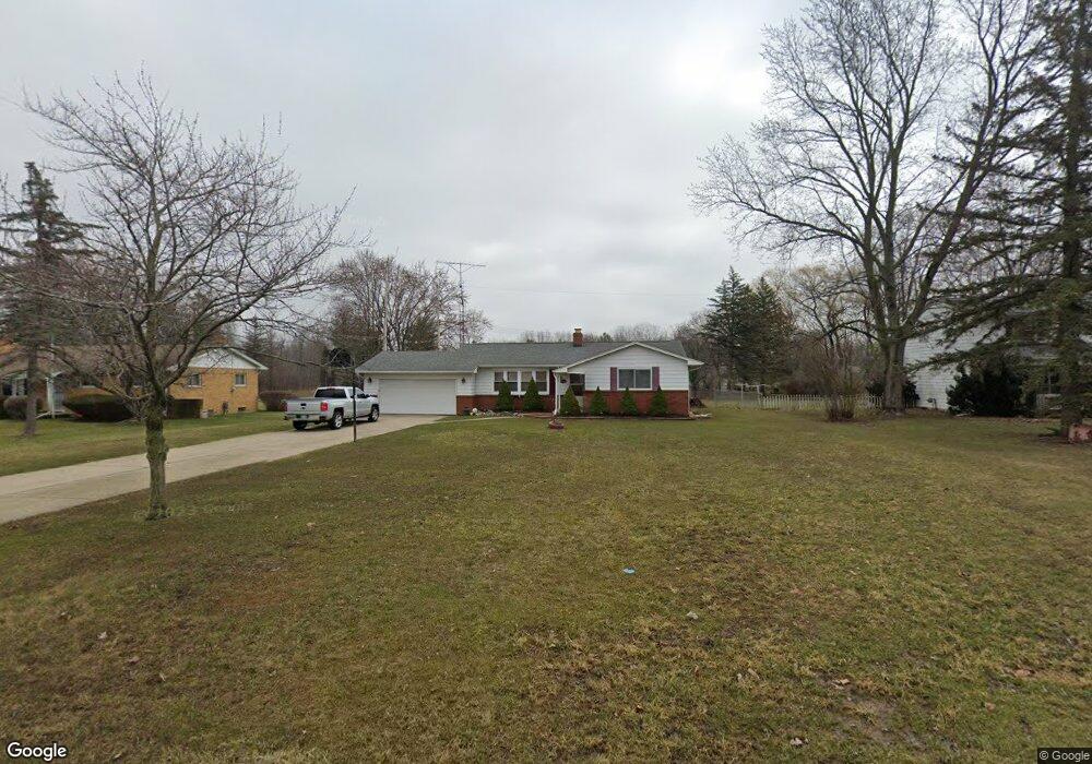
This home is located at 6015 Lancaster Dr, Flint, MI 48532 and is currently estimated at $209,893, approximately $139 per square foot. 6015 Lancaster Dr is a home located in Genesee County with nearby schools including Carman-Ainsworth High School, Genesee STEM Academy, and First Flint Seventh-day Adventist Christian School.
Ownership History
Date
Name
Owned For
Owner Type
Purchase Details
Closed on
Apr 13, 2010
Sold by
Living Well Real Estate Investments Llc
Bought by
Barfield Keith
Current Estimated Value
Purchase Details
Closed on
Dec 20, 2002
Sold by
Waller Gregory G and Waller Michelle R
Bought by
Fykes Darius
Create a Home Valuation Report for This Property
The Home Valuation Report is an in-depth analysis detailing your home's value as well as a comparison with similar homes in the area
Home Values in the Area
Average Home Value in this Area
Purchase History
| Date | Buyer | Sale Price | Title Company |
|---|---|---|---|
| Barfield Keith | $90,000 | First American Title Ins Co | |
| Fykes Darius | $135,000 | Metropolitan Title Company |
Source: Public Records
Tax History
| Year | Tax Paid | Tax Assessment Tax Assessment Total Assessment is a certain percentage of the fair market value that is determined by local assessors to be the total taxable value of land and additions on the property. | Land | Improvement |
|---|---|---|---|---|
| 2025 | $1,940 | $91,300 | $0 | $0 |
| 2024 | $1,000 | $89,700 | $0 | $0 |
| 2023 | $954 | $76,200 | $0 | $0 |
| 2022 | $858 | $69,600 | $0 | $0 |
| 2021 | $1,736 | $63,200 | $0 | $0 |
| 2020 | $857 | $53,100 | $0 | $0 |
| 2019 | $845 | $46,500 | $0 | $0 |
| 2018 | $1,583 | $41,000 | $0 | $0 |
| 2017 | $1,546 | $41,000 | $0 | $0 |
| 2016 | $1,586 | $39,300 | $0 | $0 |
| 2015 | $1,420 | $36,800 | $0 | $0 |
| 2014 | $842 | $35,300 | $0 | $0 |
| 2012 | -- | $42,000 | $42,000 | $0 |
Source: Public Records
Map
Nearby Homes
- 6090 Lancaster Dr
- 1417 Mintola Ave
- 1417 Grassmere Ave
- 6172 W Court St
- 5526 Corunna Rd
- 6007 Corunna Rd
- oo Walnut Creek Dr
- 1192 Citation Dr
- 1184 Citation Dr
- 00 Graham St
- 6272 W Court St
- 5423 Meadowcrest Dr
- 0000 Reuben Reuben St
- 000 Corunna Rd
- 1460 S Dye Rd
- 0 Country Ridge Trail
- 00 Corunna Rd
- 6142 Noel Dr
- 1161 S Dye Rd
- 2052 S Dye Rd
- 6017 Lancaster Dr
- 6013 Lancaster Dr
- 6013 Lancaster Dr
- 6011 Lancaster Dr
- 6011 Lancaster Dr
- 6028 Lancaster Dr
- 6021 Lancaster Dr
- 6033 Trenton Dr
- 6009 Lancaster Dr
- 6025 Lancaster Dr
- 6040 Lancaster Dr
- 6043 Trenton Dr
- 6035 Lancaster Dr
- 5490 W Court St
- 5522 W Court St
- 6007 Lancaster Dr
- 6050 Lancaster Dr
- 5508 W Court St
- 6045 Lancaster Dr
- 6012 W Court St
Your Personal Tour Guide
Ask me questions while you tour the home.