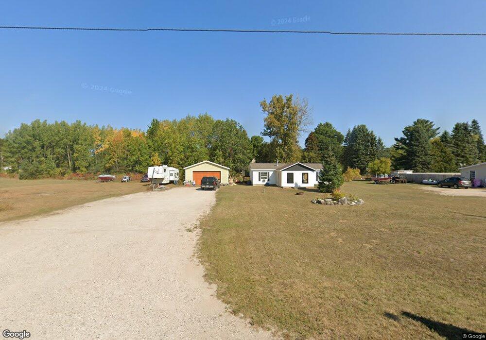
6015 Mill St Pellston, MI 49769
Estimated Value: $118,000 - $251,000
3
Beds
2
Baths
1,306
Sq Ft
$137/Sq Ft
Est. Value
About This Home
This home is located at 6015 Mill St, Pellston, MI 49769 and is currently estimated at $178,770, approximately $136 per square foot. 6015 Mill St is a home located in Emmet County with nearby schools including Pellston Elementary School and Pellston Middle/High School.
Ownership History
Date
Name
Owned For
Owner Type
Purchase Details
Closed on
Mar 3, 2026
Sold by
Doss Patricia
Bought by
Emmet County Treasurer
Current Estimated Value
Purchase Details
Closed on
Nov 28, 2023
Sold by
Emmet County Treasurer
Bought by
Doss Patricia and Doss Michael
Purchase Details
Closed on
Mar 1, 2023
Sold by
Doss Patricia
Bought by
Emmet County Treasurer
Purchase Details
Closed on
Aug 2, 2022
Sold by
Emmet County Treasurer
Bought by
Doss Patricia and Doss Michael
Purchase Details
Closed on
Mar 1, 2022
Sold by
Doss Patricia
Bought by
Emmet County Treasurer
Purchase Details
Closed on
Jun 13, 2011
Sold by
Federal Home Loan Mortgage Corporation
Bought by
Dubey Ralph
Purchase Details
Closed on
Feb 17, 2011
Sold by
Erickson Michael R
Bought by
Federal Home Loan Mortgage Corp
Purchase Details
Closed on
Jan 31, 2002
Sold by
Anderson William W
Bought by
Woods Mark T
Create a Home Valuation Report for This Property
The Home Valuation Report is an in-depth analysis detailing your home's value as well as a comparison with similar homes in the area
Purchase History
| Date | Buyer | Sale Price | Title Company |
|---|---|---|---|
| Emmet County Treasurer | $1,750 | -- | |
| Doss Patricia | $2,205 | -- | |
| Emmet County Treasurer | $2,109 | -- | |
| Doss Patricia | $2,184 | -- | |
| Emmet County Treasurer | $2,117 | -- | |
| Dubey Ralph | $25,700 | -- | |
| Federal Home Loan Mortgage Corp | $32,250 | -- | |
| Woods Mark T | $73,000 | -- |
Source: Public Records
Tax History
| Year | Tax Paid | Tax Assessment Tax Assessment Total Assessment is a certain percentage of the fair market value that is determined by local assessors to be the total taxable value of land and additions on the property. | Land | Improvement |
|---|---|---|---|---|
| 2025 | $1,609 | $74,100 | $74,100 | $0 |
| 2024 | $25 | $70,100 | $70,100 | $0 |
| 2023 | $1,357 | $63,900 | $63,900 | $0 |
| 2022 | $1,357 | $53,500 | $53,500 | $0 |
| 2021 | $1,409 | $50,800 | $50,800 | $0 |
| 2020 | $1,414 | $47,100 | $47,100 | $0 |
| 2019 | -- | $43,000 | $43,000 | $0 |
| 2018 | -- | $41,700 | $41,700 | $0 |
| 2017 | -- | $40,400 | $40,400 | $0 |
| 2016 | -- | $40,400 | $40,400 | $0 |
| 2015 | -- | $39,900 | $0 | $0 |
| 2014 | -- | $37,700 | $0 | $0 |
Source: Public Records
Map
Nearby Homes
- 6421 Airport Crossing Rd Unit 1
- TBD Teal Rd
- 8959 Robinson Rd
- 4333 U S 31
- 3954 Valley Rd
- 10826 Chickagami Trail
- 6105 U S 31
- 10999 Koepke Rd
- 10222 W Munro Lake Dr
- 6167 Lambert Dr
- 6737 Honeysette Rd
- 393 Beaux Rivages Dr
- 319 Beaux Rivages Dr
- 1830 Indian Point Rd
- 5441 Valley Rd
- 1253 Walkabout Ln
- 3955 S Pleasantview Rd Unit 6
- 7181 Maple St
- 1442 Indian Point Rd
- 7325 Keystone Park Dr Unit 18
Your Personal Tour Guide
Ask me questions while you tour the home.