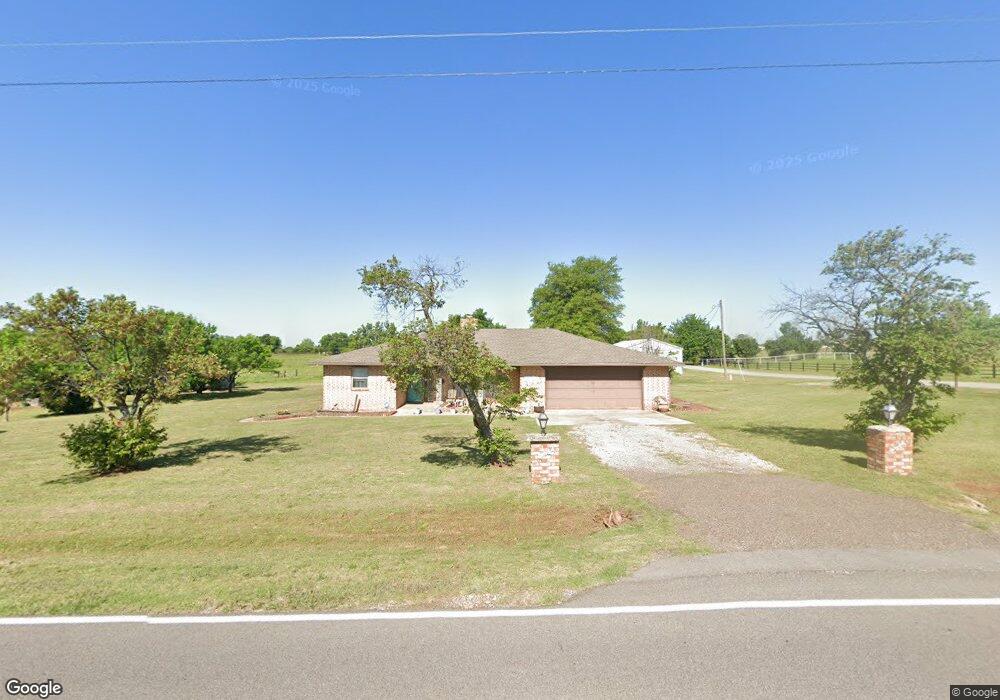
6015 S Frisco Rd Mustang, OK 73064
West Mustang NeighborhoodEstimated Value: $359,000 - $433,000
4
Beds
2
Baths
2,116
Sq Ft
$187/Sq Ft
Est. Value
About This Home
This home is located at 6015 S Frisco Rd, Mustang, OK 73064 and is currently estimated at $395,482, approximately $186 per square foot. 6015 S Frisco Rd is a home located in Canadian County with nearby schools including Mustang Lakehoma Elementary School, Mustang Horizon Intermediate School, and Mustang Middle School.
Ownership History
Date
Name
Owned For
Owner Type
Purchase Details
Closed on
Jan 25, 2024
Sold by
Percival Eddie D and Percival Jenifer
Bought by
Percival Family Trust and Percival
Current Estimated Value
Purchase Details
Closed on
Mar 30, 2007
Sold by
Bond Darren and Bond Linda
Bought by
Bond Darren and Bond Linda L
Purchase Details
Closed on
Nov 17, 1997
Sold by
Loyd Bob G and Loyd Jeannie L
Bought by
Percival Eddie D and Percival Jenifer
Purchase Details
Closed on
Feb 14, 1994
Sold by
Jaye Lorene E
Create a Home Valuation Report for This Property
The Home Valuation Report is an in-depth analysis detailing your home's value as well as a comparison with similar homes in the area
Home Values in the Area
Average Home Value in this Area
Purchase History
| Date | Buyer | Sale Price | Title Company |
|---|---|---|---|
| Percival Family Trust | -- | None Listed On Document | |
| Bond Darren | -- | None Available | |
| Percival Eddie D | $109,000 | -- | |
| -- | $86,000 | -- |
Source: Public Records
Tax History Compared to Growth
Tax History
| Year | Tax Paid | Tax Assessment Tax Assessment Total Assessment is a certain percentage of the fair market value that is determined by local assessors to be the total taxable value of land and additions on the property. | Land | Improvement |
|---|---|---|---|---|
| 2024 | $2,419 | $23,035 | $5,015 | $18,020 |
| 2023 | $2,419 | $22,362 | $4,719 | $17,643 |
| 2022 | $2,381 | $21,712 | $4,336 | $17,376 |
| 2021 | $2,299 | $21,080 | $3,860 | $17,220 |
| 2020 | $2,252 | $20,465 | $3,487 | $16,978 |
| 2019 | $2,181 | $19,870 | $3,250 | $16,620 |
| 2018 | $2,153 | $19,291 | $3,000 | $16,291 |
| 2017 | $1,789 | $18,729 | $3,000 | $15,729 |
| 2016 | $1,737 | $18,729 | $3,000 | $15,729 |
| 2015 | $1,719 | $17,561 | $3,000 | $14,561 |
| 2014 | $1,719 | $17,967 | $3,000 | $14,967 |
Source: Public Records
Map
Nearby Homes
- 0 Regan Rd
- 545 N Fox Way
- 2020 W Flintlock Way
- 1956 W Flintlock Way
- 2012 W Flintlock Way
- 7201 Country Ln
- 1736 W Zachary Way
- 1957 W Crossbow Way
- 1935 W Flintlock Way
- 14209 SW 50th Ct
- 100 S Nelson Dr
- 708 N Buckhorn Way
- 1924 W Flintlock Way
- 2241 W Mickey Dr
- 2001 W Crossbow Way
- 1721 W Antler Way
- 4712 Bermuda Dr
- 0 SW 59th St
- 708 N White Tail Way
- 7400 Lakewood Dr
- 13800 SW 59th St
- 6201 S Frisco Rd
- 6309 S Frisco Rd
- 14001 SW 62nd St
- 13900 SW 59th St
- 14102 SW 62nd St
- 13901 SW 62nd St
- 13901 SW 65th St
- 6401 S Frisco Rd
- 14000 SW 59th St
- 13621 W Southwest 59th St
- 13621 SW 59th St
- 14202 SW 62nd St
- 6020 Lakeview Dr
- 13601 SW 59th St
- 13609 SW 59th St
- 6517 S Frisco Rd
- 14001 SW 65th St
- 14003 SW 65th St
- 14000 SW 65th St