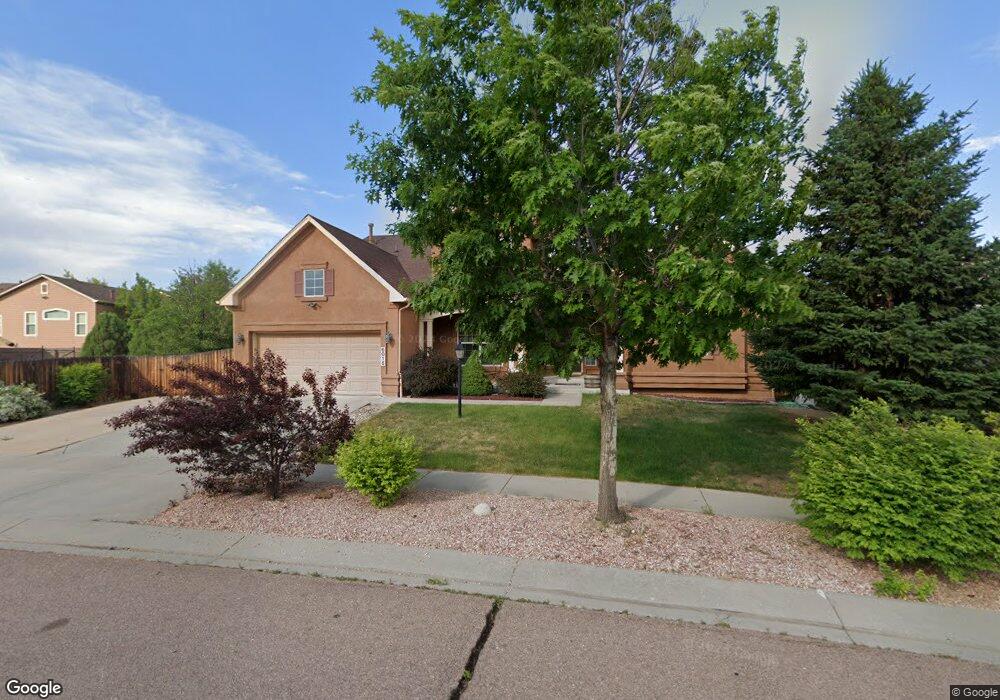
6015 Wild Bill Way Colorado Springs, CO 80923
Ridgeview NeighborhoodEstimated Value: $650,242 - $759,000
5
Beds
4
Baths
2,801
Sq Ft
$256/Sq Ft
Est. Value
About This Home
This home is located at 6015 Wild Bill Way, Colorado Springs, CO 80923 and is currently estimated at $716,061, approximately $255 per square foot. 6015 Wild Bill Way is a home located in El Paso County with nearby schools including Stetson Elementary School, Skyview Middle School, and Sand Creek High School.
Ownership History
Date
Name
Owned For
Owner Type
Purchase Details
Closed on
Jun 20, 2012
Sold by
Lintz Michelle M and Rivers Keith T
Bought by
Rivers Michelle M and Rivers Keith T
Current Estimated Value
Home Financials for this Owner
Home Financials are based on the most recent Mortgage that was taken out on this home.
Original Mortgage
$398,390
Outstanding Balance
$274,148
Interest Rate
3.68%
Mortgage Type
VA
Estimated Equity
$441,913
Purchase Details
Closed on
Sep 26, 2006
Sold by
Elite Properties Of America Inc
Bought by
Lintz Michelle M and Rivers Keith T
Home Financials for this Owner
Home Financials are based on the most recent Mortgage that was taken out on this home.
Original Mortgage
$413,748
Interest Rate
6.51%
Mortgage Type
VA
Create a Home Valuation Report for This Property
The Home Valuation Report is an in-depth analysis detailing your home's value as well as a comparison with similar homes in the area
Home Values in the Area
Average Home Value in this Area
Purchase History
| Date | Buyer | Sale Price | Title Company |
|---|---|---|---|
| Rivers Michelle M | -- | Genuine Title Llc | |
| Lintz Michelle M | $405,000 | -- |
Source: Public Records
Mortgage History
| Date | Status | Borrower | Loan Amount |
|---|---|---|---|
| Open | Rivers Michelle M | $398,390 | |
| Closed | Lintz Michelle M | $413,748 |
Source: Public Records
Tax History Compared to Growth
Tax History
| Year | Tax Paid | Tax Assessment Tax Assessment Total Assessment is a certain percentage of the fair market value that is determined by local assessors to be the total taxable value of land and additions on the property. | Land | Improvement |
|---|---|---|---|---|
| 2025 | $3,811 | $49,130 | -- | -- |
| 2024 | $4,100 | $49,240 | $7,400 | $41,840 |
| 2023 | $4,100 | $49,240 | $7,400 | $41,840 |
| 2022 | $3,055 | $33,590 | $6,670 | $26,920 |
| 2021 | $3,204 | $34,560 | $6,860 | $27,700 |
| 2020 | $2,838 | $32,650 | $5,720 | $26,930 |
| 2019 | $2,817 | $32,650 | $5,720 | $26,930 |
| 2018 | $2,753 | $31,530 | $4,840 | $26,690 |
| 2017 | $2,764 | $31,530 | $4,840 | $26,690 |
| 2016 | $2,997 | $34,850 | $4,710 | $30,140 |
| 2015 | $2,999 | $34,850 | $4,710 | $30,140 |
| 2014 | $2,600 | $29,790 | $4,460 | $25,330 |
Source: Public Records
Map
Nearby Homes
- 6016 Wild Bill Way
- 5918 Whiskey River Dr
- 7199 Quiet Pond Place
- 6292 Tenderfoot Dr
- 6771 Sunny Alp St
- 5889 Brennan Ave
- 6380 Tenderfoot Dr
- 7127 Indian River Dr
- 5919 Brennan Ave
- 6218 Escalade Point
- 5625 Dusty Chaps Dr
- 7368 Prythania Park Dr
- 6408 Butch Cassidy Blvd
- 7094 Red Sand Grove
- 7647 Desert Wind Dr
- 5739 Brennan Ave
- 6363 Sand Bar Point
- 6524 Diamond Hitch Dr
- 6481 Summer Grace St
- 5715 Brennan Ave
- 6001 Wild Bill Way
- 5974 Whiskey River Dr
- 5982 Whiskey River Dr
- 6023 High Noon Ave
- 6033 High Noon Ave
- 5966 Whiskey River Dr
- 5998 Whiskey River Dr
- 5987 Wild Bill Way
- 5950 Whiskey River Dr
- 6043 High Noon Ave
- 6002 Wild Bill Way
- 6030 Wild Bill Way
- 5973 Wild Bill Way
- 5942 Whiskey River Dr
- 5988 Wild Bill Way
- 5973 Whiskey River Dr
- 6053 High Noon Ave
- 5981 Whiskey River Dr
- 5989R Whiskey River Dr
- 5973 High Noon Ave