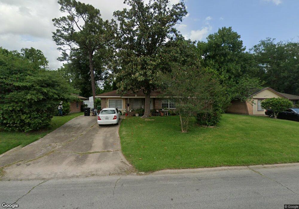
6017 Bretshire Dr Houston, TX 77016
East Little York NeighborhoodEstimated Value: $182,000 - $195,604
3
Beds
2
Baths
1,651
Sq Ft
$115/Sq Ft
Est. Value
About This Home
This home is located at 6017 Bretshire Dr, Houston, TX 77016 and is currently estimated at $189,651, approximately $114 per square foot. 6017 Bretshire Dr is a home located in Harris County with nearby schools including Shadydale Elementary School, Forest Brook Middle, and North Forest High School.
Ownership History
Date
Name
Owned For
Owner Type
Purchase Details
Closed on
Sep 23, 2021
Sold by
Bell Malone Christal H and Miller Christal
Bought by
Jordan Felix
Current Estimated Value
Purchase Details
Closed on
Sep 11, 2017
Sold by
Parker Charles R
Bought by
Bell Malone Christal H
Purchase Details
Closed on
Aug 23, 2012
Sold by
Malone Pamela D
Bought by
Malonw Woodrow D and Woodrow D Malone Living Trust
Purchase Details
Closed on
Jun 6, 2008
Sold by
Johnson Pearlie Mae and Johnson Pearlie M
Bought by
Woodrow D Malone Living Trust
Create a Home Valuation Report for This Property
The Home Valuation Report is an in-depth analysis detailing your home's value as well as a comparison with similar homes in the area
Home Values in the Area
Average Home Value in this Area
Purchase History
| Date | Buyer | Sale Price | Title Company |
|---|---|---|---|
| Jordan Felix | -- | None Available | |
| Bell Malone Christal H | $48,000 | None Available | |
| Malonw Woodrow D | -- | -- | |
| Malonw Woodrow D | -- | -- | |
| Woodrow D Malone Living Trust | -- | Texas American Title Company |
Source: Public Records
Tax History Compared to Growth
Tax History
| Year | Tax Paid | Tax Assessment Tax Assessment Total Assessment is a certain percentage of the fair market value that is determined by local assessors to be the total taxable value of land and additions on the property. | Land | Improvement |
|---|---|---|---|---|
| 2025 | $4,213 | $182,135 | $55,430 | $126,705 |
| 2024 | $4,213 | $201,334 | $39,127 | $162,207 |
| 2023 | $3,945 | $195,816 | $39,127 | $156,689 |
| 2022 | $4,071 | $184,904 | $39,127 | $145,777 |
| 2021 | $3,495 | $149,953 | $26,085 | $123,868 |
| 2020 | $3,121 | $128,882 | $17,607 | $111,275 |
| 2019 | $2,581 | $101,996 | $11,152 | $90,844 |
| 2018 | $2,053 | $81,137 | $11,152 | $69,985 |
| 2017 | $2,052 | $81,137 | $11,152 | $69,985 |
| 2016 | $1,924 | $76,076 | $11,152 | $64,924 |
| 2015 | $1,543 | $72,057 | $11,152 | $60,905 |
| 2014 | $1,543 | $60,040 | $11,152 | $48,888 |
Source: Public Records
Map
Nearby Homes
- 6001 Bretshire Dr
- 10221 Bretton Dr
- 10122 Rockaway Dr
- 10201 Homestead Rd
- 10806 Bird of Paradise Ln
- 10808 Bird of Paradise Ln
- 10810 Bird of Paradise Ln
- 10120 Homestead Rd
- 10124 Homestead Rd
- 10128 Homestead Rd
- 10317 Kelburn Dr
- 7220 Parker Rd
- 7210 Colton St
- 10434 Envoy St
- 9838 Camay Dr
- 7234 Boggess Rd
- 10430 Royal Oaks Dr
- 7218 Bretshire Dr
- 7252 Parker Rd
- 7226 Gore Dr
- 6013 Bretshire Dr
- 6021 Bretshire Dr
- 10109 Bretton Dr
- 6009 Bretshire Dr
- 10113 Bretton Dr
- 0 Lanewood Dr Unit 39417255
- 6005 Bretshire Dr
- 10117 Bretton Dr
- 10106 Bretton Dr
- 10110 Bretton Dr
- 10114 Bretton Dr
- 10102 Bretton Dr
- 10121 Bretton Dr
- 10122 Envoy St
- 10118 Bretton Dr
- 10125 Bretton Dr
- 10122 Bretton Dr
- 10130 Envoy St
- 7101 Parker Rd
- 10129 Bretton Dr