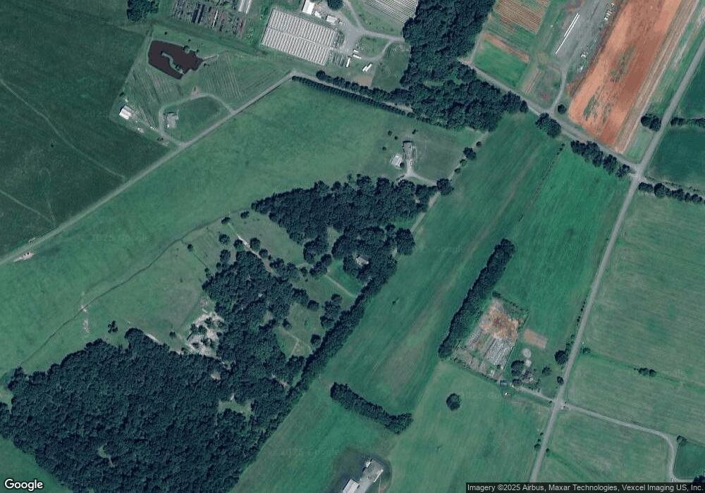
6017 Dwyer Ln Bealeton, VA 22712
Estimated Value: $430,000 - $439,000
2
Beds
1
Bath
1,334
Sq Ft
$325/Sq Ft
Est. Value
About This Home
This home is located at 6017 Dwyer Ln, Bealeton, VA 22712 and is currently estimated at $432,974, approximately $324 per square foot. 6017 Dwyer Ln is a home located in Fauquier County with nearby schools including Mary Walter Elementary School, Cedar Lee Middle School, and Liberty High School.
Ownership History
Date
Name
Owned For
Owner Type
Purchase Details
Closed on
Jul 12, 2018
Sold by
Dwyer Larry G and Dwyer Sharon R
Bought by
Dwyder Matthew G
Current Estimated Value
Home Financials for this Owner
Home Financials are based on the most recent Mortgage that was taken out on this home.
Original Mortgage
$220,000
Outstanding Balance
$190,663
Interest Rate
4.5%
Mortgage Type
New Conventional
Estimated Equity
$242,311
Create a Home Valuation Report for This Property
The Home Valuation Report is an in-depth analysis detailing your home's value as well as a comparison with similar homes in the area
Home Values in the Area
Average Home Value in this Area
Purchase History
| Date | Buyer | Sale Price | Title Company |
|---|---|---|---|
| Dwyder Matthew G | $275,000 | None Available |
Source: Public Records
Mortgage History
| Date | Status | Borrower | Loan Amount |
|---|---|---|---|
| Open | Dwyder Matthew G | $220,000 |
Source: Public Records
Tax History Compared to Growth
Tax History
| Year | Tax Paid | Tax Assessment Tax Assessment Total Assessment is a certain percentage of the fair market value that is determined by local assessors to be the total taxable value of land and additions on the property. | Land | Improvement |
|---|---|---|---|---|
| 2025 | $2,934 | $303,400 | $121,400 | $182,000 |
| 2024 | $2,875 | $303,400 | $121,400 | $182,000 |
| 2023 | $2,753 | $303,400 | $121,400 | $182,000 |
| 2022 | $2,753 | $303,400 | $121,400 | $182,000 |
| 2021 | $2,403 | $240,400 | $106,400 | $134,000 |
| 2020 | $2,403 | $240,400 | $106,400 | $134,000 |
| 2019 | $2,403 | $240,400 | $106,400 | $134,000 |
| 2018 | $2,374 | $240,400 | $106,400 | $134,000 |
| 2016 | $1,969 | $188,200 | $88,700 | $99,500 |
| 2015 | -- | $188,200 | $88,700 | $99,500 |
| 2014 | -- | $188,200 | $88,700 | $99,500 |
Source: Public Records
Map
Nearby Homes
- 0 Rt 17 and Inglewood Farm Ln Unit VAFQ2016840
- 5474 Woodside Ln
- 5364 Woodside Ln
- 12406-B Strodes Mill Rd
- 0 Remington Rd Unit VAFQ2003648
- 0 Piney Ln Unit VAFQ2018214
- 12406 Strodes Mill Rd
- 0 Davis Rd Unit VAFQ2017056
- 7058 Helm Dr
- 0 Old Mill Rd Unit LotWP001 21203612
- 0 Old Mill Rd Unit VAFQ2016622
- 11326-BUILD SOUTH Rogues Rd
- 12190 Remland Ct
- 0 Piney Ridge Rd
- 11256 Torrie Way Unit K
- 11241 Craig Ln
- 11708 Flag Rock Dr
- 5263 Stewart Rd
- 11358 Whipkey Dr
- 404 N Franklin St
- 6019 Dwyer Ln
- 12086 Morgansburg Rd
- 12144 Morgansburg Rd
- 6062 Dwyer Ln
- 12200 Morgansburg Rd
- 6084 Dwyer Ln
- 12097 Morgansburg Rd
- 12149 Morgansburg Rd
- 12036 Morgansburg Rd
- 5578 Winter Wood Ln
- 12238 Morgansburg Rd
- 5695 Winter Wood Ln
- 11999 Morgansburg Rd
- 12008 Morgansburg Rd
- 5694 Winter Wood Ln
- 11775 Morgansburg Rd
- 11759 Morgansburg Rd
- 11707 Morgansburg Rd
- 12109 Lucky Hill Rd
- 0 Morgansburg Rd Unit VAFQ2009662
