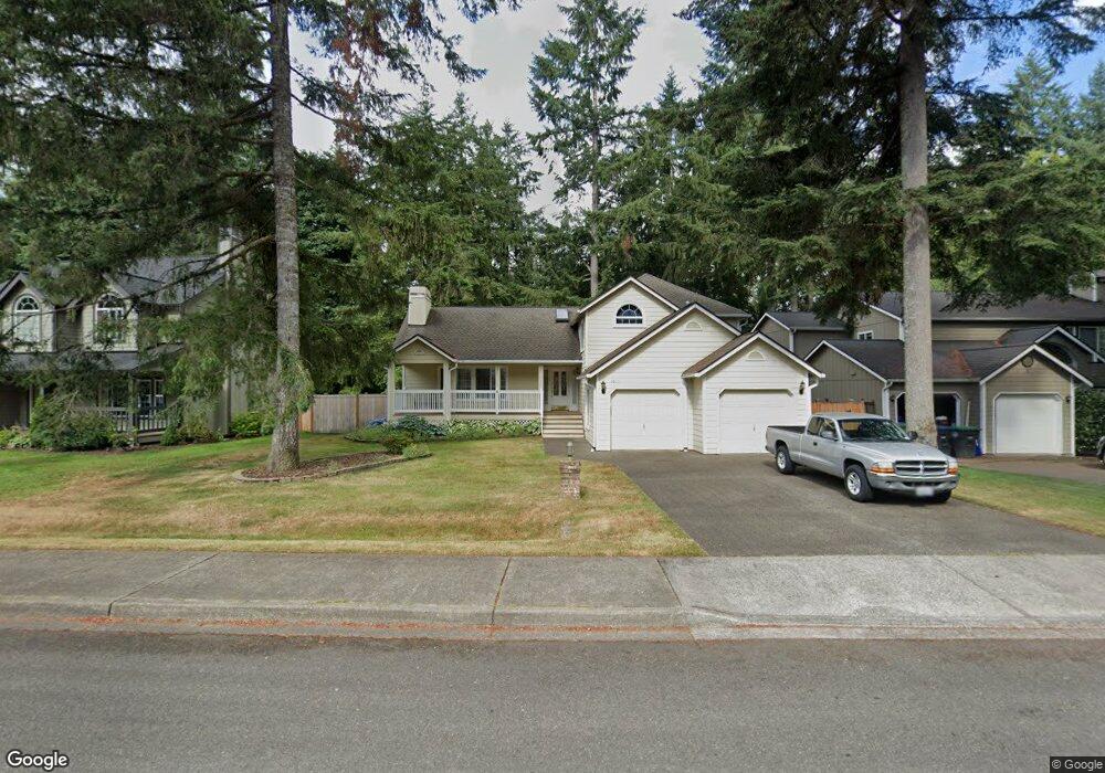
6017 Newport Ct SW Olympia, WA 98512
Littlerock NeighborhoodEstimated Value: $583,000 - $646,000
4
Beds
3
Baths
2,019
Sq Ft
$299/Sq Ft
Est. Value
About This Home
This home is located at 6017 Newport Ct SW, Olympia, WA 98512 and is currently estimated at $603,695, approximately $299 per square foot. 6017 Newport Ct SW is a home located in Thurston County with nearby schools including Black Lake Elementary School, Tumwater Middle School, and A.G. West Black Hills High School.
Ownership History
Date
Name
Owned For
Owner Type
Purchase Details
Closed on
Aug 14, 1998
Sold by
Jones James Richard and Jones Amelia Dejesus
Bought by
Gray John H and Gray Patricia A
Current Estimated Value
Home Financials for this Owner
Home Financials are based on the most recent Mortgage that was taken out on this home.
Original Mortgage
$184,070
Outstanding Balance
$38,267
Interest Rate
6.88%
Mortgage Type
VA
Estimated Equity
$565,428
Create a Home Valuation Report for This Property
The Home Valuation Report is an in-depth analysis detailing your home's value as well as a comparison with similar homes in the area
Home Values in the Area
Average Home Value in this Area
Purchase History
| Date | Buyer | Sale Price | Title Company |
|---|---|---|---|
| Gray John H | $190,900 | Transnation Title Insurance |
Source: Public Records
Mortgage History
| Date | Status | Borrower | Loan Amount |
|---|---|---|---|
| Open | Gray John H | $184,070 |
Source: Public Records
Tax History Compared to Growth
Tax History
| Year | Tax Paid | Tax Assessment Tax Assessment Total Assessment is a certain percentage of the fair market value that is determined by local assessors to be the total taxable value of land and additions on the property. | Land | Improvement |
|---|---|---|---|---|
| 2024 | $4,943 | $528,600 | $190,000 | $338,600 |
| 2023 | $4,943 | $493,800 | $158,900 | $334,900 |
| 2022 | $4,606 | $460,900 | $125,000 | $335,900 |
| 2021 | $4,150 | $384,500 | $106,200 | $278,300 |
| 2020 | $4,096 | $316,500 | $104,700 | $211,800 |
| 2019 | $3,719 | $303,200 | $73,200 | $230,000 |
| 2018 | $3,642 | $275,800 | $78,300 | $197,500 |
| 2017 | $3,648 | $271,300 | $76,300 | $195,000 |
| 2016 | $3,541 | $257,150 | $82,150 | $175,000 |
| 2014 | -- | $253,550 | $82,150 | $171,400 |
Source: Public Records
Map
Nearby Homes
- 6018 Jody Ct SW
- 6311 Black Lake Belmore Rd SW
- 3244 66th Ave SW Unit 33
- 3244 66th Ave SW Unit 48
- 6137 Kirsop Rd SW
- 7025 Cavalier St SW
- 4045 49th Ave SW Unit 7
- 4045 49th Ave SW Unit 74
- 4045 49th Ave SW Unit 70
- 4027 Dent Rd SW
- 3140 66th Ave SW
- 7125 Cavalier Loop SW
- 3115 69th Ln SW
- 3019 Shalom Ct SW
- 3021 70th Way SW
- 5647 Black Lake Blvd SW
- 3011 Bush Mountain Ct SW
- 7049 Rothenberg Dr SW
- 2828 71st Way SW
- 2709 Vacation Dr SW
- 6025 Newport Ct SW
- 5937 Newport Ct SW
- 6039 Newport Ct SW
- 5923 Newport Ct SW
- 6012 Newport Ct SW
- 5936 Newport Ct SW
- 6012 Jody Ct SW
- 6026 Newport Ct SW
- 5924 Newport Ct SW
- 5936 Jody Ct SW
- 6030 Newport Ct SW
- 6026 Jody Ct SW
- 5915 Newport Ct SW
- 6123 Newport Ct SW
- 6116 Newport Ct SW
- 5916 Newport Ct SW
- 5924 Jody Ct SW
- 5910 Newport Ct SW
- 6038 Jody Ct SW
- 6124 Newport Ct SW