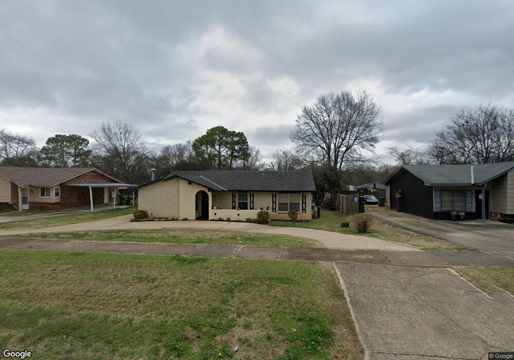
6017 Wares Ferry Rd Montgomery, AL 36117
East Montgomery NeighborhoodEstimated Value: $131,000 - $145,000
3
Beds
2
Baths
1,509
Sq Ft
$91/Sq Ft
Est. Value
About This Home
This home is located at 6017 Wares Ferry Rd, Montgomery, AL 36117 and is currently estimated at $136,840, approximately $90 per square foot. 6017 Wares Ferry Rd is a home located in Montgomery County with nearby schools including Wares Ferry Road Elementary School, Goodwyn Middle School, and Dr. Percy L. Julian High School.
Ownership History
Date
Name
Owned For
Owner Type
Purchase Details
Closed on
Nov 10, 2005
Sold by
Carter Hubert Wayne and Clark Myra Joyce
Bought by
Clark Haywood and Clark Carolyn
Current Estimated Value
Home Financials for this Owner
Home Financials are based on the most recent Mortgage that was taken out on this home.
Original Mortgage
$68,900
Outstanding Balance
$44,818
Interest Rate
9.3%
Mortgage Type
Fannie Mae Freddie Mac
Estimated Equity
$92,022
Create a Home Valuation Report for This Property
The Home Valuation Report is an in-depth analysis detailing your home's value as well as a comparison with similar homes in the area
Home Values in the Area
Average Home Value in this Area
Purchase History
| Date | Buyer | Sale Price | Title Company |
|---|---|---|---|
| Clark Haywood | -- | -- |
Source: Public Records
Mortgage History
| Date | Status | Borrower | Loan Amount |
|---|---|---|---|
| Open | Clark Haywood | $68,900 | |
| Closed | Clark Haywood | $20,000 |
Source: Public Records
Tax History Compared to Growth
Tax History
| Year | Tax Paid | Tax Assessment Tax Assessment Total Assessment is a certain percentage of the fair market value that is determined by local assessors to be the total taxable value of land and additions on the property. | Land | Improvement |
|---|---|---|---|---|
| 2025 | $539 | $11,750 | $1,500 | $10,250 |
| 2024 | $526 | $11,480 | $1,500 | $9,980 |
| 2023 | $526 | $11,070 | $1,500 | $9,570 |
| 2022 | $285 | $8,920 | $1,500 | $7,420 |
| 2021 | $251 | $8,000 | $0 | $0 |
| 2020 | $251 | $7,990 | $1,500 | $6,490 |
| 2019 | $270 | $8,510 | $1,500 | $7,010 |
| 2018 | $294 | $8,050 | $1,500 | $6,550 |
| 2017 | $230 | $14,820 | $3,000 | $11,820 |
| 2014 | $230 | $7,410 | $1,500 | $5,910 |
| 2013 | -- | $8,250 | $1,500 | $6,750 |
Source: Public Records
Map
Nearby Homes
- 0000 N Burbank Dr
- 6119 Hinchcliff Rd
- 6120 Hinchcliff Rd
- 740 Havelock Ln
- 6228 Hinchcliff Rd
- 6201 Dalford Dr
- 767 N Burbank Dr
- 6241 Wares Ferry Rd
- 310 Kroy Dr
- 6214 Gladstone Dr
- 709 Balfour Rd
- 5743 Belleau Dr
- 5821 Hyde Park Dr
- 5737 Darien Dr
- 576 Dunbarton Rd
- 6204 Lycoming Rd
- 532 Lynnhurst Ct
- 6037 Burbank Crossing Loop
- 6427 Pinebrook Dr
- 6408 Pinebrook Dr
- 6025 Wares Ferry Rd
- 6009 Wares Ferry Rd
- 6033 Wares Ferry Rd
- 673 Burlington Dr
- 681 Burlington Dr
- 682 N Burbank Dr
- 665 Burlington Dr
- 6041 Wares Ferry Rd
- 6018 Wares Ferry Rd
- 6010 Wares Ferry Rd
- 6026 Wares Ferry Rd
- 689 Burlington Dr
- 690 N Burbank Dr
- 6008 Winslow Ln
- 6049 Wares Ferry Rd
- 6034 Wares Ferry Rd
- 649 Burlington Dr
- 6042 Wares Ferry Rd
- 680 Burlington Dr
- 700 N Burbank Dr