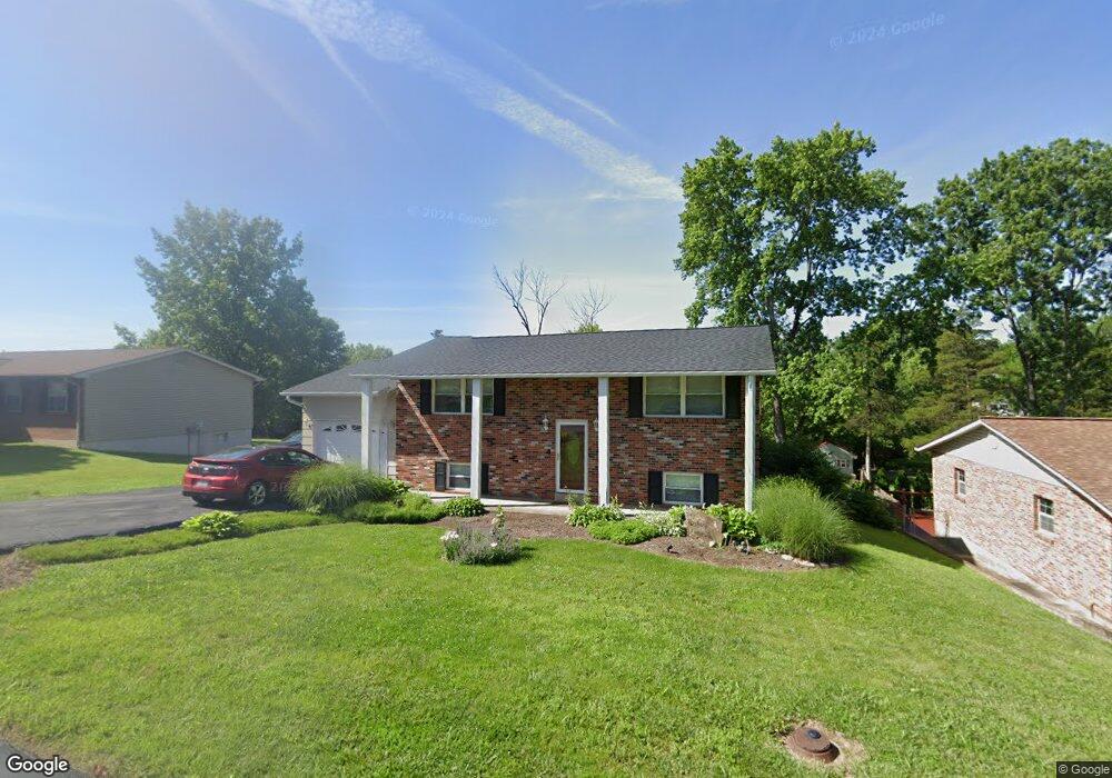
6018 Carol St House Springs, MO 63051
Estimated Value: $167,959 - $242,000
--
Bed
1
Bath
960
Sq Ft
$218/Sq Ft
Est. Value
About This Home
This home is located at 6018 Carol St, House Springs, MO 63051 and is currently estimated at $209,740, approximately $218 per square foot. 6018 Carol St is a home located in Jefferson County with nearby schools including Northwest High School and St. Anthony School.
Ownership History
Date
Name
Owned For
Owner Type
Purchase Details
Closed on
Apr 23, 1999
Sold by
Ridgetop Estates Inc
Bought by
Steinfeld Thomas F and Steinfeld Tamela D
Current Estimated Value
Create a Home Valuation Report for This Property
The Home Valuation Report is an in-depth analysis detailing your home's value as well as a comparison with similar homes in the area
Home Values in the Area
Average Home Value in this Area
Purchase History
| Date | Buyer | Sale Price | Title Company |
|---|---|---|---|
| Steinfeld Thomas F | -- | -- |
Source: Public Records
Tax History Compared to Growth
Tax History
| Year | Tax Paid | Tax Assessment Tax Assessment Total Assessment is a certain percentage of the fair market value that is determined by local assessors to be the total taxable value of land and additions on the property. | Land | Improvement |
|---|---|---|---|---|
| 2025 | $1,487 | $22,400 | $1,900 | $20,500 |
| 2024 | $1,487 | $20,600 | $1,900 | $18,700 |
| 2023 | $1,487 | $20,600 | $1,900 | $18,700 |
| 2022 | $1,481 | $20,600 | $1,900 | $18,700 |
| 2021 | $1,472 | $20,600 | $1,900 | $18,700 |
| 2020 | $1,368 | $18,700 | $1,600 | $17,100 |
| 2019 | $1,367 | $18,700 | $1,600 | $17,100 |
| 2018 | $1,385 | $18,700 | $1,600 | $17,100 |
| 2017 | $1,265 | $18,700 | $1,600 | $17,100 |
| 2016 | $1,160 | $17,000 | $1,700 | $15,300 |
| 2015 | $1,192 | $17,000 | $1,700 | $15,300 |
| 2013 | -- | $16,500 | $1,700 | $14,800 |
Source: Public Records
Map
Nearby Homes
- 6042 Carol St
- 173 Cardinal Ln Unit 173
- 5899 Midridge Dr
- 74 Mockingbird Hill Unit 74
- 65 Mockingbird Hill Unit 65
- 0 Manor Crest Dr Unit MIS25054810
- 6144 Misty Meadow Dr
- 4138 Elizabeth Dr
- 5919 Brookside Place
- 5916 Brookside Place
- 5916 Roger Rd
- 3833 Dorchester Ct
- 5814 Mayfair Ct
- 6302 Upper Byrnes Mill Rd
- 3734 Carol Park Rd
- 0 Lots 6 Cedar Dr
- 0 Lot 40 & 41 Fernwood Unit 21026109
- 0 Lot 45fernwood
- 5975 Ridge Dr
- 0 Fernwood Cir