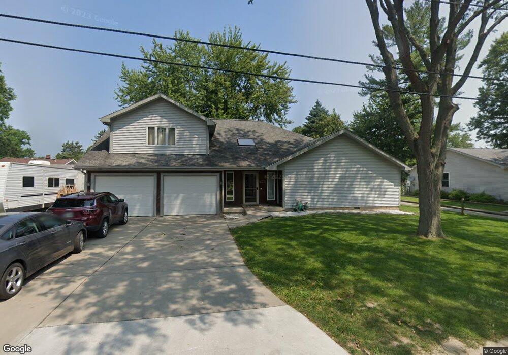
6019 Colchester Rd Oregon, OH 43616
Estimated Value: $219,000 - $293,000
3
Beds
3
Baths
2,224
Sq Ft
$115/Sq Ft
Est. Value
About This Home
This home is located at 6019 Colchester Rd, Oregon, OH 43616 and is currently estimated at $255,518, approximately $114 per square foot. 6019 Colchester Rd is a home located in Lucas County.
Ownership History
Date
Name
Owned For
Owner Type
Purchase Details
Closed on
May 7, 2003
Sold by
Wineland Martin J and Wineland Deborah A
Bought by
Lunsford Michael D
Current Estimated Value
Home Financials for this Owner
Home Financials are based on the most recent Mortgage that was taken out on this home.
Original Mortgage
$152,296
Outstanding Balance
$67,298
Interest Rate
6.02%
Mortgage Type
FHA
Estimated Equity
$188,220
Create a Home Valuation Report for This Property
The Home Valuation Report is an in-depth analysis detailing your home's value as well as a comparison with similar homes in the area
Home Values in the Area
Average Home Value in this Area
Purchase History
| Date | Buyer | Sale Price | Title Company |
|---|---|---|---|
| Lunsford Michael D | $153,500 | -- |
Source: Public Records
Mortgage History
| Date | Status | Borrower | Loan Amount |
|---|---|---|---|
| Open | Lunsford Michael D | $152,296 |
Source: Public Records
Tax History Compared to Growth
Tax History
| Year | Tax Paid | Tax Assessment Tax Assessment Total Assessment is a certain percentage of the fair market value that is determined by local assessors to be the total taxable value of land and additions on the property. | Land | Improvement |
|---|---|---|---|---|
| 2024 | $1,905 | $80,570 | $11,095 | $69,475 |
| 2023 | $3,565 | $64,190 | $6,895 | $57,295 |
| 2022 | $3,592 | $64,190 | $6,895 | $57,295 |
| 2021 | $3,621 | $64,190 | $6,895 | $57,295 |
| 2020 | $3,703 | $58,380 | $6,230 | $52,150 |
| 2019 | $3,597 | $58,380 | $6,230 | $52,150 |
| 2018 | $3,627 | $58,380 | $6,230 | $52,150 |
| 2017 | $3,746 | $57,050 | $6,090 | $50,960 |
| 2016 | $3,697 | $163,000 | $17,400 | $145,600 |
| 2015 | $3,672 | $163,000 | $17,400 | $145,600 |
| 2014 | $3,409 | $55,940 | $5,990 | $49,950 |
| 2013 | $3,409 | $55,940 | $5,990 | $49,950 |
Source: Public Records
Map
Nearby Homes
- 1862 Lilias Dr
- 1830 Lilias Dr
- 2057 Blanche Dr
- 5911 Plympton Cir
- 5243 Eagles Landing Dr
- 5102 Bay Ridge Ct
- 1633 Grand Bay Dr
- 6530 Corduroy Rd
- 2079 Arkansas St
- 140 N Wynn Rd
- 234 Avilyn Ln
- 4263 Corduroy Rd
- 5054 Magnolia Dr
- 5065 Magnolia Dr
- 5071 Magnolia Dr
- 5047 Noah Ln
- 5037 Easton Dr
- 5033 Easton Dr
- 5029 Easton Dr
- 5025 Easton Dr
- 1936 Ashcroft Dr
- 1930 Ashcroft Dr
- 6023 Colchester Rd
- 6020 Wildhurst Ln
- 1944 Ashcroft Dr
- 6016 Wildhurst Ln
- 6012 Colchester Rd
- 6018 Colchester Rd
- 6030 Wildhurst Ln
- 1918 Ashcroft Dr
- 6026 Colchester Rd
- 6037 Colchester Rd
- 1950 Ashcroft Dr
- 6030 Colchester Rd
- 1925 Ashcroft Dr
- 1910 Ashcroft Dr
- 6036 Wildhurst Ln
- 6021 Wildhurst Ln
- 1937 Ashcroft Dr
- 6013 Wildhurst Ln