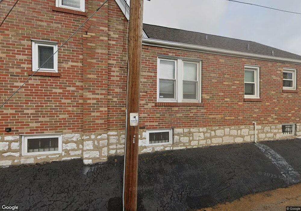
6019 Pernod Ave Saint Louis, MO 63139
Lindenwood Park NeighborhoodEstimated Value: $298,314 - $375,000
--
Bed
2
Baths
2,430
Sq Ft
$136/Sq Ft
Est. Value
About This Home
This home is located at 6019 Pernod Ave, Saint Louis, MO 63139 and is currently estimated at $330,829, approximately $136 per square foot. 6019 Pernod Ave is a home located in St. Louis City with nearby schools including Mason Elementary School, Long International Middle School, and Roosevelt High School.
Ownership History
Date
Name
Owned For
Owner Type
Purchase Details
Closed on
May 29, 1997
Sold by
Davidson Ronald E and Davidson Charlotte N
Bought by
Deaton Jeffrey M and Deaton Christine M
Current Estimated Value
Home Financials for this Owner
Home Financials are based on the most recent Mortgage that was taken out on this home.
Original Mortgage
$101,950
Outstanding Balance
$14,740
Interest Rate
8.1%
Mortgage Type
Purchase Money Mortgage
Estimated Equity
$316,089
Create a Home Valuation Report for This Property
The Home Valuation Report is an in-depth analysis detailing your home's value as well as a comparison with similar homes in the area
Home Values in the Area
Average Home Value in this Area
Purchase History
| Date | Buyer | Sale Price | Title Company |
|---|---|---|---|
| Deaton Jeffrey M | -- | -- |
Source: Public Records
Mortgage History
| Date | Status | Borrower | Loan Amount |
|---|---|---|---|
| Open | Deaton Jeffrey M | $101,950 |
Source: Public Records
Tax History Compared to Growth
Tax History
| Year | Tax Paid | Tax Assessment Tax Assessment Total Assessment is a certain percentage of the fair market value that is determined by local assessors to be the total taxable value of land and additions on the property. | Land | Improvement |
|---|---|---|---|---|
| 2025 | $3,996 | $56,220 | $3,330 | $52,890 |
| 2024 | $3,801 | $47,400 | $3,330 | $44,070 |
| 2023 | $3,801 | $47,400 | $3,330 | $44,070 |
| 2022 | $3,616 | $43,400 | $3,330 | $40,070 |
| 2021 | $3,610 | $43,400 | $3,330 | $40,070 |
| 2020 | $3,284 | $39,750 | $3,330 | $36,420 |
| 2019 | $3,272 | $39,750 | $3,330 | $36,420 |
| 2018 | $3,167 | $37,280 | $3,000 | $34,280 |
| 2017 | $3,113 | $37,280 | $3,000 | $34,280 |
| 2016 | $2,776 | $32,780 | $3,000 | $29,770 |
| 2015 | $2,516 | $32,770 | $3,000 | $29,770 |
| 2014 | $2,321 | $32,770 | $3,000 | $29,770 |
| 2013 | -- | $30,230 | $3,000 | $27,230 |
Source: Public Records
Map
Nearby Homes
- 6041 Tholozan Ave
- 6214 Oleatha Ave
- 5743 Mardel Ave
- 5716 Pernod Ave
- 5701 Pernod Ave
- 6325 Marquette Ave
- 5736 Lindenwood Ave
- 6339 Marquette Ave
- 3807 Tamm Ave
- 3905 Tamm Ave
- 6439 Mardel Ave
- 6411 Hancock Ave
- 6300 Fyler Ave
- 6437 Hancock Ave
- 6517 Tholozan Ave
- 5504 Mardel Ave
- 6315 Bradley Ave
- 5500 Lindenwood Ave
- 3282 Watson Rd
- 6562 Oleatha Ave
- 6015 Pernod Ave
- 6023 Pernod Ave
- 6025 Pernod Ave
- 6029 Pernod Ave
- 500608 Pernod Ave
- 494042 Pernod Ave
- 504648 Pernod Ave
- 6018 Oleatha Ave
- 6014 Oleatha Ave
- 6022 Oleatha Ave
- 6033 Pernod Ave
- 6024 Oleatha Ave
- 6028 Oleatha Ave
- 6037 Pernod Ave
- 6032 Oleatha Ave
- 6041 Pernod Ave
- 6036 Oleatha Ave
- 6043 Pernod Ave
- 6040 Oleatha Ave
- 6038 Pernod Ave