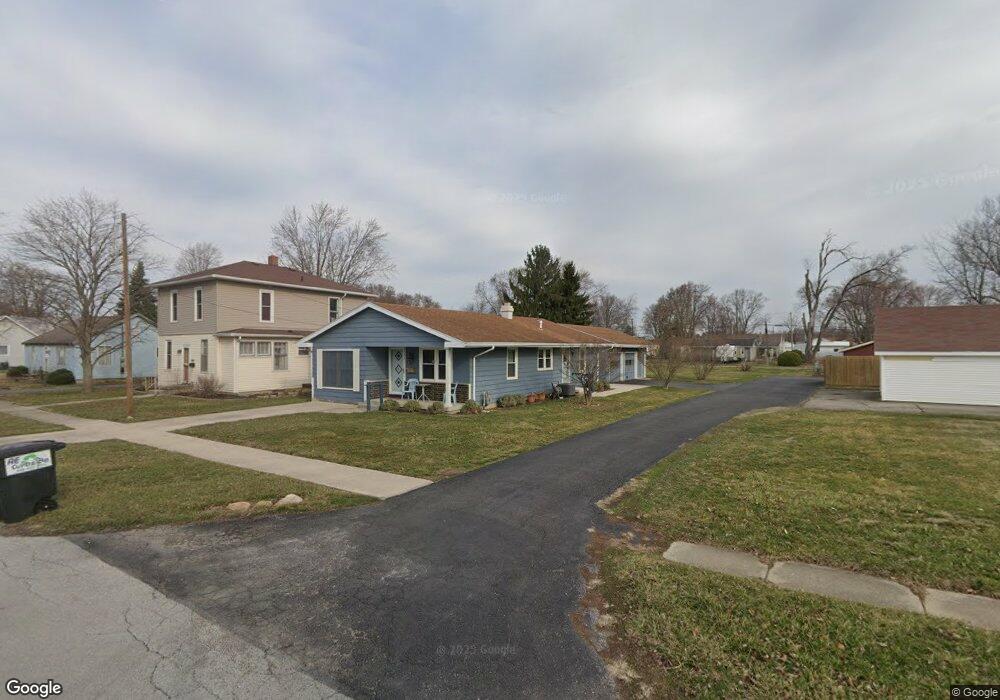
602 Allen Ave Findlay, OH 45840
Estimated Value: $158,000 - $196,000
3
Beds
1
Bath
1,263
Sq Ft
$137/Sq Ft
Est. Value
About This Home
This home is located at 602 Allen Ave, Findlay, OH 45840 and is currently estimated at $173,136, approximately $137 per square foot. 602 Allen Ave is a home located in Hancock County with nearby schools including Whittier Primary School, Bigelow Hill Elementary School, and Glenwood Middle School.
Ownership History
Date
Name
Owned For
Owner Type
Purchase Details
Closed on
Jun 18, 2021
Sold by
Hindall Teddy G and Hindall Dolores C
Bought by
Hindall Dolores C
Current Estimated Value
Purchase Details
Closed on
Feb 22, 2008
Sold by
Hindall Teddy G and Hindall Dolores C
Bought by
Hindall Teddy G and Hindall Dolores C
Create a Home Valuation Report for This Property
The Home Valuation Report is an in-depth analysis detailing your home's value as well as a comparison with similar homes in the area
Home Values in the Area
Average Home Value in this Area
Purchase History
| Date | Buyer | Sale Price | Title Company |
|---|---|---|---|
| Hindall Dolores C | -- | Assured Title Agency | |
| Hindall Teddy G | -- | Attorney |
Source: Public Records
Tax History
| Year | Tax Paid | Tax Assessment Tax Assessment Total Assessment is a certain percentage of the fair market value that is determined by local assessors to be the total taxable value of land and additions on the property. | Land | Improvement |
|---|---|---|---|---|
| 2024 | $1,090 | $40,490 | $4,780 | $35,710 |
| 2023 | $1,114 | $40,490 | $4,780 | $35,710 |
| 2022 | $1,125 | $40,490 | $4,780 | $35,710 |
| 2021 | $1,030 | $34,050 | $4,800 | $29,250 |
| 2020 | $1,030 | $34,050 | $4,800 | $29,250 |
| 2019 | $1,009 | $34,050 | $4,800 | $29,250 |
| 2018 | $841 | $28,100 | $4,360 | $23,740 |
| 2017 | $841 | $28,100 | $4,360 | $23,740 |
| 2016 | $841 | $28,100 | $4,360 | $23,740 |
| 2015 | $974 | $31,020 | $4,740 | $26,280 |
| 2014 | $974 | $31,020 | $4,740 | $26,280 |
| 2012 | $982 | $31,020 | $4,740 | $26,280 |
Source: Public Records
Map
Nearby Homes
- 322 Midland Ave
- 301 Allen Ave
- 1062 Vincent St
- 716 Winfield Ave
- 1820 Gayle Ln
- 912 Parkside Place
- 206 Midland Ave
- 0 Sheridan Ave
- 741 Central Ave
- 1142 Concord Ct
- 1725 Parkside Place
- 1030 Sheridan Ave
- 1216 Concord Ct
- 810 Mcconnell St
- 626 Central Ave
- 1108 Glen Meadow Dr
- 828 N Hill Trail
- 1209 Heather Dr
- 1125 Glen Meadow Dr
- 0 E Melrose Ave
- 600 Allen Ave
- 904 Crystal Ave
- 528 Allen Ave
- 608 Allen Ave
- 908 Crystal Ave
- 522 Allen Ave
- 607 E Foulke Ave
- 609 E Foulke Ave
- 820 Crystal Ave
- 615 E Foulke Ave
- 910 Crystal Ave
- 531 Allen Ave
- 525 E Foulke Ave
- 912 Crystal Ave
- 518 Allen Ave
- 518 Allen Ave
- 527 Allen Ave
- 601 E Foulke Ave
- 519 E Foulke Ave
- 617 E Foulke Ave
Your Personal Tour Guide
Ask me questions while you tour the home.