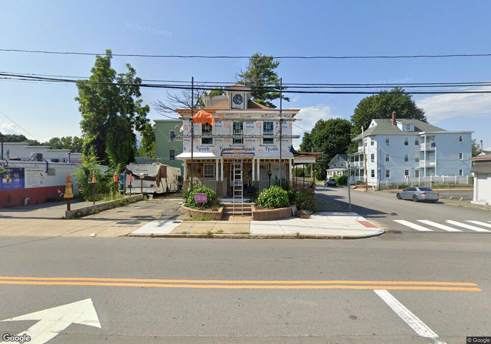
602 Andover St Lawrence, MA 01843
South West NeighborhoodEstimated Value: $631,722 - $883,000
6
Beds
2
Baths
2,438
Sq Ft
$327/Sq Ft
Est. Value
About This Home
This home is located at 602 Andover St, Lawrence, MA 01843 and is currently estimated at $798,431, approximately $327 per square foot. 602 Andover St is a home located in Essex County with nearby schools including John Breen School, Emily G. Wetherbee School (K-8), and School For Exceptional Studies.
Ownership History
Date
Name
Owned For
Owner Type
Purchase Details
Closed on
Jun 9, 1999
Sold by
Yameen Yvonne T
Bought by
Llanos Cesar A
Current Estimated Value
Home Financials for this Owner
Home Financials are based on the most recent Mortgage that was taken out on this home.
Original Mortgage
$106,689
Outstanding Balance
$27,790
Interest Rate
6.9%
Mortgage Type
Purchase Money Mortgage
Estimated Equity
$770,641
Create a Home Valuation Report for This Property
The Home Valuation Report is an in-depth analysis detailing your home's value as well as a comparison with similar homes in the area
Home Values in the Area
Average Home Value in this Area
Purchase History
| Date | Buyer | Sale Price | Title Company |
|---|---|---|---|
| Llanos Cesar A | $50,000 | -- |
Source: Public Records
Mortgage History
| Date | Status | Borrower | Loan Amount |
|---|---|---|---|
| Open | Llanos Cesar A | $106,689 | |
| Previous Owner | Llanos Cesar A | $20,000 | |
| Previous Owner | Llanos Cesar A | $20,000 |
Source: Public Records
Tax History
| Year | Tax Paid | Tax Assessment Tax Assessment Total Assessment is a certain percentage of the fair market value that is determined by local assessors to be the total taxable value of land and additions on the property. | Land | Improvement |
|---|---|---|---|---|
| 2025 | $4,969 | $564,700 | $93,800 | $470,900 |
| 2024 | $5,341 | $577,400 | $101,500 | $475,900 |
| 2023 | $5,576 | $548,800 | $94,200 | $454,600 |
| 2022 | $5,206 | $455,100 | $85,300 | $369,800 |
| 2021 | $4,806 | $391,700 | $85,300 | $306,400 |
| 2020 | $4,625 | $372,100 | $80,900 | $291,200 |
| 2019 | $4,450 | $325,300 | $67,200 | $258,100 |
| 2018 | $4,071 | $284,300 | $63,700 | $220,600 |
| 2017 | $3,774 | $246,000 | $60,100 | $185,900 |
| 2016 | $3,716 | $239,600 | $49,500 | $190,100 |
| 2015 | $3,603 | $238,300 | $49,500 | $188,800 |
Source: Public Records
Map
Nearby Homes
- 37 Tewksbury St Unit 39
- 543 Andover St Unit 6
- 312 Water St Unit 4
- 35 Adams St
- 18 Doyle St
- 91-93 Newton St
- 95 Hancock St
- 49 Bowdoin St Unit 51
- 11 W Hawley St
- 19 Oregon Ave
- 12-12A Durham St
- 87-87A Brookfield St
- 0
- 82 S Broadway
- 24 Inman St Unit 6
- 24 Inman St Unit 4
- 1008 Essex St Unit 1010
- 82 Water St
- 341 S Broadway- Parcel II
- 1082 Essex St
- 606 Andover St
- 57 Eaton St Unit 61
- 596 Andover St
- 54 Eaton St Unit 56
- 54 Eaton St
- 48 Furber St
- 54-56 Eaton St
- 45 Eaton St
- 610 Andover St
- 610 Andover St
- 594-594A Andover St
- 180 Everett St
- 46 Eaton St
- 590-592 Andover St
- 594 Andover St Unit 594A
- 594 Andover St
- 590 Andover St Unit 592
- 612-614 Andover St
- 612 Andover St Unit 614
- 42 Eaton St
Your Personal Tour Guide
Ask me questions while you tour the home.