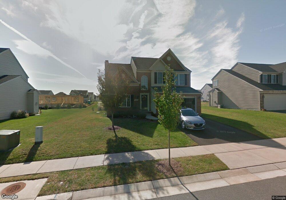
602 Brookfield Dr Centreville, MD 21617
Estimated Value: $506,104 - $547,000
4
Beds
3
Baths
2,604
Sq Ft
$205/Sq Ft
Est. Value
About This Home
This home is located at 602 Brookfield Dr, Centreville, MD 21617 and is currently estimated at $532,526, approximately $204 per square foot. 602 Brookfield Dr is a home located in Queen Anne's County with nearby schools including Kennard Elementary School, Centreville Middle School, and Queen Anne's County High School.
Ownership History
Date
Name
Owned For
Owner Type
Purchase Details
Closed on
Jun 26, 2009
Sold by
Canuel Brian R
Bought by
Nevins Peter Brent
Current Estimated Value
Purchase Details
Closed on
May 19, 2005
Sold by
Sierra Homes Inc
Bought by
Canuel Brian R and T/E Erica N Canuel
Purchase Details
Closed on
May 17, 2005
Sold by
W & L Rentals Llc
Bought by
Sierra Homes Inc
Create a Home Valuation Report for This Property
The Home Valuation Report is an in-depth analysis detailing your home's value as well as a comparison with similar homes in the area
Home Values in the Area
Average Home Value in this Area
Purchase History
| Date | Buyer | Sale Price | Title Company |
|---|---|---|---|
| Nevins Peter Brent | $350,000 | -- | |
| Canuel Brian R | $105,000 | -- | |
| Sierra Homes Inc | $2,000,000 | -- |
Source: Public Records
Mortgage History
| Date | Status | Borrower | Loan Amount |
|---|---|---|---|
| Open | Nevins Peter Brent | $358,160 | |
| Closed | Nevins Peter Brent | $25,600 | |
| Previous Owner | Canuel Brian R | $50,000 | |
| Previous Owner | Canuel Brian R | $295,000 | |
| Closed | Nevins Peter Brent | -- |
Source: Public Records
Tax History Compared to Growth
Tax History
| Year | Tax Paid | Tax Assessment Tax Assessment Total Assessment is a certain percentage of the fair market value that is determined by local assessors to be the total taxable value of land and additions on the property. | Land | Improvement |
|---|---|---|---|---|
| 2025 | $5,478 | $419,067 | $0 | $0 |
| 2024 | $5,116 | $383,600 | $110,500 | $273,100 |
| 2023 | $4,865 | $364,100 | $0 | $0 |
| 2022 | $4,619 | $344,600 | $0 | $0 |
| 2021 | $4,052 | $325,100 | $95,500 | $229,600 |
| 2020 | $4,052 | $325,100 | $95,500 | $229,600 |
| 2019 | $4,049 | $325,100 | $95,500 | $229,600 |
| 2018 | $4,221 | $346,600 | $90,800 | $255,800 |
| 2017 | $4,027 | $326,300 | $0 | $0 |
| 2016 | -- | $306,000 | $0 | $0 |
| 2015 | $2,050 | $285,700 | $0 | $0 |
| 2014 | $2,050 | $285,700 | $0 | $0 |
Source: Public Records
Map
Nearby Homes
- 131 E Meadow Dr
- 109 E Meadow Dr
- 143 Long Creek Way
- 144 Cool Meadow Dr
- The Miles Plan at Northbrook
- 105 Granard Ave
- 120 Brook Knoll Way
- 233 N Field Way
- 217 Elm St
- 307 Old Line Dr
- 331 Old Line Dr
- 704 Church Hill Rd
- 111 Pleasant Springs Dr
- 122 Lently Farm Ln
- 322 Shrewsbury Farm Ln
- 106 Turpins Ln
- 125 Price St
- 127 Price St
- 112 S Commerce St
- 114 S Commerce St
- 606 Brookfield Dr
- 572 Brookfield Dr
- 159 Meadow Brook Way
- 153 Meadowbrook Way
- 614 Brookfield Dr
- 568 Brookfield Dr
- 163 Meadow Brook Way
- 601 Brookfield Dr
- 607 Brookfield Dr
- 573 Brookfield Dr
- 147 Meadow Brook Way
- 167 Meadow Brook Way
- 615 Brookfield Dr
- 618 Brookfield Dr
- 562 Brookfield Dr
- 569 Brookfield Dr
- 143 Meadow Brook Way
- 621 Brookfield Dr
- 158 Meadow Brook Way
- 158 Meadowbrook Way