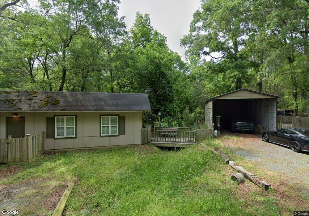
602 Dee Farrell Rd Pittsboro, NC 27312
Estimated Value: $207,997 - $765,000
--
Bed
--
Bath
--
Sq Ft
6.3
Acres
About This Home
This home is located at 602 Dee Farrell Rd, Pittsboro, NC 27312 and is currently estimated at $467,999. 602 Dee Farrell Rd is a home with nearby schools including Pittsboro Elementary School, George Moses Horton Middle School, and Thales Academy Pittsboro Pre-K-6.
Ownership History
Date
Name
Owned For
Owner Type
Purchase Details
Closed on
Aug 15, 2013
Sold by
Barnes Dana T and Thomas Jimmie
Bought by
Barnes Dana T
Current Estimated Value
Purchase Details
Closed on
Aug 8, 2013
Sold by
Barnes Dana T and Barnes Bobby D
Bought by
Waters Burke Benjamin Eugene and Waters Burke Meredith
Purchase Details
Closed on
Feb 2, 2007
Sold by
Thomas Sue P and Thomas Jimmie
Bought by
Thomas Jimmie
Create a Home Valuation Report for This Property
The Home Valuation Report is an in-depth analysis detailing your home's value as well as a comparison with similar homes in the area
Home Values in the Area
Average Home Value in this Area
Purchase History
| Date | Buyer | Sale Price | Title Company |
|---|---|---|---|
| Barnes Dana T | -- | None Available | |
| Waters Burke Benjamin Eugene | $68,000 | None Available | |
| Thomas Jimmie | -- | None Available |
Source: Public Records
Tax History Compared to Growth
Tax History
| Year | Tax Paid | Tax Assessment Tax Assessment Total Assessment is a certain percentage of the fair market value that is determined by local assessors to be the total taxable value of land and additions on the property. | Land | Improvement |
|---|---|---|---|---|
| 2025 | $799 | $112,535 | $107,010 | $5,525 |
| 2024 | $799 | $81,827 | $76,950 | $4,877 |
| 2023 | $710 | $81,827 | $76,950 | $4,877 |
| 2022 | $783 | $81,827 | $76,950 | $4,877 |
| 2021 | $790 | $81,827 | $76,950 | $4,877 |
| 2020 | $595 | $56,168 | $52,032 | $4,136 |
| 2019 | $445 | $56,168 | $52,032 | $4,136 |
| 2018 | $588 | $56,168 | $52,032 | $4,136 |
| 2017 | $607 | $56,168 | $52,032 | $4,136 |
| 2016 | $565 | $47,376 | $40,650 | $6,726 |
| 2015 | $554 | $43,991 | $40,650 | $3,341 |
| 2014 | $551 | $43,991 | $40,650 | $3,341 |
| 2013 | -- | $43,991 | $40,650 | $3,341 |
Source: Public Records
Map
Nearby Homes
- 245 Hanks Loop Rd
- 59 Riverstone Dr
- 102 Peddler Mill Way Unit 23
- 226 Evington Dr
- 115 Evington Dr Unit 29
- 186 Evington Dr
- 82 Stevens Creek Dr
- 240 Riverstone Dr
- 291 Riverstone Dr
- 387 Riverstone Dr
- 0 Us 64 E Unit 10094521
- 639 Hills of the Haw Rd
- 313 Parkland Dr
- 331 Beacon Dr
- 335 Beacon Dr
- 309 Beacon Dr
- 301 Beacon Dr
- 339 Beacon Dr
- 32 Relaxing Way
- 285 Parkland Dr
- 1421 Hanks Chapel Rd
- 1419 Hanks Chapel Rd
- 376 Dee Farrell Rd
- 363 Dee Farrell Rd
- 0 Dee Farrell Rd Unit TR1830880
- 1411 Hanks Chapel Rd
- 509 Fearrington Post
- 1537 Hanks Chapel Rd
- 1474 Hanks Chapel Rd
- 1474 Hanks Chapel Rd
- 835 Foxfire Trace
- 383 Dee Farrell Rd
- 1394 Hanks Chapel Rd
- 55 Hanks Loop Rd
- 281 Dee Farrell Rd
- 839 Foxfire Trace
- 217 Dee Farrell Rd
- 1636 Hanks Chapel Rd
- 0 Arborgate Rd Unit 1870642
- 0 Arborgate Rd Unit 941015