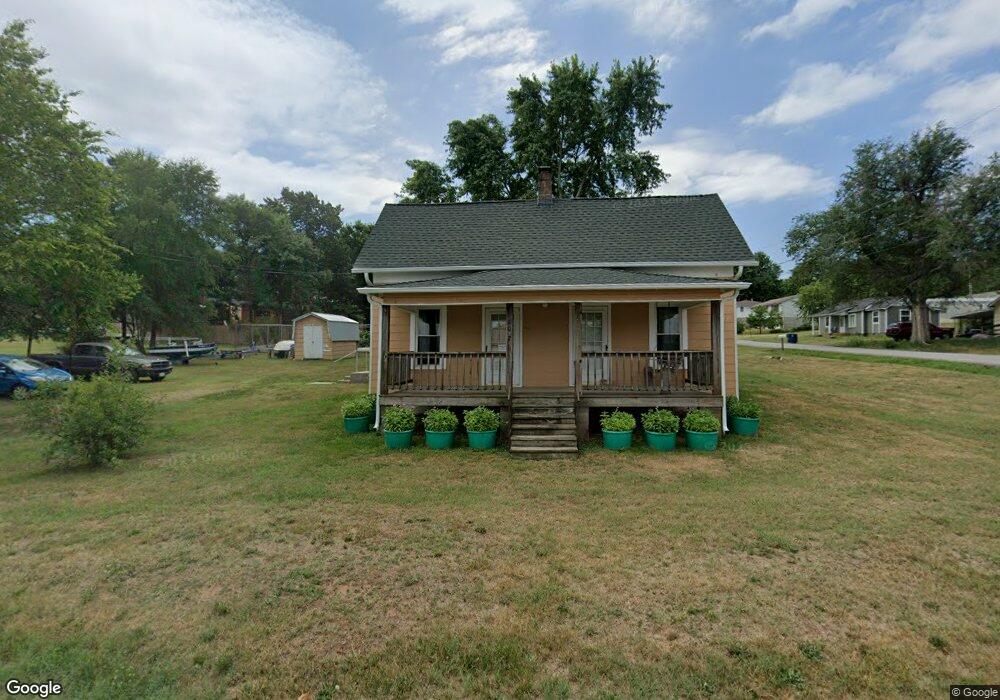
602 E Locust St Stockton, MO 65785
Estimated Value: $99,000 - $137,000
2
Beds
1
Bath
992
Sq Ft
$119/Sq Ft
Est. Value
About This Home
This home is located at 602 E Locust St, Stockton, MO 65785 and is currently estimated at $118,505, approximately $119 per square foot. 602 E Locust St is a home located in Cedar County with nearby schools including Stockton Elementary School, Stockton Middle School, and Stockton High School.
Ownership History
Date
Name
Owned For
Owner Type
Purchase Details
Closed on
Dec 26, 2017
Sold by
Dodson John Mark and Dodson Mark
Bought by
Helzel William O and Helzel Doris M
Current Estimated Value
Home Financials for this Owner
Home Financials are based on the most recent Mortgage that was taken out on this home.
Original Mortgage
$21,500
Outstanding Balance
$18,063
Interest Rate
3.95%
Mortgage Type
Future Advance Clause Open End Mortgage
Estimated Equity
$100,442
Create a Home Valuation Report for This Property
The Home Valuation Report is an in-depth analysis detailing your home's value as well as a comparison with similar homes in the area
Purchase History
| Date | Buyer | Sale Price | Title Company |
|---|---|---|---|
| Helzel William O | -- | None Available |
Source: Public Records
Mortgage History
| Date | Status | Borrower | Loan Amount |
|---|---|---|---|
| Open | Helzel William O | $21,500 |
Source: Public Records
Tax History
| Year | Tax Paid | Tax Assessment Tax Assessment Total Assessment is a certain percentage of the fair market value that is determined by local assessors to be the total taxable value of land and additions on the property. | Land | Improvement |
|---|---|---|---|---|
| 2025 | $206 | $4,820 | $1,200 | $3,620 |
| 2024 | $2 | $4,270 | $1,060 | $3,210 |
| 2023 | $208 | $4,280 | $0 | $0 |
| 2022 | $208 | $4,280 | $0 | $0 |
| 2020 | $201 | $4,140 | $0 | $0 |
| 2019 | $196 | $4,140 | $0 | $0 |
| 2018 | $195 | $4,140 | $0 | $0 |
| 2017 | -- | $4,140 | $0 | $0 |
| 2016 | -- | $4,140 | $0 | $0 |
| 2015 | -- | $4,140 | $0 | $0 |
| 2014 | -- | $4,140 | $0 | $0 |
| 2013 | -- | $4,140 | $0 | $0 |
Source: Public Records
Map
Nearby Homes
- 502 E Highway 32
- 312 East St
- 111 S Galyan St
- 303 S Church St
- 204 N Blake
- 212 East St
- 807 E Surf St
- 008 State Highway 32
- 006 State Highway 32
- 007 State Highway 32
- 101 S High St
- 21772 State Highway 32
- 11615 State Highway 32
- 000 S Highway J
- TBDB S Highway J
- 000b S Highway J
- 0 S Highway J Unit HMS2545441
- Tbd S Highway J
- 105 W Craig St
- 312 Highway Rb
- 601 E Locust St
- 205 S Sac St
- 200 Sac
- 303 S Chestnut St
- 301 S Chestnut St
- 307 S Chestnut St
- 310 S Chestnut St
- 308 S Chestnut St
- 306 S Chestnut St
- 201 Sac St
- 214 S Sac St
- 506 E Locust St
- 0 E Locust St Unit 11208026
- 0 E Locust St Unit 60009547
- 0 E Locust St Unit 60086634
- 306 Sac St
- 307 Sac St
- 309 S Sac St
- 501 E Locust St
- 505 E Locust St
Your Personal Tour Guide
Ask me questions while you tour the home.