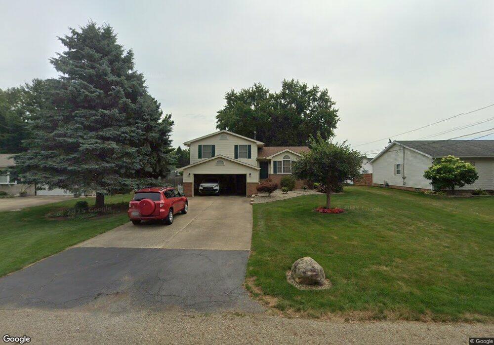
602 Hazel Ave Louisville, OH 44641
Estimated Value: $217,627 - $247,000
3
Beds
2
Baths
1,352
Sq Ft
$171/Sq Ft
Est. Value
About This Home
This home is located at 602 Hazel Ave, Louisville, OH 44641 and is currently estimated at $230,907, approximately $170 per square foot. 602 Hazel Ave is a home located in Stark County with nearby schools including Louisville High School and St. Thomas Aquinas High School & Middle School.
Ownership History
Date
Name
Owned For
Owner Type
Purchase Details
Closed on
Jun 13, 1997
Sold by
Heilman Beth E
Bought by
Stipe John H and Stipe Susan
Current Estimated Value
Home Financials for this Owner
Home Financials are based on the most recent Mortgage that was taken out on this home.
Original Mortgage
$83,000
Outstanding Balance
$12,031
Interest Rate
8.13%
Mortgage Type
New Conventional
Estimated Equity
$218,876
Purchase Details
Closed on
Jan 11, 1996
Sold by
Mcdonald Margaret A
Bought by
Heilman Beth E
Home Financials for this Owner
Home Financials are based on the most recent Mortgage that was taken out on this home.
Original Mortgage
$94,500
Interest Rate
7.36%
Mortgage Type
New Conventional
Purchase Details
Closed on
Jan 6, 1994
Purchase Details
Closed on
Jul 31, 1990
Purchase Details
Closed on
Sep 5, 1989
Create a Home Valuation Report for This Property
The Home Valuation Report is an in-depth analysis detailing your home's value as well as a comparison with similar homes in the area
Home Values in the Area
Average Home Value in this Area
Purchase History
| Date | Buyer | Sale Price | Title Company |
|---|---|---|---|
| Stipe John H | $112,000 | -- | |
| Heilman Beth E | $105,000 | -- | |
| -- | -- | -- | |
| -- | $79,000 | -- | |
| -- | $10,500 | -- |
Source: Public Records
Mortgage History
| Date | Status | Borrower | Loan Amount |
|---|---|---|---|
| Open | Stipe John H | $83,000 | |
| Previous Owner | Heilman Beth E | $94,500 |
Source: Public Records
Tax History Compared to Growth
Tax History
| Year | Tax Paid | Tax Assessment Tax Assessment Total Assessment is a certain percentage of the fair market value that is determined by local assessors to be the total taxable value of land and additions on the property. | Land | Improvement |
|---|---|---|---|---|
| 2025 | -- | $57,130 | $14,110 | $43,020 |
| 2024 | -- | $57,130 | $14,110 | $43,020 |
| 2023 | $2,285 | $53,170 | $13,300 | $39,870 |
| 2022 | $2,241 | $52,010 | $13,300 | $38,710 |
| 2021 | $2,247 | $52,010 | $13,300 | $38,710 |
| 2020 | $1,987 | $49,950 | $11,970 | $37,980 |
| 2019 | $1,995 | $51,380 | $11,970 | $39,410 |
| 2018 | $2,044 | $51,380 | $11,970 | $39,410 |
| 2017 | $1,903 | $46,140 | $10,540 | $35,600 |
| 2016 | $1,942 | $46,140 | $10,540 | $35,600 |
| 2015 | $1,947 | $46,140 | $10,540 | $35,600 |
| 2014 | $1,810 | $39,870 | $9,100 | $30,770 |
| 2013 | $909 | $39,870 | $9,100 | $30,770 |
Source: Public Records
Map
Nearby Homes
- 1715 High St
- 1812 E Broad St
- 641 S Nickelplate St
- 308 Superior St
- 520 S Silver St
- 0 Michigan Blvd
- 728 E Broad St
- 2110 Edmar St
- 2015 E Main St
- 204 E Broad St
- 510 S Bauman Ct
- 107 E Broad St
- 325 Lincoln Ave
- 908 Sand Lot Cir
- 1170 Winding Ridge Ave
- 910 Crosswyck Cir
- 3390 Meese Rd NE
- 1702 View Pointe Ave
- 428 Honeycrisp Dr NE
- 3047 Mcintosh Dr NE