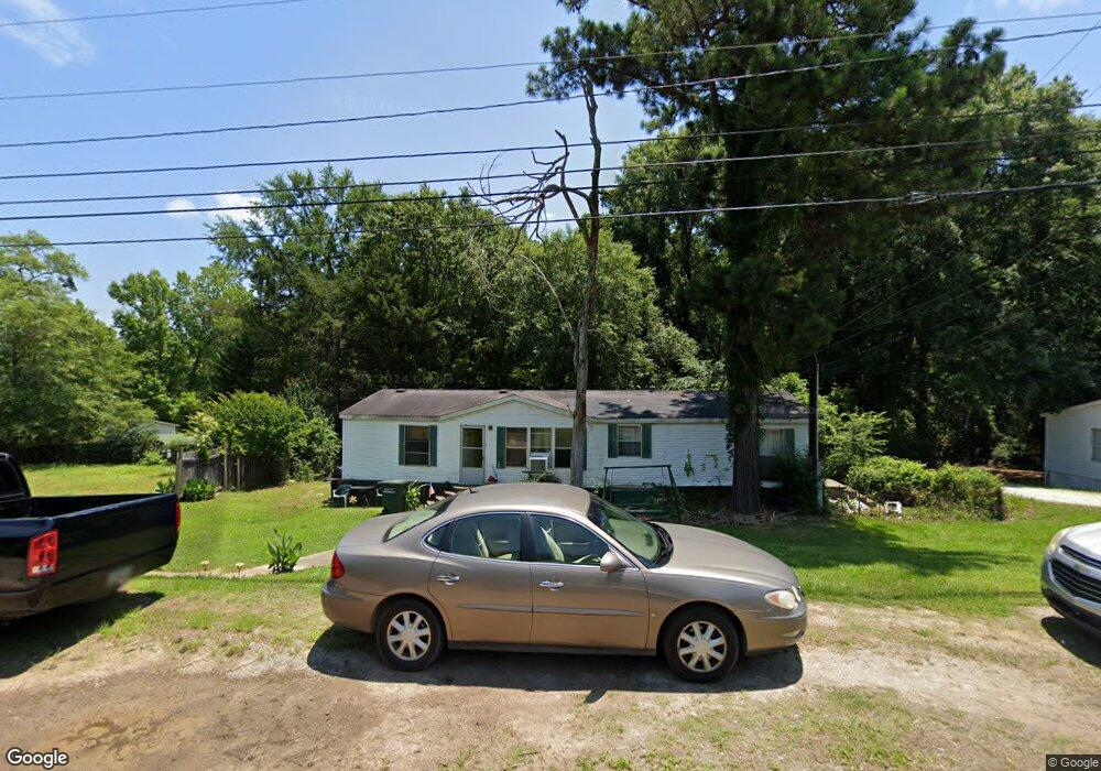
602 Hudson St Winnsboro, SC 29180
Estimated Value: $20,832 - $288,000
3
Beds
2
Baths
--
Sq Ft
10,454
Sq Ft Lot
About This Home
This home is located at 602 Hudson St, Winnsboro, SC 29180 and is currently estimated at $135,277. 602 Hudson St is a home located in Fairfield County with nearby schools including Fairfield Middle School, Fairfield Central High School, and Midlands STEM Institute.
Ownership History
Date
Name
Owned For
Owner Type
Purchase Details
Closed on
Aug 3, 2023
Sold by
Windham Barbara Lynn
Bought by
Windham Danny Ray and Windham Brandon R
Current Estimated Value
Purchase Details
Closed on
May 11, 2017
Sold by
Sherrod Irene Windham and Windham Irene
Bought by
Windham Danny Ray and Windham Barbara Lynn
Purchase Details
Closed on
Sep 17, 2008
Sold by
Smith John Paul
Bought by
Windham Irene
Purchase Details
Closed on
Aug 5, 2008
Sold by
Us Bank Na
Bought by
Smith John Paul
Purchase Details
Closed on
Apr 22, 2008
Sold by
Bailey Reginald and Foster Sharon
Bought by
U S Bank Na and Holders Of Asset Backed Securities Corp
Create a Home Valuation Report for This Property
The Home Valuation Report is an in-depth analysis detailing your home's value as well as a comparison with similar homes in the area
Home Values in the Area
Average Home Value in this Area
Purchase History
| Date | Buyer | Sale Price | Title Company |
|---|---|---|---|
| Windham Danny Ray | -- | None Listed On Document | |
| Windham Danny Ray | -- | None Available | |
| Windham Irene | $9,000 | -- | |
| Smith John Paul | $8,000 | -- | |
| U S Bank Na | $15,000 | -- |
Source: Public Records
Tax History Compared to Growth
Tax History
| Year | Tax Paid | Tax Assessment Tax Assessment Total Assessment is a certain percentage of the fair market value that is determined by local assessors to be the total taxable value of land and additions on the property. | Land | Improvement |
|---|---|---|---|---|
| 2024 | $65 | $360 | $360 | $0 |
| 2023 | $65 | $360 | $360 | $0 |
| 2022 | $0 | $360 | $360 | $0 |
| 2021 | $0 | $360 | $360 | $0 |
| 2020 | $0 | $360 | $360 | $0 |
| 2019 | $63 | $360 | $360 | $0 |
| 2018 | $63 | $360 | $360 | $0 |
| 2017 | $62 | $360 | $0 | $0 |
| 2016 | $209 | $540 | $0 | $0 |
| 2015 | $65 | $0 | $0 | $0 |
| 2014 | $65 | $360 | $0 | $0 |
| 2012 | $65 | $360 | $0 | $0 |
Source: Public Records
Map
Nearby Homes
- 116 N Zion St
- 0 Fairview Rd
- 129 N Zion St
- 201 Hillcrest Dr
- 124 W Liberty St
- 205 Drayton St
- 211 W Liberty St
- 401 Palmetto Ave
- 200 Dogwood Ave
- 0 S Carolina 200
- 64 Robinson Ave
- 323 W High St
- 904 State Highway 200
- 904 S Carolina 200
- 175 Robinson Ave
- 207 Calhoun St Unit 418151
- 104 Dogwood Ave
- 108 Cornwallis Dr
- 207 Forest Hills Dr
- 129 Maple St
- 604 1/2 Hudson St
- 0 Hudson St Unit 214746
- 0 Hudson St Unit CAR4018664
- 0 Hudson St Unit 559599
- 603 Hudson St
- 601 Hudson St
- 605 Hudson St
- 607 Hudson St
- 109 Fairview Rd
- 103 Fairview Rd
- 610 Hudson St
- 503 Hudson St
- 111 Fairview Rd
- 113 Fairview Rd
- 612 Hudson St
- 501 Hudson St Unit 4461
- 611 Hudson St
- 614 Hudson St
- 105 Rice St
- 110 Fairview Rd