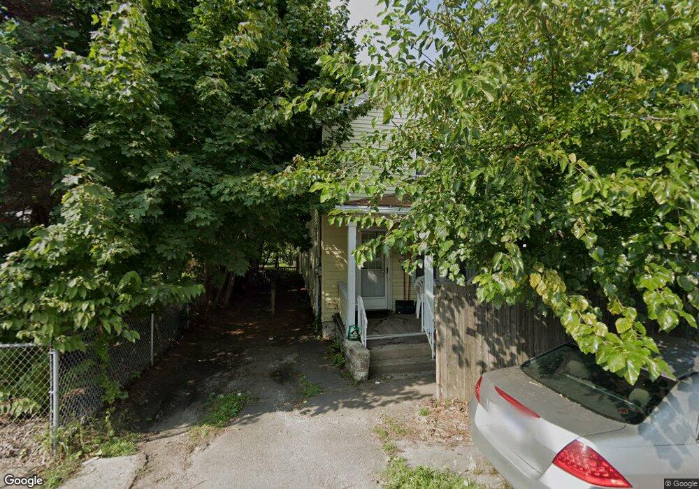
602 Langstaff Place Scranton, PA 18508
The Plot NeighborhoodEstimated Value: $118,000 - $139,000
3
Beds
2
Baths
1,468
Sq Ft
$89/Sq Ft
Est. Value
About This Home
This home is located at 602 Langstaff Place, Scranton, PA 18508 and is currently estimated at $129,984, approximately $88 per square foot. 602 Langstaff Place is a home located in Lackawanna County with nearby schools including Pinchbeck Elementary School, Isaac Tripp Elementary School, and Columbia Heights Elementary School.
Ownership History
Date
Name
Owned For
Owner Type
Purchase Details
Closed on
May 15, 2008
Sold by
Okafor Uche and Okafor Rachael O
Bought by
Billeck Donald R and Billeck Joyce A
Current Estimated Value
Purchase Details
Closed on
Feb 13, 2007
Sold by
Trach Donna and Pace Donna
Bought by
Okafor Uche
Home Financials for this Owner
Home Financials are based on the most recent Mortgage that was taken out on this home.
Original Mortgage
$14,628
Interest Rate
6.22%
Mortgage Type
Purchase Money Mortgage
Create a Home Valuation Report for This Property
The Home Valuation Report is an in-depth analysis detailing your home's value as well as a comparison with similar homes in the area
Home Values in the Area
Average Home Value in this Area
Purchase History
| Date | Buyer | Sale Price | Title Company |
|---|---|---|---|
| Billeck Donald R | $63,000 | None Available | |
| Okafor Uche | $58,510 | None Available |
Source: Public Records
Mortgage History
| Date | Status | Borrower | Loan Amount |
|---|---|---|---|
| Previous Owner | Okafor Uche | $14,628 |
Source: Public Records
Tax History Compared to Growth
Tax History
| Year | Tax Paid | Tax Assessment Tax Assessment Total Assessment is a certain percentage of the fair market value that is determined by local assessors to be the total taxable value of land and additions on the property. | Land | Improvement |
|---|---|---|---|---|
| 2025 | $940 | $3,000 | $350 | $2,650 |
| 2024 | $857 | $3,000 | $350 | $2,650 |
| 2023 | $857 | $3,000 | $350 | $2,650 |
| 2022 | $839 | $3,000 | $350 | $2,650 |
| 2021 | $839 | $3,000 | $350 | $2,650 |
| 2020 | $822 | $3,000 | $350 | $2,650 |
| 2019 | $773 | $3,000 | $350 | $2,650 |
| 2018 | $773 | $3,000 | $350 | $2,650 |
| 2017 | $759 | $3,000 | $350 | $2,650 |
| 2016 | $215 | $3,000 | $350 | $2,650 |
| 2015 | $565 | $3,000 | $350 | $2,650 |
| 2014 | -- | $3,000 | $350 | $2,650 |
Source: Public Records
Map
Nearby Homes
- 938 Providence Rd
- 942 Providence Rd
- 375 Grove St
- 833 Powderly Ct
- 1206 Blair Ave Unit Rear
- 1126 W Gibson St
- 1227 Providence Rd
- 991 N Sumner Ave Unit 1/2 L 13
- 846 Capouse Ave
- 848 Capouse Ave
- 656 Philo St
- 853 Lords Ct
- 1425 Bulwer St
- 1431 Dorothy St
- 331 Phelps St
- 1311 Short Ave
- 1327 Oram St
- 4 Plum Place
- 1057 Euclid Ave
- 7 Plum Place
- 604 Langstaff Place
- 606 Langstaff Place Unit 608
- 0 Langstaff Place Unit GSB014690
- 0 Langstaff Place
- 917 Albright Ave
- 915 Albright Ave
- 610 Langstaff Place Unit 612
- 612 Langstaff Place
- 913 Albright Ave
- 956 Meade Ave Unit 1
- 954 Meade Ave Unit 56
- 962 Meade Ave
- 983 Albright Ave Unit 985
- 618 Langstaff Place Unit 620
- 987 Albright Ave Unit 989
- 909 Albright Ave
- 909 Albright Ave
- 966 Meade Ave
- 909 Rear Albright Ave
- 1004 Meade Ave