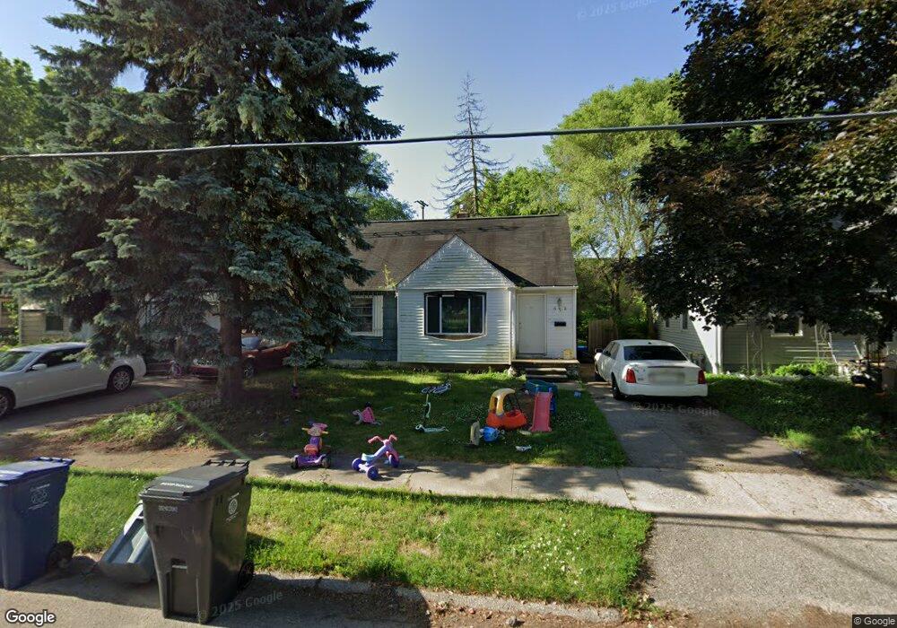
602 Macdonald Ave Flint, MI 48507
Circle Drive NeighborhoodEstimated Value: $70,686 - $89,000
3
Beds
2
Baths
1,120
Sq Ft
$73/Sq Ft
Est. Value
About This Home
This home is located at 602 Macdonald Ave, Flint, MI 48507 and is currently estimated at $82,172, approximately $73 per square foot. 602 Macdonald Ave is a home located in Genesee County with nearby schools including Freeman Elementary School, Flint Southwestern Classical Academy, and International Academy of Flint (K-12).
Ownership History
Date
Name
Owned For
Owner Type
Purchase Details
Closed on
Apr 17, 2018
Sold by
Genesee County Land Bank Authority
Bought by
Groves Shawn Joseph
Current Estimated Value
Purchase Details
Closed on
Mar 2, 2000
Sold by
Thompson T L
Bought by
Handa Philip J and Handa Susan E
Create a Home Valuation Report for This Property
The Home Valuation Report is an in-depth analysis detailing your home's value as well as a comparison with similar homes in the area
Home Values in the Area
Average Home Value in this Area
Purchase History
| Date | Buyer | Sale Price | Title Company |
|---|---|---|---|
| Groves Shawn Joseph | $70,000 | None Available | |
| Handa Philip J | $59,900 | Lawyers Title Insurance Corp |
Source: Public Records
Tax History Compared to Growth
Tax History
| Year | Tax Paid | Tax Assessment Tax Assessment Total Assessment is a certain percentage of the fair market value that is determined by local assessors to be the total taxable value of land and additions on the property. | Land | Improvement |
|---|---|---|---|---|
| 2025 | $1,240 | $33,000 | $0 | $0 |
| 2024 | $1,147 | $29,500 | $0 | $0 |
| 2023 | $1,119 | $25,900 | $0 | $0 |
| 2022 | $0 | $21,100 | $0 | $0 |
| 2021 | $1,135 | $18,700 | $0 | $0 |
| 2020 | $1,042 | $15,000 | $0 | $0 |
| 2019 | $1,017 | $11,600 | $0 | $0 |
| 2018 | $221 | $0 | $0 | $0 |
| 2017 | $986 | $0 | $0 | $0 |
| 2016 | $979 | $0 | $0 | $0 |
| 2015 | -- | $0 | $0 | $0 |
| 2014 | -- | $0 | $0 | $0 |
| 2012 | -- | $14,900 | $0 | $0 |
Source: Public Records
Map
Nearby Homes
- 810 Macdonald Ave
- 4127 Custer Ave
- 4205 Red Arrow Rd
- 621 Burroughs Ave
- 4424 Cheyenne Ave
- 630 Buckingham Ave
- 4310 Cheyenne Ave
- 326 Burroughs Ave
- 3343 Cheyenne Ave
- 454 E Atherton Rd
- 3512 Barcey Ct
- 3614 Comanche Ave
- 2207 E Boatfield Ave
- 2130 E Whittemore Ave
- 4010 Milton Dr
- 3505 Comanche Ave
- 2231 E Bergin Ave
- 1453 Carman St
- 2077 E Boatfield Ave
- 2220 E Bergin Ave
- 534 Macdonald Ave
- 530 Macdonald Ave
- 617 E Hemphill Rd
- 524 Macdonald Ave
- 606 Macdonald Ave
- 633 E Hemphill Rd
- 518 Macdonald Ave
- 0 E Hemphill Rd Unit G1202 20058652
- 0 E Hemphill Rd Unit G1202 20381505
- 0 E Hemphill Rd Unit 30014892
- 4615 Red Arrow Rd
- 610 Macdonald Ave
- 2278 E Hemphill Rd
- 641 E Hemphill Rd
- Lot 94 Hemphill Rd
- 2116 Hemphill Rd
- 2180 Hemphill Rd
- 12245 E Mt Morris Rd Hemphill Rd
- 614 Macdonald Ave
- 533 Macdonald Ave