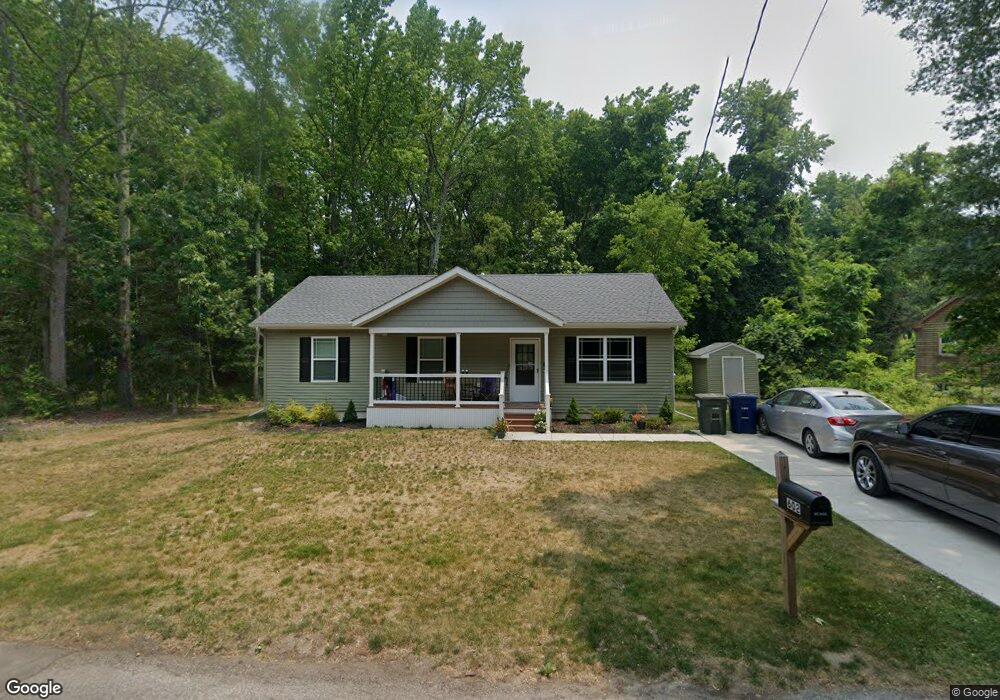
602 Pershing Ave Glassboro, NJ 08028
Estimated Value: $264,404 - $290,000
--
Bed
--
Bath
1,144
Sq Ft
$242/Sq Ft
Est. Value
About This Home
This home is located at 602 Pershing Ave, Glassboro, NJ 08028 and is currently estimated at $276,468, approximately $241 per square foot. 602 Pershing Ave is a home with nearby schools including J Harvey Rodgers School, Dorothy L Bullock Elementary, and Glassboro Intermediate School.
Ownership History
Date
Name
Owned For
Owner Type
Purchase Details
Closed on
Jul 29, 2021
Sold by
Gloucester County Habitat For Humanity
Bought by
Watson Ayisha
Current Estimated Value
Home Financials for this Owner
Home Financials are based on the most recent Mortgage that was taken out on this home.
Original Mortgage
$0
Interest Rate
2.9%
Mortgage Type
Second Mortgage Made To Cover Down Payment
Purchase Details
Closed on
Apr 7, 2021
Sold by
Gloucester County Habitat For Humanity
Bought by
Gloucester County Habitat For Humanity
Purchase Details
Closed on
Jun 25, 2019
Sold by
Borough Of Glassboro
Bought by
Glouster County Habitat For Humanity
Purchase Details
Closed on
Feb 26, 2010
Sold by
Saud Aziz and Saud Lucrecia
Bought by
Aziz Saud and Saud Lucrecia
Create a Home Valuation Report for This Property
The Home Valuation Report is an in-depth analysis detailing your home's value as well as a comparison with similar homes in the area
Home Values in the Area
Average Home Value in this Area
Purchase History
| Date | Buyer | Sale Price | Title Company |
|---|---|---|---|
| Watson Ayisha | $185,000 | West Jersey Title Agency | |
| Gloucester County Habitat For Humanity | -- | West Jersey Title Agency | |
| Gloucester County Habitat For | -- | None Listed On Document | |
| Glouster County Habitat For Humanity | -- | None Available | |
| Aziz Saud | -- | Group 21 Title Agency |
Source: Public Records
Mortgage History
| Date | Status | Borrower | Loan Amount |
|---|---|---|---|
| Closed | Watson Ayisha | $0 | |
| Open | Watson Ayisha | $75,000 |
Source: Public Records
Tax History Compared to Growth
Tax History
| Year | Tax Paid | Tax Assessment Tax Assessment Total Assessment is a certain percentage of the fair market value that is determined by local assessors to be the total taxable value of land and additions on the property. | Land | Improvement |
|---|---|---|---|---|
| 2025 | $2,640 | $75,000 | $36,900 | $38,100 |
| 2024 | $2,624 | $75,000 | $36,900 | $38,100 |
| 2023 | $2,624 | $75,000 | $36,900 | $38,100 |
| 2022 | $6,408 | $75,000 | $36,900 | $38,100 |
| 2021 | $1,300 | $36,900 | $36,900 | $0 |
| 2020 | $1,307 | $36,900 | $36,900 | $0 |
| 2019 | $1,310 | $36,900 | $36,900 | $0 |
| 2018 | $1,310 | $36,900 | $36,900 | $0 |
| 2017 | $1,317 | $36,900 | $36,900 | $0 |
| 2016 | $1,279 | $36,900 | $36,900 | $0 |
| 2015 | $1,251 | $36,900 | $36,900 | $0 |
| 2014 | $1,223 | $36,900 | $36,900 | $0 |
Source: Public Records
Map
Nearby Homes
- 161 165 S Delsea Dr
- 1200 Walnut St
- 213 15 S Academy St
- 1215 S Academy St
- 428 Truman Ave
- 1400 Walnut St
- 119 S Academy St
- 1504 S Academy St
- 254 Stanger Ave
- 1701 Filbert St
- 242 Stanger Ave
- 10 Grove St
- 301 Mazzeo Dr
- 309 Mazzeo Dr
- 192 Mazzeo Dr
- 134 S Main St
- 47 S Academy St
- 125 Earl Ave
- 122 Earl Ave
- 1447 S Mallard St
- 606 Pershing Ave
- 606 Pershing St
- 0 Pershing St Unit 1007211120
- 0 Pershing St Unit 6091397
- 0 Pershing St Unit 6356830
- 339 Grant Ave
- 505 Pershing Ave
- 310 Grant Ave
- 701 Pershing Ave
- 705 Pershing Ave
- 510 S Academy St
- 213 Lincoln Ave
- 317 Lincoln Ave
- 212 Harding Ave
- 209 Lincoln Ave
- 208 Harding Ave
- 205 Lincoln Ave
- 211 Harding Ave
- 300 Washington Ave
- 505 S Academy St