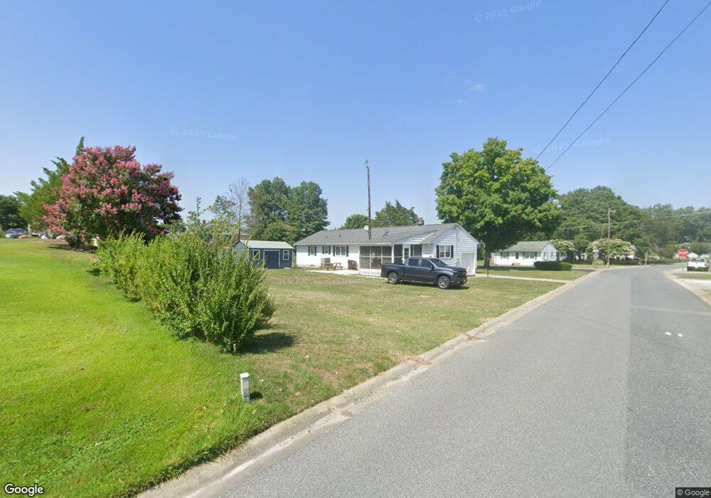
602 Taylor St Sharptown, MD 21861
Estimated Value: $253,000 - $284,000
--
Bed
1
Bath
1,606
Sq Ft
$165/Sq Ft
Est. Value
About This Home
This home is located at 602 Taylor St, Sharptown, MD 21861 and is currently estimated at $264,319, approximately $164 per square foot. 602 Taylor St is a home located in Wicomico County with nearby schools including Northwestern Elementary School.
Ownership History
Date
Name
Owned For
Owner Type
Purchase Details
Closed on
Mar 18, 2024
Sold by
Jones Damian and Jones William Douglas
Bought by
Jones William Douglas and Jones Holly D
Current Estimated Value
Home Financials for this Owner
Home Financials are based on the most recent Mortgage that was taken out on this home.
Original Mortgage
$231,990
Outstanding Balance
$228,232
Interest Rate
6.77%
Mortgage Type
FHA
Estimated Equity
$36,087
Purchase Details
Closed on
Feb 21, 2023
Sold by
Doyle Nicklaus C
Bought by
Jones Damian and Jones William Douglas
Home Financials for this Owner
Home Financials are based on the most recent Mortgage that was taken out on this home.
Original Mortgage
$205,770
Interest Rate
6.33%
Mortgage Type
New Conventional
Create a Home Valuation Report for This Property
The Home Valuation Report is an in-depth analysis detailing your home's value as well as a comparison with similar homes in the area
Home Values in the Area
Average Home Value in this Area
Purchase History
| Date | Buyer | Sale Price | Title Company |
|---|---|---|---|
| Jones William Douglas | -- | Ocean Investments Title | |
| Jones William Douglas | -- | Ocean Investments Title | |
| Jones Damian | $216,600 | -- |
Source: Public Records
Mortgage History
| Date | Status | Borrower | Loan Amount |
|---|---|---|---|
| Open | Jones William Douglas | $231,990 | |
| Closed | Jones William Douglas | $231,990 | |
| Previous Owner | Jones Damian | $205,770 |
Source: Public Records
Tax History Compared to Growth
Tax History
| Year | Tax Paid | Tax Assessment Tax Assessment Total Assessment is a certain percentage of the fair market value that is determined by local assessors to be the total taxable value of land and additions on the property. | Land | Improvement |
|---|---|---|---|---|
| 2025 | $1,232 | $165,533 | $0 | $0 |
| 2024 | $1,232 | $128,467 | $0 | $0 |
| 2023 | $904 | $91,400 | $23,800 | $67,600 |
| 2022 | $896 | $87,933 | $0 | $0 |
| 2021 | $849 | $84,467 | $0 | $0 |
| 2020 | $835 | $81,000 | $23,800 | $57,200 |
| 2019 | $848 | $81,000 | $23,800 | $57,200 |
| 2018 | $852 | $81,000 | $23,800 | $57,200 |
| 2017 | $934 | $88,800 | $0 | $0 |
| 2016 | -- | $88,567 | $0 | $0 |
| 2015 | $1,069 | $88,333 | $0 | $0 |
| 2014 | $1,069 | $88,100 | $0 | $0 |
Source: Public Records
Map
Nearby Homes
- 603 Ferry St
- 507 Ferry St
- 611 Main St
- 0 Quinton Rd Unit MDWC2009044
- 407 Main St
- 715 Main St
- 605 4th St
- 605 State St
- 0 Sharptown Line Rd
- 0 Callaway Wharf Rd
- 33016 Forest Knoll Dr
- 11654 Norris Twilley Rd
- 33015 Forest Knoll Dr
- 5611 Galestown Rd
- 11511 Old School Rd
- Lot 1 Old Sharptown Rd
- 11285 Snethen Church Rd
- 11453 Riverton Rd
- 6108 Delaware Line-Reliance Rd
- 30772 River Rd